Marjorie Turner Hollman is an author, creator, observer, and disability advocate who loves the outdoors. Link to all Marjorie’s books.
LISTEN HERE:
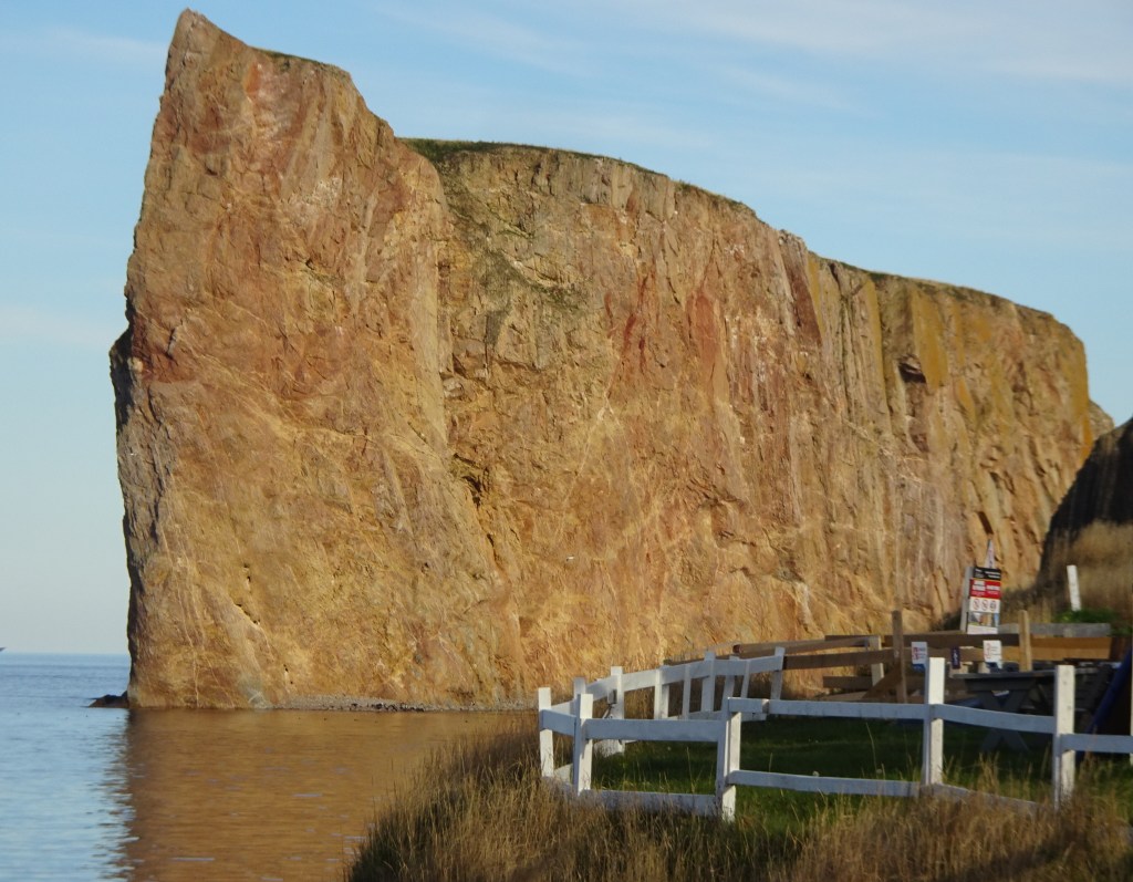
Percé Rock
It’s the rock that will grab you when you come around the bend in the road. Massive, kinda rectangular. My first view was near sunset. The light hit the massive stone structure just off shore and turned it a glowing gold-reddish hue. A small arch at the bottom, at sea level, added an intriguing detail to this iconic landmark, Percé Rock, just offshore from the boardwalk and bustling tourist town of Percé.
Marjorie Turner Hollman is an author, creator, observer, and disability advocate who loves the outdoors. Link to all Marjorie’s books.
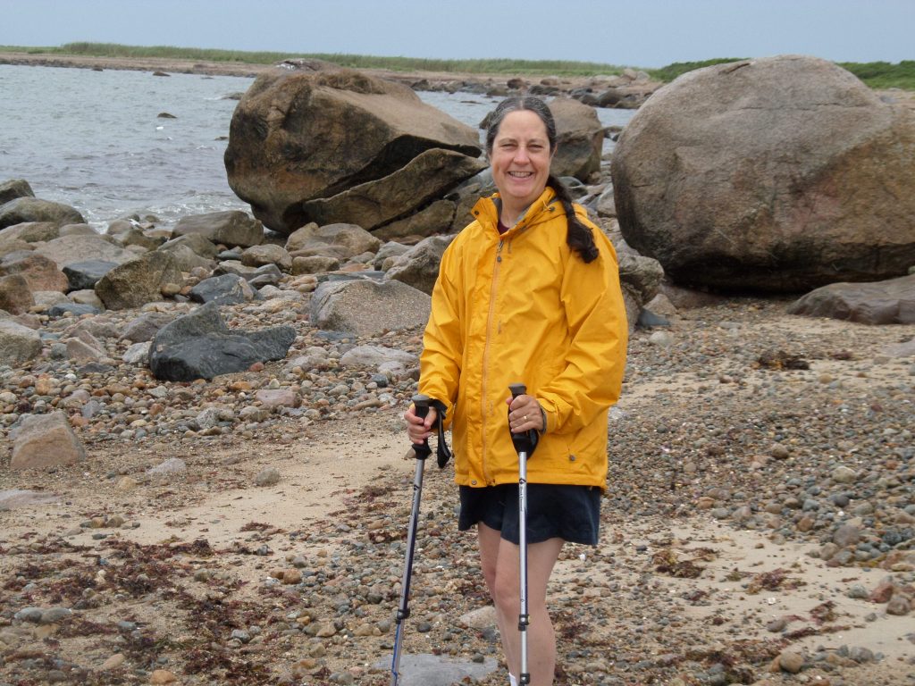
Visiting Gooseberry Island on a warm day (note the shorts–not what I wear in winter)
LISTEN HERE:
One of my favorite pieces of shoreline is on the southeast coast of Massachusetts. New England is well known for its rugged, rocky coast. This little spit of land, Gooseberry Island, juts out into Long Island Sound and has some sandy beaches and oversize boulders. A causeway allows visitors to drive out onto the island.
Marjorie Turner Hollman is an author, creator, observer, and disability advocate who loves the outdoors. Link to all Marjorie’s books.
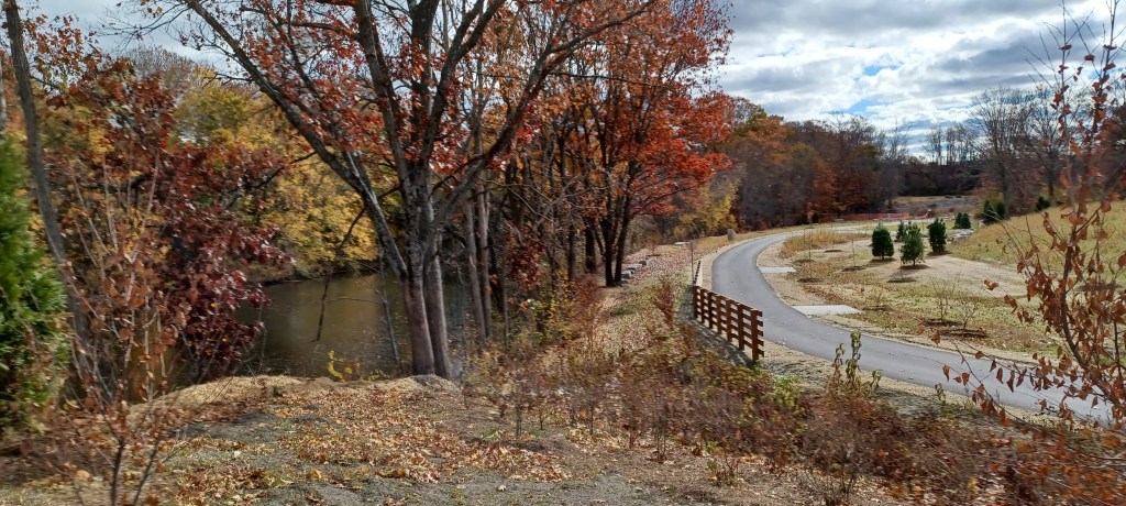
Newest section of the Blackstone River Greenway/Bikeway now open!
LISTEN HERE:
Because the process of developing rail trails is such a monumental effort, the easiest sections are generally completed first. (Higher in elevation, already somewhat cleared, lacking encroachment from neighbors). Tying together these disparate, already completed sections of one proposed project is a challenge. When new connections are established the rail trail becomes more attractive for those of us who enjoy traveling by bicycle. And thus, my enthusiasm as we watched progress on the Blackstone Riverway rail trail extension from Blackstone, Massachusetts into Rhode Island.
Marjorie Turner Hollman is an author, creator, observer, and disability advocate who loves the outdoors. Link to all Marjorie’s books.
LISTEN HERE:
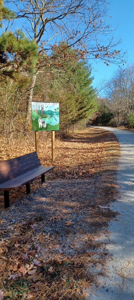
On a warm November day we headed over to Medfield, MA to visit the relatively new Medfield Rail Trail. The path is a work in progress as part of the Bay Colony Rail trail, with plans to connect with more of the rail trail located in Dover, Needham and Newton. The Needham and Newton portions are finished while the Dover section is in the planning stage. An updated mapfrom December, 2023 details the completed sections of trail and the plans for further development of this recreational resource. It is also is part of the much larger trail network of the Bay Circuit trail.
Marjorie Turner Hollman is an author, creator, observer, and disability advocate who loves the outdoors. Link to all Marjorie’s books.
LISTEN HERE:
When we planned our trip to the Gaspé peninsula we had no real idea what we might find. Online photos can offer some clues, and descriptions (like this!) may help potential visitors decide if they want to make the effort to spend time in any particular place. We have found that “on the ground” experience is so much more helpful than other ways of learning about an area can convey.
Marjorie Turner Hollman is an author, creator, observer, and disability advocate who loves the outdoors. Link to all Marjorie’s books.
LISTEN HERE:
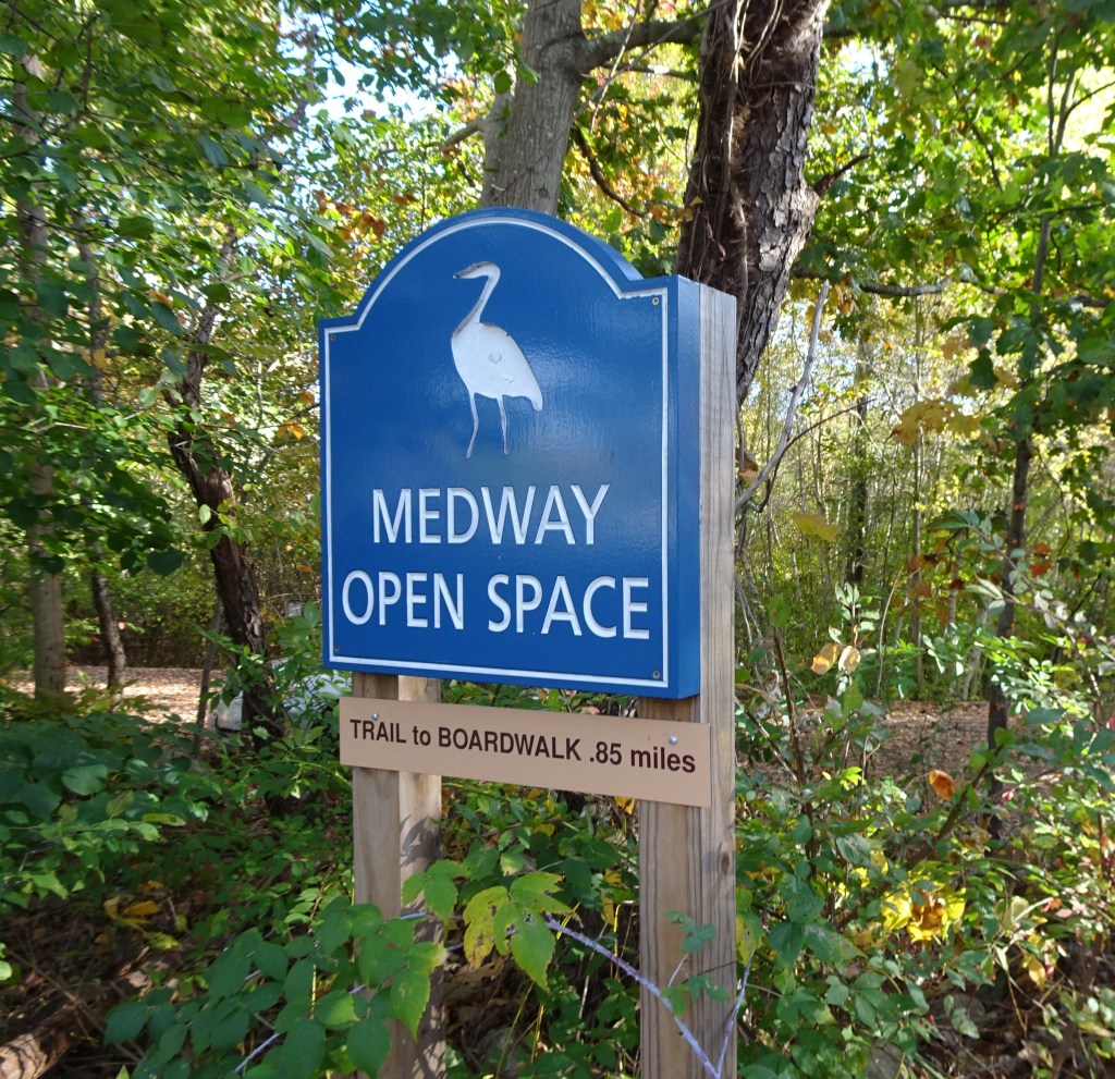
The Medway (MA) Trails Club and Open Space Committee have been hard at work since I last updated the 2nd edition of Easy Walks in Massachusetts in 2016. I recently visited Medway a couple of times to see for myself the changes that have taken place. Here’s a link to maps of all the open space in Medway.
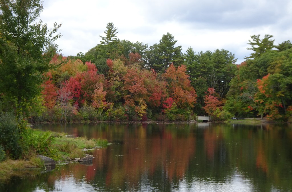
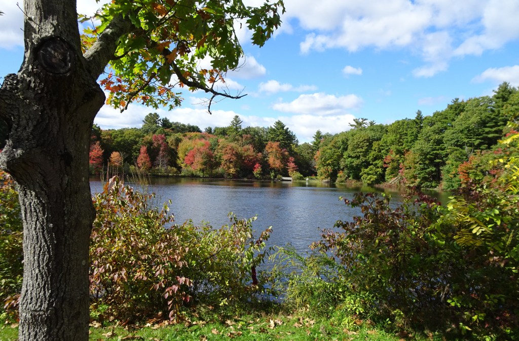
As I work to update the book, my first outing to Choate Park this year with my friend Nancy was simply to capture some of the stunning foliage around Choate Pond, just off Rt. 109 in Medway. The trees did not disappoint. Watery reflections doubled the display of fall color.
Turtles resting on a log in Choate Pond
In the afternoon sunlight a row of turtles perched themselves on a tree trunk that had conveniently fallen into the pond.
Stone walls follow parts of the path from Choate Park onto Medway High School and beyond
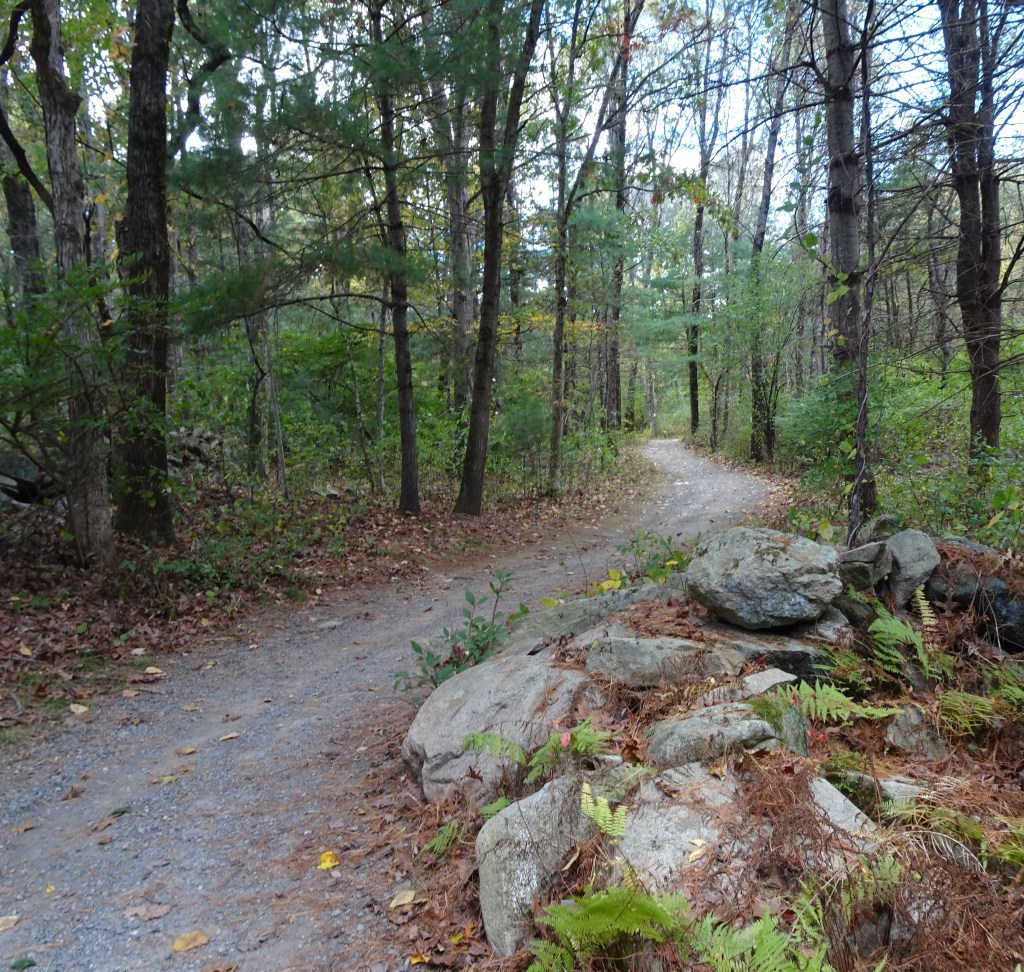
The trail to Medway High School is accessed directly from the Choate Park recreation area. Keep an eye out in the afternoon when school is dismissed. Students use this trail when leaving for the day. The Cross Country (CC) team also uses this area as their CC race course. Plan to enjoy the quiet, stone walls, a small stream, and access to additional trails which will take ambitious walkers on several more miles of trail.
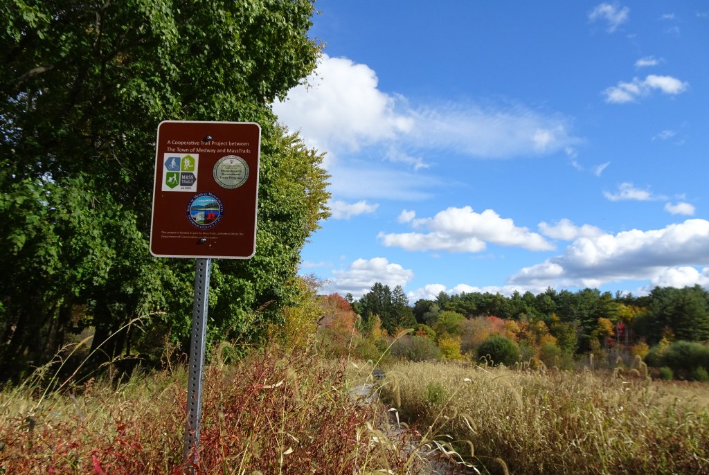
I learned that a new parking area, with access to a handicapped accessible path through the Adams Street meadow, is now useable.
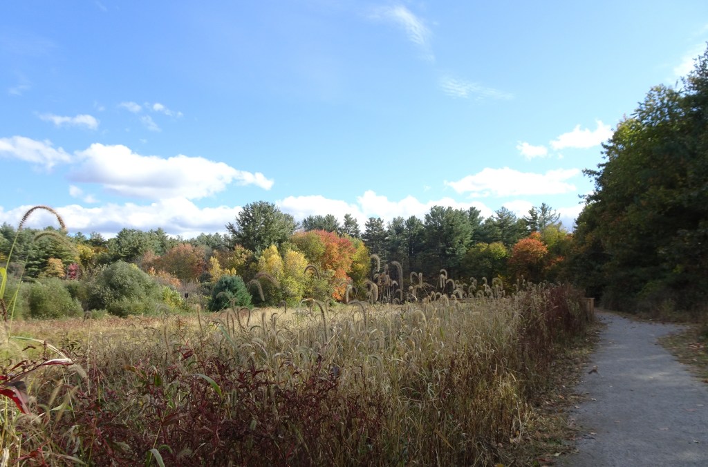
Packed stone dust path encircles the Adams St. meadow
The grand opening for the trail is not yet scheduled, but the trail and parking area are finished and ready for visitors.
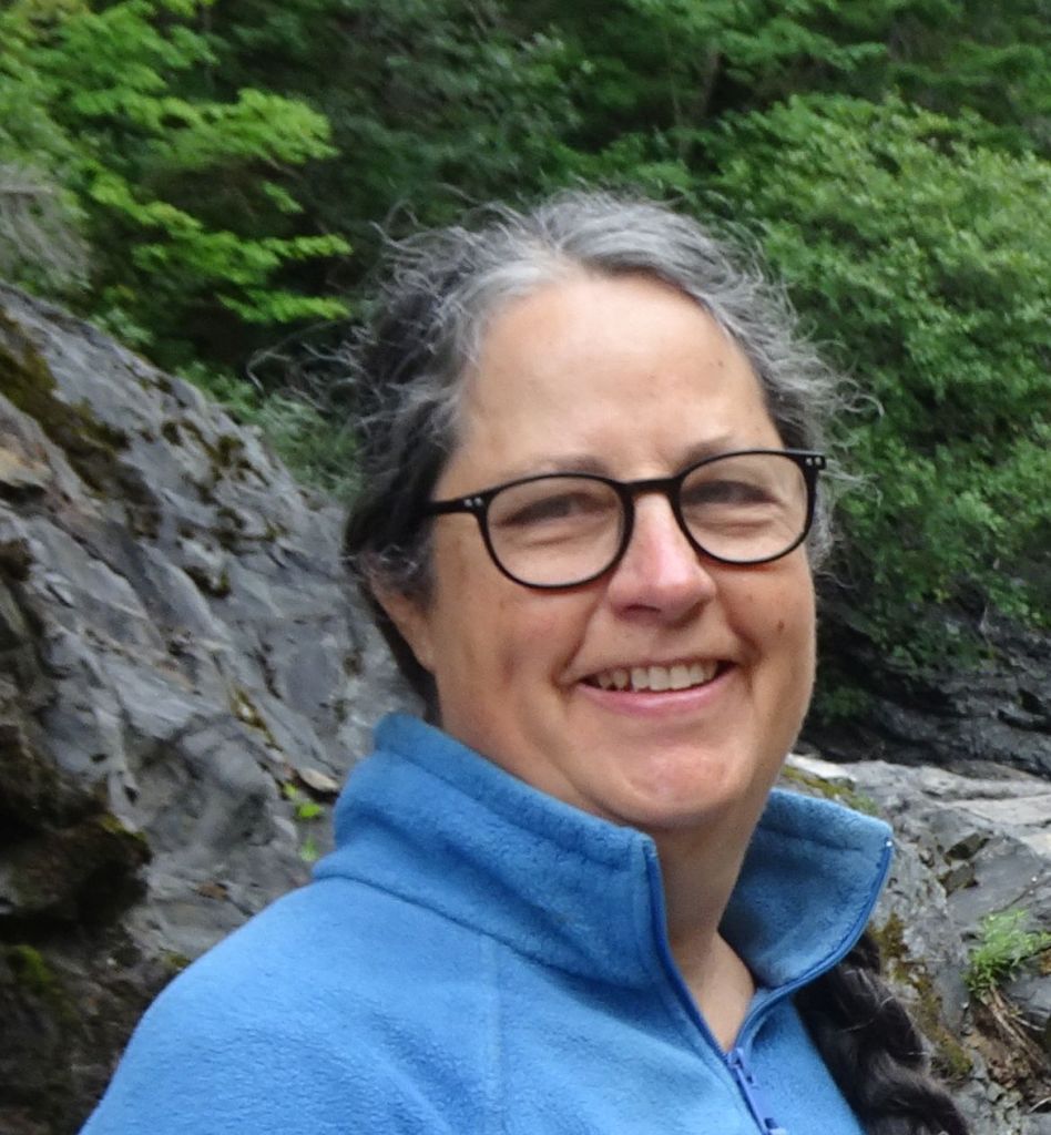
My tour guide Andrea
A member of the Open Space committee, Andrea, joined me for my visit to the meadow. Thanks to the hard work of local committees and additional funding through an RTP grant from Massachusetts Division of Conservation and Recreation (DCR), the meadow trail provides a paved handicapped accessible parking area. The crushed stone path takes visitors around the circumference of the meadow.
One of several benches in place along the Meadow trail
Multiple benches and picnic tables provide places to rest, or simply spend some time enjoying the view.
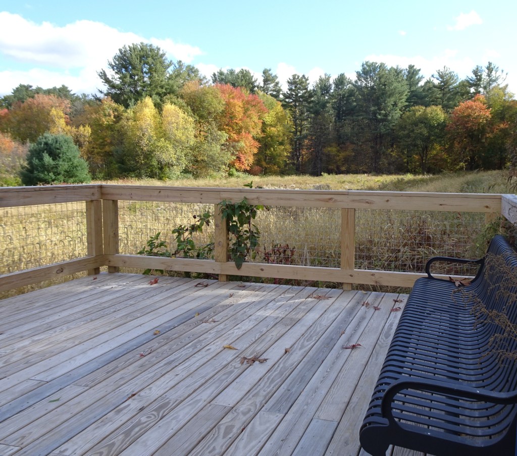
Viewing platform, overlooking the meadow
Species such as bluebirds and bobolinks need open space such as the Adams St. meadow to thrive. A handicapped accessible viewing platform hosts a bench for those looking to spend some time relaxing there. Additional connecting trails take visitors behind Medway High School back toward Choate Park.
Boardwalk over Chicken Brook
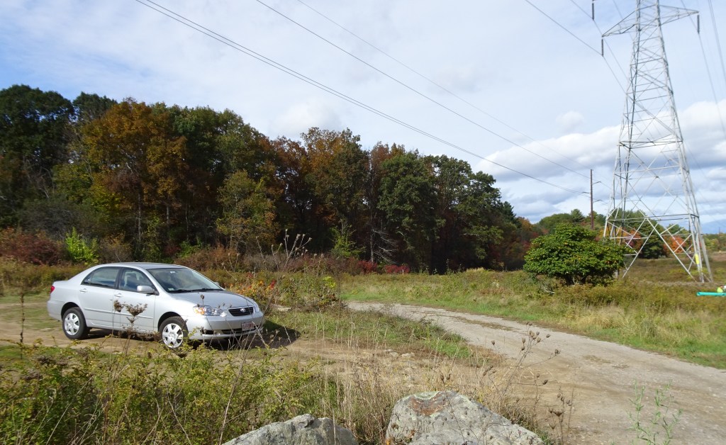
Yet another trail system on the other side of Adams St. hosts two boardwalks that cross Chicken Brook (a tributary of the Charles River). This portion of the trail has a small parking area on Adams St. next to the high tension wires that cross the area. The path from the high tension wires goes through woodland and wetland (thus the boardwalks) on its way to a small parking area on Lovering Street. Both Adams and Lovering Street and their parking areas are accessed from Summer Street (Rt. 126) in Medway.
Parking area at high tension lines on Adams St.Parking area sign at Lovering St.
I was excited to see all the progress that has occurred since I released the second edition of Easy Walks in Massachusetts. Our local rail trails have seen the most progress in connecting portions of trail from one town to the next. The town-owned open space of Choate Park is impressive, not only for efforts within the town to provide better access to their trail network, but for the countless volunteer hours that have contributed to making well marked trails available for residents and visitors alike.
Choate Park and its network of trails in Medway, MA are a worthwhile destination for sure. Happy trails!
Marjorie Turner Hollman is an author, creator, observer, and disability advocate who loves the outdoors. Link to all Marjorie’s books.
LISTEN HERE:
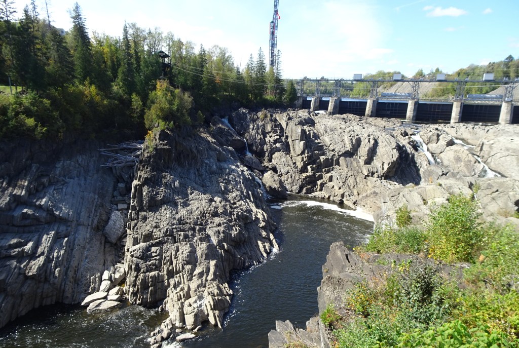
Grand Falls in autumn. The St. John River created this massive gorge and cascade
Choosing to travel to Canada when living in New England is not that big a challenge. On a recent trip we left from Massachusetts and headed for the Gaspé Peninsula in Quebec, and stopped at Grand Falls, New Brunswick (NB) on our way farther north. After studying our planned route, we decided to include Grand Falls as an incidental stop along the way to the Gaspé Peninsula. Sometimes the unplanned stops along the way can be the most rewarding. Grand Falls was the perfect start of our travels north, beyond the border of Maine and the U.S.
Years ago my husband and I visited often the Acton Arboretum, just off Rt. 2 on Taylor Road. On our previous visit the parking area was rough with potholes, but a few of the paths were handicapped accessible. Some benches were available here and there.
Returning ten years later, we were amazed at the positive changes that have made this open space into a destination I would highly recommend.
Our fully loaded adaptive tandem bicycle. We look like we are headed out for a week, but this is what it takes to keep me safe on the trail.
In this post we’re off to Westfield, MA and heading south into Connecticut. Late spring, cooler summer days, and early fall are the times when we take out our adaptive tandem bicycle. Our visit to Westfield was early summer, overcast and comfortable.
On the trail with our adaptive tandem bicycle
My walking distance is limited, but when we climb onto our tandem bicycle we can travel substantially farther (often between 10 and 35 miles round trip) and enjoy varied terrain along the way. On these tandem outings we often cross multiple rivers, streams, and ponds.
We started on the Columbia Greenway Rail Trail in Westfield, continuing into Southwick, MA. Our plan was to head south from Westfield to the Farmington Rail trail. It is designated as the Farmington Canal Heritage Trail and Farmington River Trail, the boundaries of which reach from the Massachusetts/Connecticut line south to New Haven, Connecticut.
In the area where we pedaled, we spotted a few small sections of what was once the Farmington Canal, which was begun in the 1820s (from the Massachusetts state line south to New Haven, Connecticut) and operated through the 1840s. As a transportation option, the canal was never a financial success. For the most part, few signs of the canal structures are still intact. We spotted a stretch of water with exceedingly straight banks, most probably a small portion of the erstwhile canal. Water flowed through a small stream underneath a bridge along the trail, and then continued on to the man-made waterway.
In Simsbury, the next town south of Granby, the trail took a detour around the Monrovia Nursery Company and Imperial Nurseries. There is a dedicated path for trail users but it requires crossing at a busy light. The paved section at the back side of the nursery is quite narrow. Take care. An overzealous rider coming from the opposite direction chose to speed up to squeeze between us and another bike that was approaching us. With inches to spare we all got past each other. This is a down side of sharing a path with others.
Lake Basile in Simsbury, Connecticut was where we turned around. Before heading back north we found a bench overlooking the lake and pulled out our lunch.
Tasty wild strawberriesVandalized turtle nest on the shores of Lake Basile
Ripe wild strawberries added to our meal (but be careful of the poison ivy!) The sandy shoreline next to the water was pock-marked with remnants of turtle nests that had been dug up. The curled up remains of turtle eggs surrounded each excavated hole. A raccoon or skunk must have had a feast.
Much of the area we passed through is cultivated farmland. We saw corn crops, the young plants just poking up out of the ground. Other fields were planted with vegetables. Road crossings in these rural areas were, for the most part, easily gotten past. A few heavily trafficked streets had crosswalk lights that helped us to safely get to the other side of the trail.
Fun sculptures at a road crossing in Simsbury
As with many rail trails, the path itself is relatively level, yet seemied to slope down in each direction we traveled. We were reminded of the stories of past generations when children walked uphill both ways in the snow on their way to school. In our case, however, it felt as though we mostly rolled downhill both ways. Happy trails!