Marjorie Turner Hollman helps authors self-publish their nonfiction books. She is also a disability advocate, sharing information about Easy Walks (not too many roots or rocks, relatively level with firm footing, and something of interest along the way) in open space.Learn more.
LISTEN:
Sights along the trailCampground next to trail
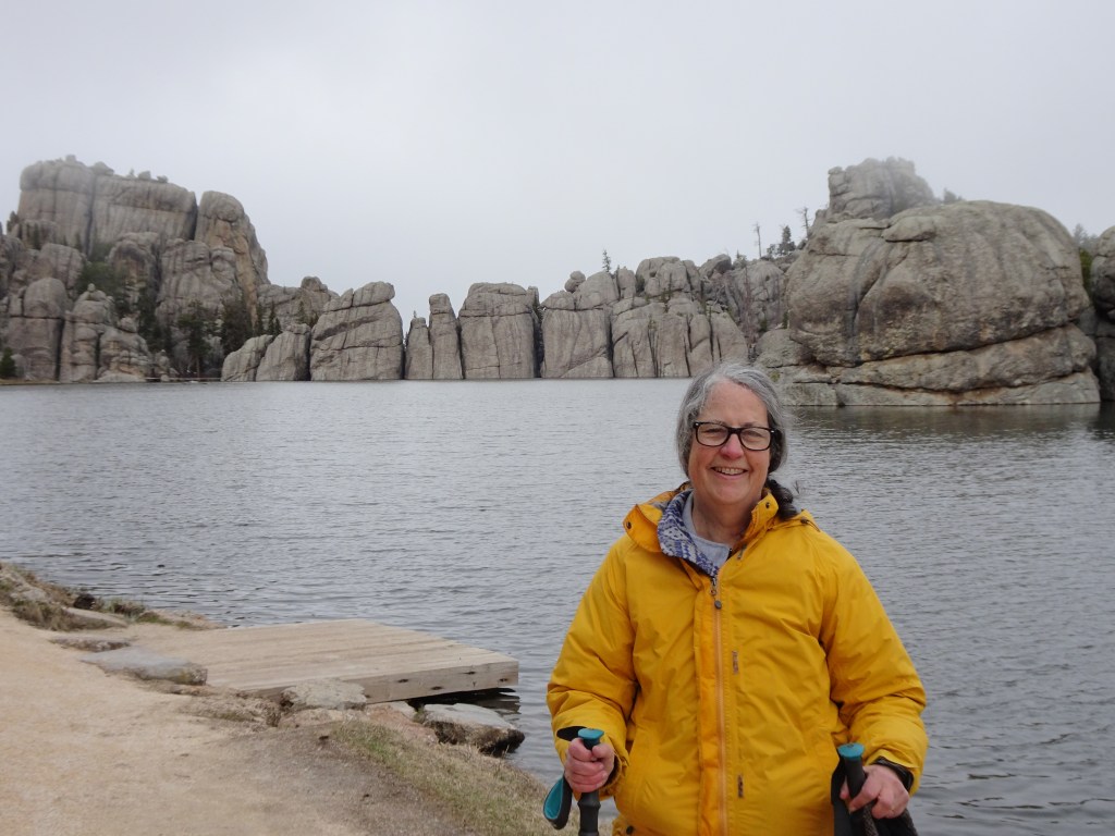
We had hoped to visit Yellowstone National Park and the Grand Tetons on our trip west from New England. Unpredictable spring weather, however, caused us to pause in the Black Hills, hoping the weather farther west would warm up. It didn’t (at least not on our time schedule!).
Marjorie Turner Hollman helps authors self-publish their nonfiction books. She is also a disability advocate, sharing information about Easy Walks (not too many roots or rocks, relatively level with firm footing, and something of interest along the way) in open space.Learn more.
Marjorie Turner Hollman helps authors self-publish their nonfiction books. She is also a disability advocate, sharing information about Easy Walks (not too many roots or rocks, relatively level with firm footing, and something of interest along the way) in open space.Learn more.
LISTEN:
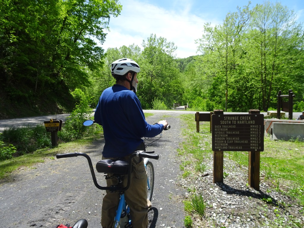
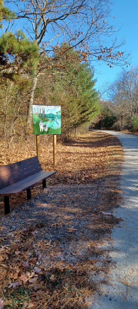
The Elk River rail trail was not on our radar until we stopped for the night at a Harvest Hosts camping spot near Beckley, West Virginia. We were on our way home to Massachusetts after visiting grandboys in Tennessee. As we sat around the campfire next to our host’s riverside spot, they mentioned a rail trail alongside the Elk River that they had heard about.
Marjorie Turner Hollman helps authors self-publish their nonfiction books. She is also a disability advocate, sharing information about Easy Walks (not too many roots or rocks, relatively level with firm footing, and something of interest along the way) in open space.Learn more.
LISTEN:
You know it’s summer when you have an errand and immediately think, “Where can we ride our bike near where we’ll be anyway?” The border of Massachusetts and New Hampshire is a pretty good distance from our home, (Rhode Island is a stone’s throw from my house), but we were on a mission, and Pepperell was on our calendar. The day was not too hot (for me) and our adaptive tandem bicycle was ready to roll. And so we did!
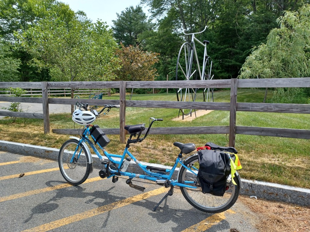
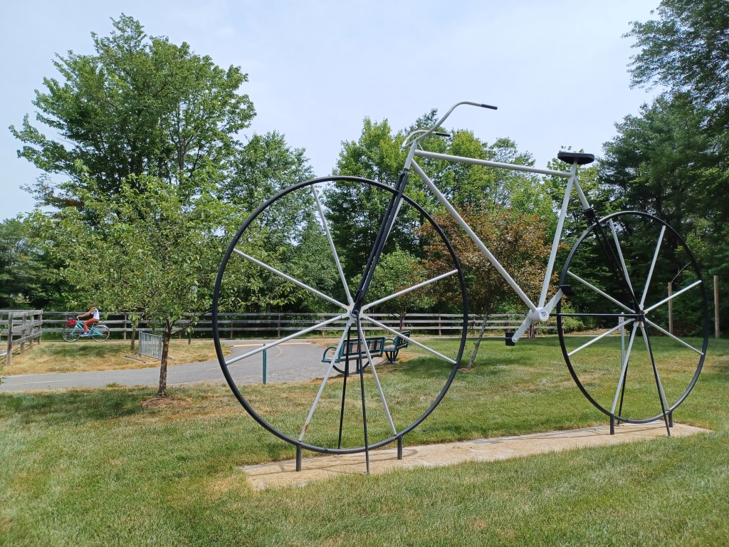
A giant bicycle sculpture next to the trail
The first sight that greeted us as we arrived at the small town park in Winchendon was the giant bicycle next to the parking area. What a friendly invitation for bicyclists to join others enjoying the trail.
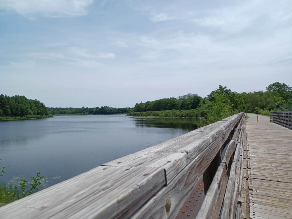
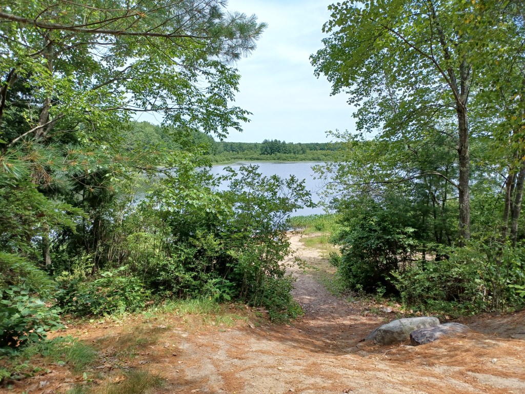
Access to downtown WinchendonWater views along the trail
It had been ten years since we last visited this trail. The water views are the same, but the paved path has been vastly improved. For a holiday weekend, the North Central Parkway was not crowded. Several families with children passed us along the six miles or so we pedaled on the paved path. A few others on wheels passed us, including a child riding her small tricycle. Slowing down and being willing to stop when little ones stray over the line is part of the territory. Offering a smile to parents who are getting their kids out makes life better for all of us.
It takes practice to understand how to navigate rail trails that are shared by walkers, bicyclists, and dog walkers. Staying to one side or the other can be confusing. Chatting with friends can distract us from looking out for others on the trail. And some who (likely) walk ever day appear to use headphones to keep them entertained.
Safety tip—doing anything that compromises your ability to hear while on a rail trail is dangerous. You will not be able to hear when people pass by you from behind. Perhaps more concerning, if someone might wish you harm, you could be caught unawares. Be selfish—take care of yourself and others by using all your senses!
OK, end of public service announcement.
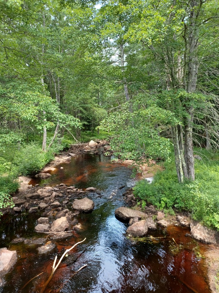
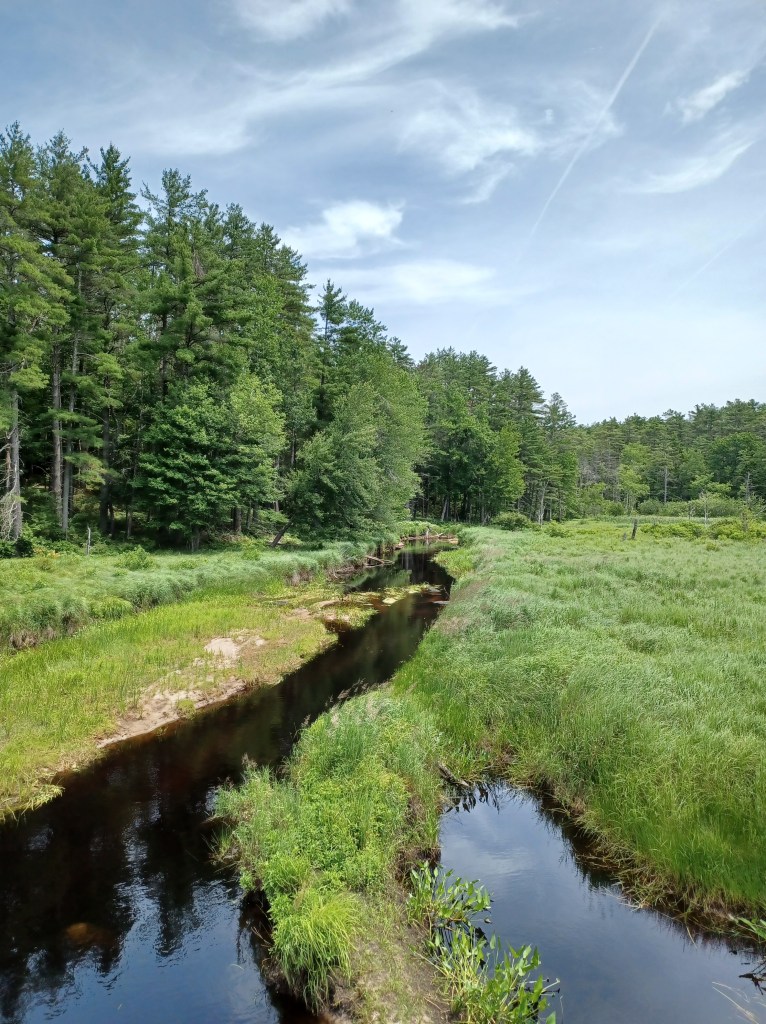
I so enjoyed the multiple spots along this trail with water views. Small streams cross underneath the path. Wetlands with little pools of water are right off the trail. Reminders remain of important infrastructure trains used along this right of way in days gone by. Look for old bridge abutments next to or underneath where new bridges now allow us to cross streams along the way.
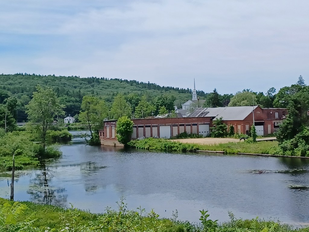
Old mill buidlingsAccess to the pond
Some mill buildings remain next to Whitney Pond, from a time when Winchendon was one of many New England towns with local industry that used water power to run their machinery. A bridge spanning a portion of the pond allows for access from the downtown to the rest of the trail.
We found multiple benches along the way, many with nice water views. We stopped at one spot for a snack. The chocolate in our trail mix had not melted, thanks to the ice I carry to help keep me cool. Once I got the nuts and chocolate in my hand, however, I was reminded why the company that makes M&Ms claims, “melts in your mouth, not in your hands.” My hands would have been less messy if our trail mix had had M&Ms as one of the ingredients. Live and learn? Maybe.
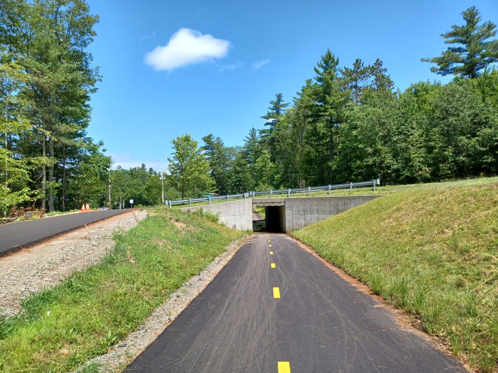
Small tunnel along the wayTrail access
We returned the next weekend to check out the Gardner section of the North-central pathway. We parked on Commercial Drive, in Gardner, just off Rt. 140. The paved rail trail goes right underneath the road and continues both directions. Additional parking is available just off Old Gardner Road, right off Rt. 140.
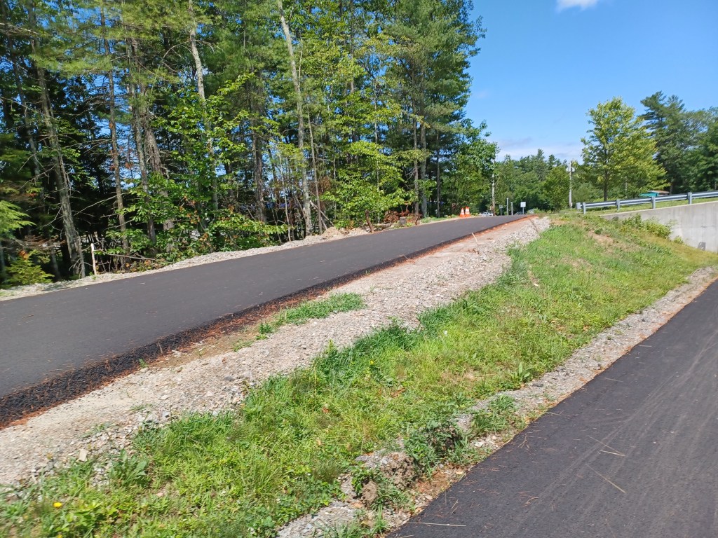
The old Gardner Road parking marks the northern end of the developed section of the Gardner trail. By continuing past the parking on Old Gardner Road, you will soon intersect with Spring St., Rt. 12. Just a short distance southeast on Rt. 12 is North Ashburnham Rd. Turn left and travel a quarter mile to the Winchendon portion of the trail. Riding on Old Gardner, Rt. 12 and North Ashburnham Road allows you to avoid the undeveloped portion of the trail between Gardner and Winchendon. That unimproved section is damp, with lots of roots, some rather large rocks, and has evidence of ATV usage. We pedaled along it for a short distance till we encountered a tree trunk too large for us to remove.
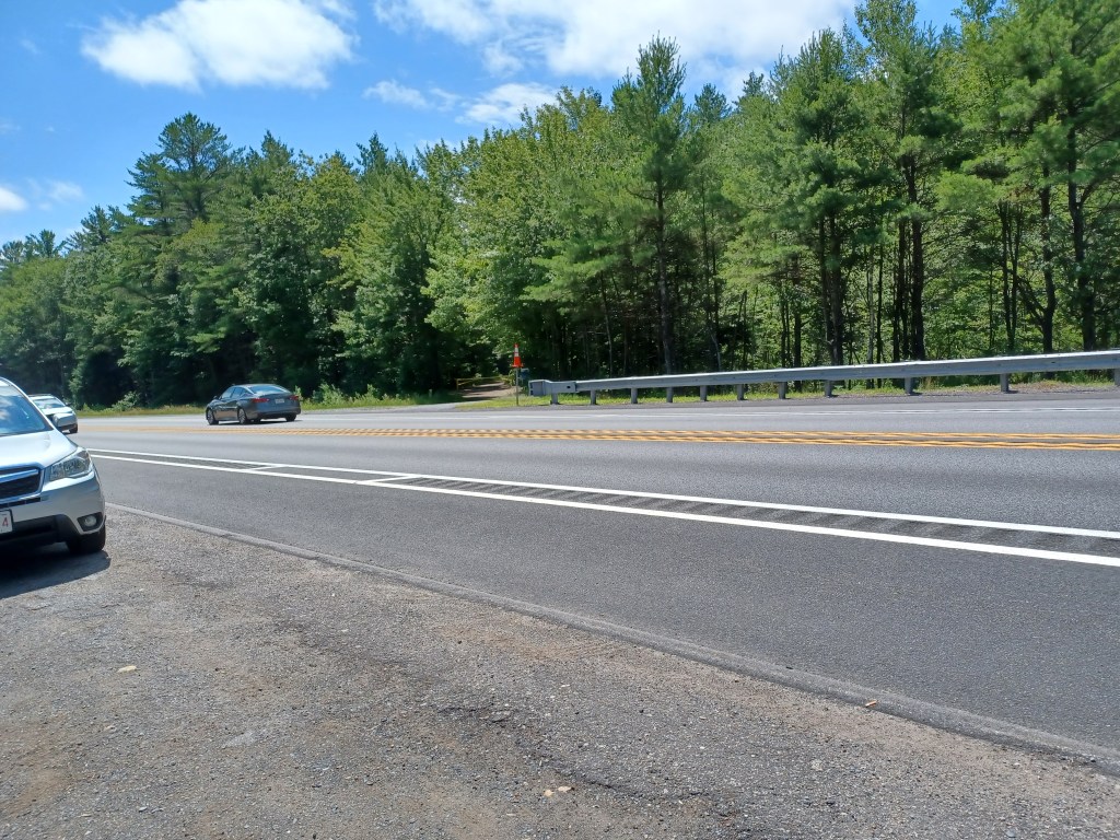
We headed back south on the Gardner section, crossing several pretty streams along the way. When the trail intersected with Rt. 140, we could see that it continued beyond the highway. There is no cross walk nor signals to warn traffic of potential travelers crossing the road. The speed of oncoming traffic from both directions persuaded us to turn around.
Rt. 140 is a formidable barrier between two sections of the Gardner part of trail
While some of the trail hugs busy Rt. 140 (and thus is pretty noisy), much of what we rode on during our second visit offered quiet, and water views. Other than at mid-day, much of this trail, both in Winchendon and Gardner, has welcome shade in the summer. Summer bike rides provide plenty to love, but I for one am looking forward to foliage season and cooler weather. Till next time, happy trails!
Marjorie Turner Hollman helps authors self-publish their books. She is also a disability advocate, sharing information about Easy Walks (not too many roots or rocks, relatively level with firm footing, and something of interest along the way) in open space.Click to learn more.
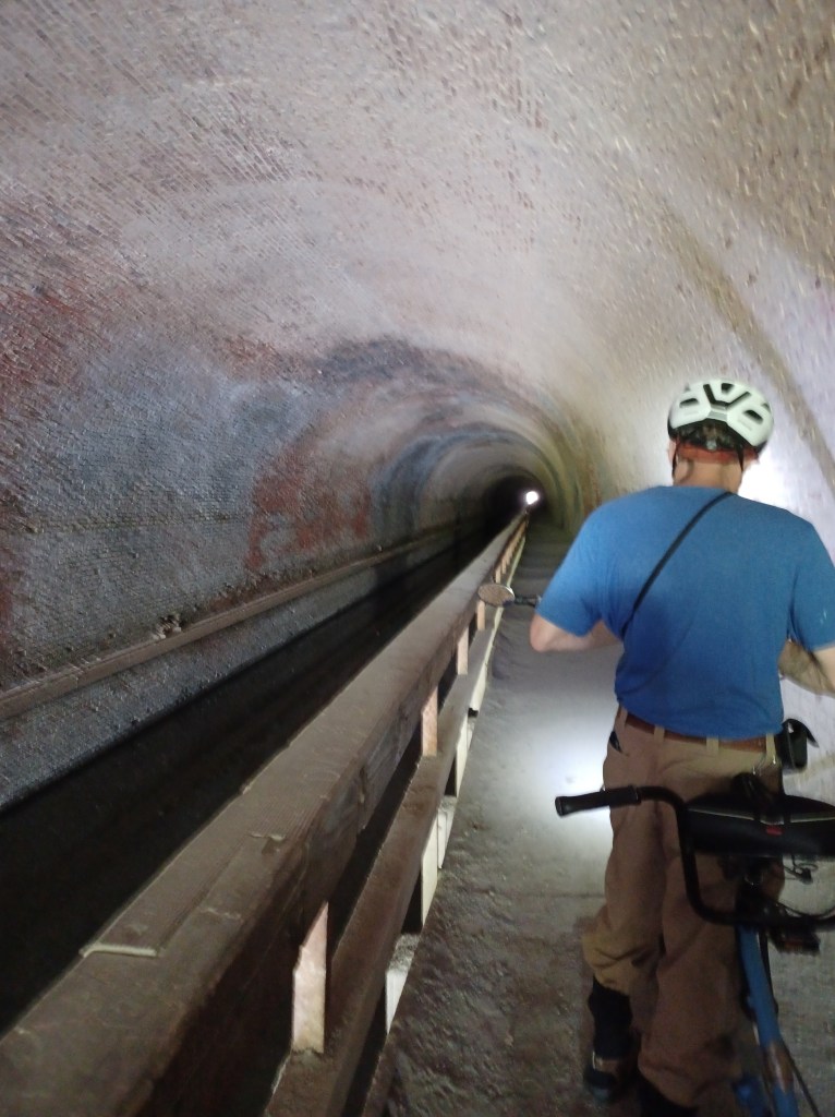
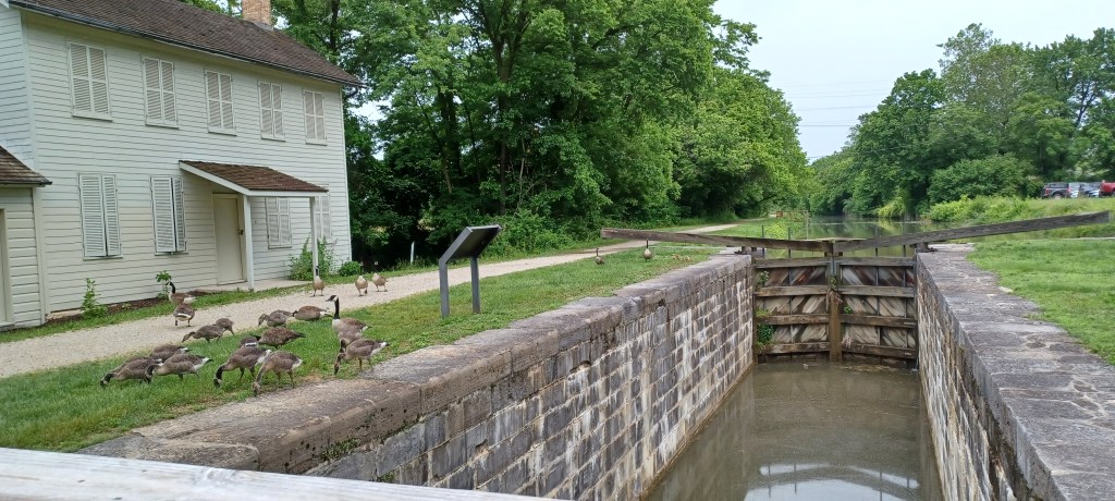
We rode our handicapped accessible tandem bicycle along the 184 mile C&O Canal rail trail, with the goal of going through the Paw Paw Tunnel in Paw Paw, West Virginia. Rather than creating an opening through the mountain (now called Tunnel Hill) for trains to traverse this rough terrain, this tunnel was built to allow canal boats to carry coal, lumber, and produce to market.
Water still flows through the canal inside the tunnel, although much of the remaining canal infrastructure suffered floods and is now infilled with soil. The tow path, a number of locks, and lock keeper cottages remain from when the canal network was an important form of transportation in the 1800s. The linear C&O (Chesapeake and Ohio) National Historical Park documents the history of the canal, which operated alongside the shoreline of the Potomac River from Maryland, into West Virginia then back into Maryland, finally terminating in Georgetown, Washington D.C.
The brick-lined Paw Paw tunnel is too narrow to safely ride a bike through the half mile distance as it burrows underneath the mountain. A sturdy railing between the tow path and the canal protects visitors from tumbling into the water.
Inside the tunnel
Headlamps are helpful when passing through the tunnel. The footing is somewhat irregular. Apparently floods over the years have washed through the area, creating potholes and various other irregularities on the former towpath that makes walking challenging (at least for me). The tunnel has leaks, and water collects in various spots along the walkway.
The other side of the tunnel
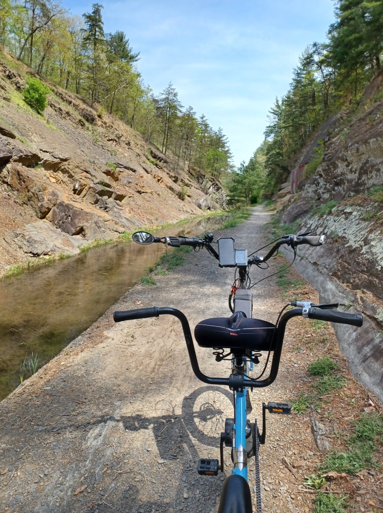
On the other side of the tunnel, a wide vista opens up. Massive rock faces on either side of the water-filled canal and tow path provide visual evidence of the monumental effort that went into the construction of the canal. Run off from the mountain flows across the path in several places. We needed to dismount from our bike several times in order to safely cross the narrow platforms that spanned those areas.
Intact canal with infrastructure in place
As the tunnel receded into the distance, views of the Potomac River opened up. We encountered a series of canal locks, the granite blocks of each lock still in place. Where water once flowed, many of the locks are now filled with soil and grass.
The signs for the locks near the tunnel have posted numbers. They also offered fractions. Lock No. 64 1/3 then Lock No. 64 2/3. The next lock we found bore the label, Lock No. 66. We never found Lock No. 65.
The near 90 degree (f) day shortened our outing, but the coolness of the tunnel provided a respite from the unseasonable heat of spring. It is especially important to make way for travelers you meet or who need to pass you in the tunnel itself.
We met some through-bikers on the trail, kitted out with all their supplies in panniers attached to their bikes. Multiple tent-only campsites along the trail invite ambitious bicyclists to ride for days on end with no need for motorized transport. Pedal power alone takes riders from one point on the trail to the next.
Campsite area (tents only) offer through bikers a place to rest overnight
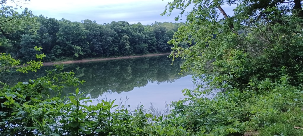
We have ridden on several sections of the C&O rail trail in Maryland. We have now added to our visits a portion in West Virginia. We look forward to making trips to enjoy more views of the Potomac as it wends its way (mostly) southeast to the nation’s capital. The trail surface along every portion we’ve visited are impressively well-maintained, packed, crushed stone dust.
Camping alongside the Potomac River. West Virginia is just on the other side of the river
McCoy’s Ferry National Park campground has been our go-to stop when traveling from New England to visit grandchildren in Tennessee.
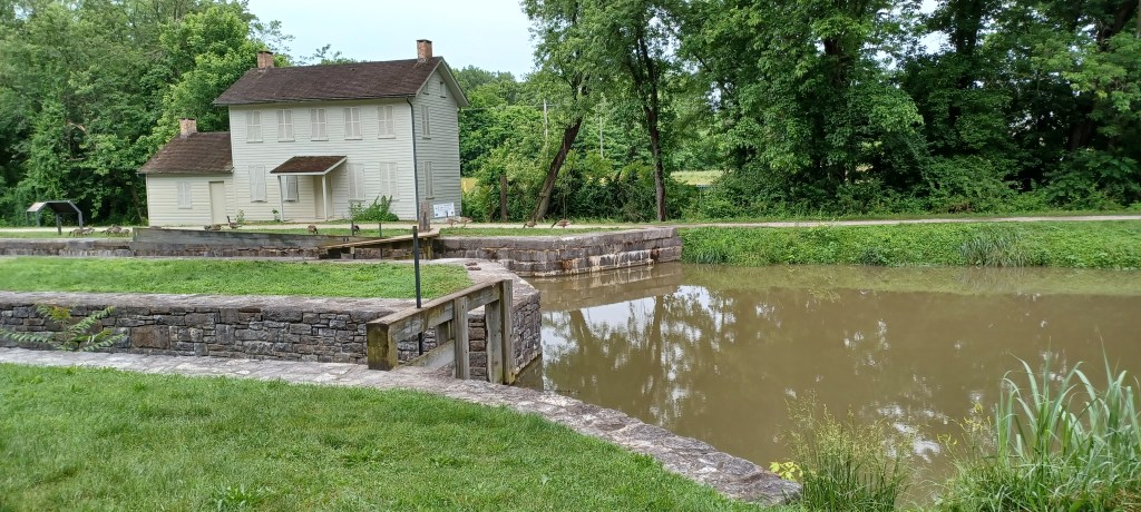
Cushwa Basin, Williamsport, Maryland
It is just north of the Cushwa Basin, site of the C&O National Historical Park headquarters in Williamsport, Maryland.
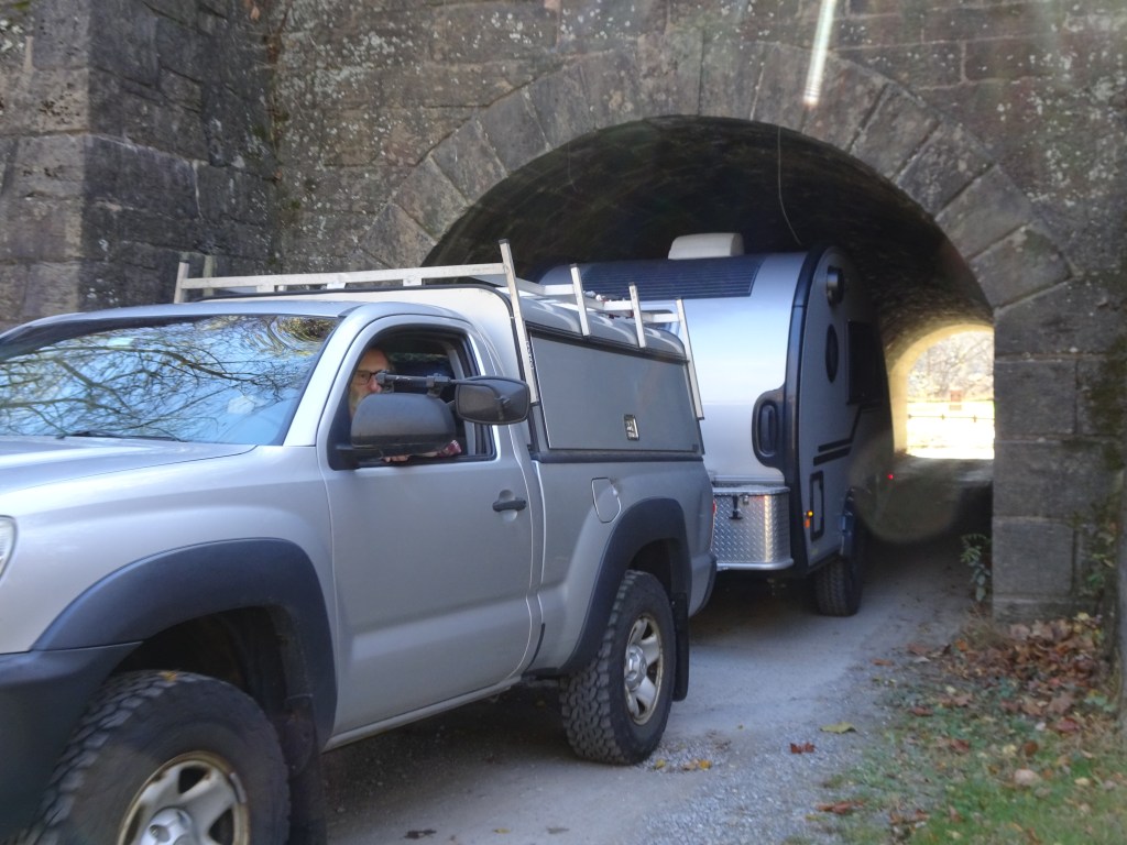
A snug fit passing through the tunnel at McCoy’s Ferry Campground
A diminutive tunnel at the entrance to the campground severely restricts the size of RV that can use the site alongside the Potomac. We have a very small camper, and it is still a very tight fit.
One of the multiple intact locks, with a lock keeper’s cottage on left. Rail trail next to canal
The rail trail is accessible from McCoys Ferry. A steep slope makes getting up to the trail somewhat of a challenge, but allows for leaving directly from the campground and spending the day on the trail. We look forward to more visits along this extensive rail trail network the next time we are in the neighborhood.
Marjorie Turner Hollman helps authors self-publish their nonfiction books. She is also a disability advocate, sharing information about Easy Walks (not too many roots or rocks, relatively level with firm footing, and something of interest along the way) in open space. Link to all Marjorie’s books.
Umpachene Falls in springtime
LISTEN:
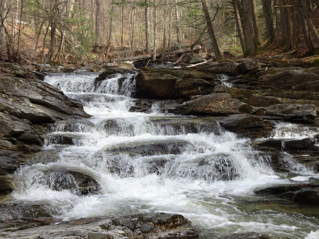
After an icy winter we were anxious to get outdoors and stretch our legs. Western Massachusetts was our destination. Finding some waterfalls was our goal. Umpachene Falls Park in New Marlborough, Massachusetts, was our first stop. This riverfront park includes a small grassy riverside space I’d describe as an Easy Walk, that is, not too many roots or rocks, relatively level with firm footing and something of interest along the way.
Marjorie Turner Hollman is an author, creator, observer, and disability advocate who loves the outdoors. Link to all Marjorie’s books.
LISTEN HERE:
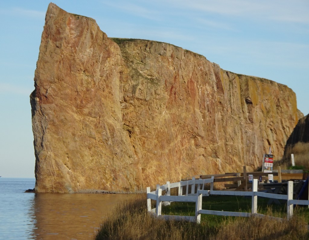
Percé Rock
It’s the rock that will grab you when you come around the bend in the road. Massive, kinda rectangular. My first view was near sunset. The light hit the massive stone structure just off shore and turned it a glowing gold-reddish hue. A small arch at the bottom, at sea level, added an intriguing detail to this iconic landmark, Percé Rock, just offshore from the boardwalk and bustling tourist town of Percé.
Marjorie Turner Hollman is an author, creator, observer, and disability advocate who loves the outdoors. Link to all Marjorie’s books.
Newest section of the Blackstone River Greenway/Bikeway now open!
LISTEN HERE:
Because the process of developing rail trails is such a monumental effort, the easiest sections are generally completed first. (Higher in elevation, already somewhat cleared, lacking encroachment from neighbors). Tying together these disparate, already completed sections of one proposed project is a challenge. When new connections are established the rail trail becomes more attractive for those of us who enjoy traveling by bicycle. And thus, my enthusiasm as we watched progress on the Blackstone Riverway rail trail extension from Blackstone, Massachusetts into Rhode Island.
Marjorie Turner Hollman is an author, creator, observer, and disability advocate who loves the outdoors. Link to all Marjorie’s books.
LISTEN HERE:
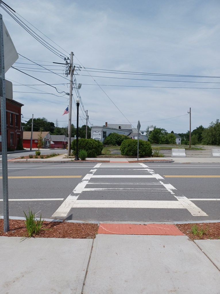
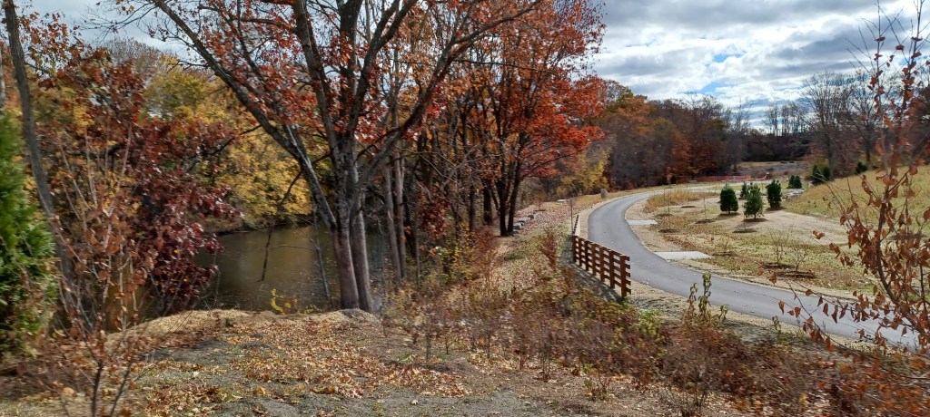
On a warm November day we headed over to Medfield, MA to visit the relatively new Medfield Rail Trail. The path is a work in progress as part of the Bay Colony Rail trail, with plans to connect with more of the rail trail located in Dover, Needham and Newton. The Needham and Newton portions are finished while the Dover section is in the planning stage. An updated mapfrom December, 2023 details the completed sections of trail and the plans for further development of this recreational resource. It is also is part of the much larger trail network of the Bay Circuit trail.