

Marjorie Turner Hollman is a writer who loves the outdoors. Link to all Marjorie’s books.
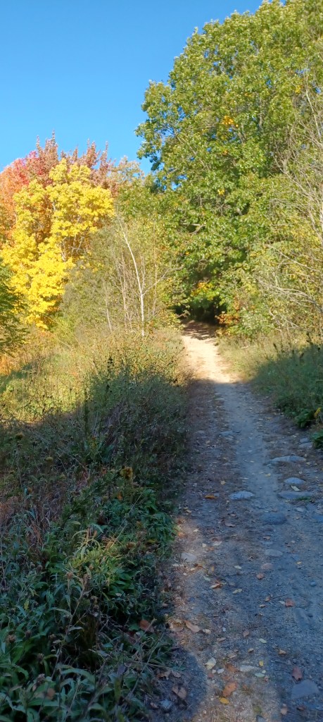
We have spent the past several weeks exploring the SNETT (Southern New England Trunkline Trail) that runs quite near our home. Improvements have just been completed from Center Street in Bellingham, MA west to Rt. 126, near the Blackstone, MA line. What has up to now been one of the more challenging sections of the SNETT, this portion of the trail has limited views, but is key to opening up further sections of the SNETT west of here. Park at the Center Street parking area. Once parked, head west. An additional, Harpin Street entrance is next to DiPietro Elementary School, with parking across the street at the athletic fields. This area was until recently a barrier for those wanting to access other western sections of the trail.
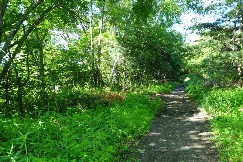
The path from Center Street, on to the west was overgrown, filled with poison ivy, and littered with rocks and large puddles.
This tough section of trail has now been turned into an Easy Walk through woodland, open now for an additonal mile to the bridge that was built over Rt. 126 a number of years ago, anticipating development of the trail. The day has finally arrived when the hope for a passable trail to this tunnel has been fulfilled.
Besides visiting the new Bellingham section of the SNETT, we also undertook additional outings in neighboring Blackstone, MA, where we parked at Farm Street and walked east toward Bellingham, and on another visit went west along the SNETT starting from the same location on Farm Street.


When we walked eastward from Farm Street in Blackstone, we found that it was relatively easy to go all the way back to the Rt 126 tunnel in Bellingham. While not officially improved, the trail is passable, especially when no recent rains fill the depressions in the path with water.
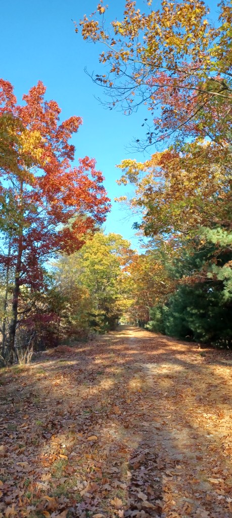
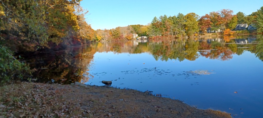
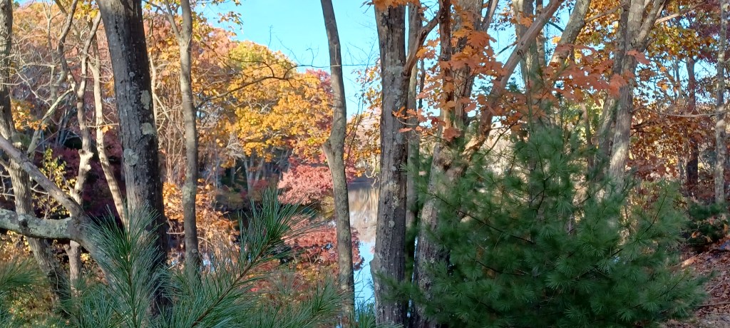
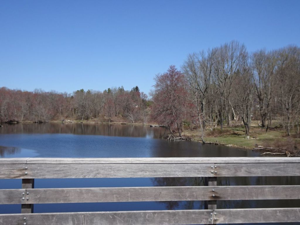
From Farm Street in Blackstone, going west is also quite passable all the way to Rocco Drive in Blackstone. Both sections in Blackstone, starting at Farm Street, east back to Bellingham and west toward Rocco Drive, offer water views. We enjoyed colorful foliage, and a few rock cuts, which is where rock was blasted to make way for the train tracks. Dynamite was used to make way through the rock for the tracks. Lots of crushed stone was produced by these efforts, which was used to fill in low places when the rail line was being constructed. Trains cannot pull up steep grades. This fact has made the beds of reclaimed rail line ideal for rail trails, and Easy Walks.
Over the past thirty or so years I have attended meetings talking about the possibilities of developing the abandoned rail line (the SNETT) that runs through six local towns near me, including Bellingham, MA, where I reside. The track through the woods is walking distance from my home, so we have been keen to see something (anything!) happen to make this a more usable recreational resource.
In those early years few people realized the rail line right-of-way was even there. No designated parking existed, no signs pointed to the right of way’s presence, and the condition of the path was pretty rough. A series of roller coaster-type ups and downs caused by dirt bike traffic made for challenging walking. Riding those ups and downs on our tandem bike made me feel as quesy as when on a boat in heavy seas.
Around ten years ago a group of local folks got together to see if they could encourage the state recreation agency (DCR), which owned the right of way, to dedicate funds to begin developing the trail. Local support for any project of this size (ultimate about twenty-two miles) is necessary to convince those controlling the purse strings to set aside monies to undertake the work.
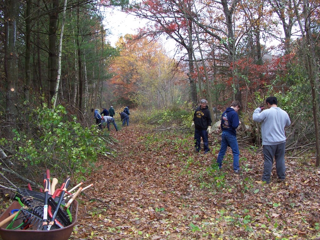
Groups of volunteers began clearing brush, erecting parking signs, and persuading officials in towns the trail passes through to create dedicated parking areas. Boards in each town have bought in to the plan and have invested money and effort to move this project along. Each step has raised awareness and enthusiasm for the trail.
In 2017 my friends with the Massachusetts Walking Tour came to our area to walk from town to town, carrying all their instruments, and hosting community concerts. The plan was to use the SNETT, in whatever condition it was in, as a pathway from one town to the next as they spent time hereabouts walking, camping, and providing live local music.


The day came for them to head out on the SNETT from Bellingham to Franklin, MA, starting at the SNETT parking at Lake Street. We knew DCR had been doing work on the Bellingham to Franklin section of the trail, but hoped they would be finished before the Walking Tour needed to use it. The morning the Tour planned to access the path, construction workers were still hard at work on the trail. A brief conversation between the workers and our group resulted in the musicians and others walking with care around the construction, then heading on their way.
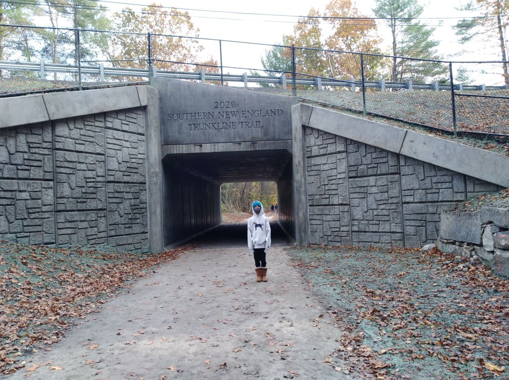
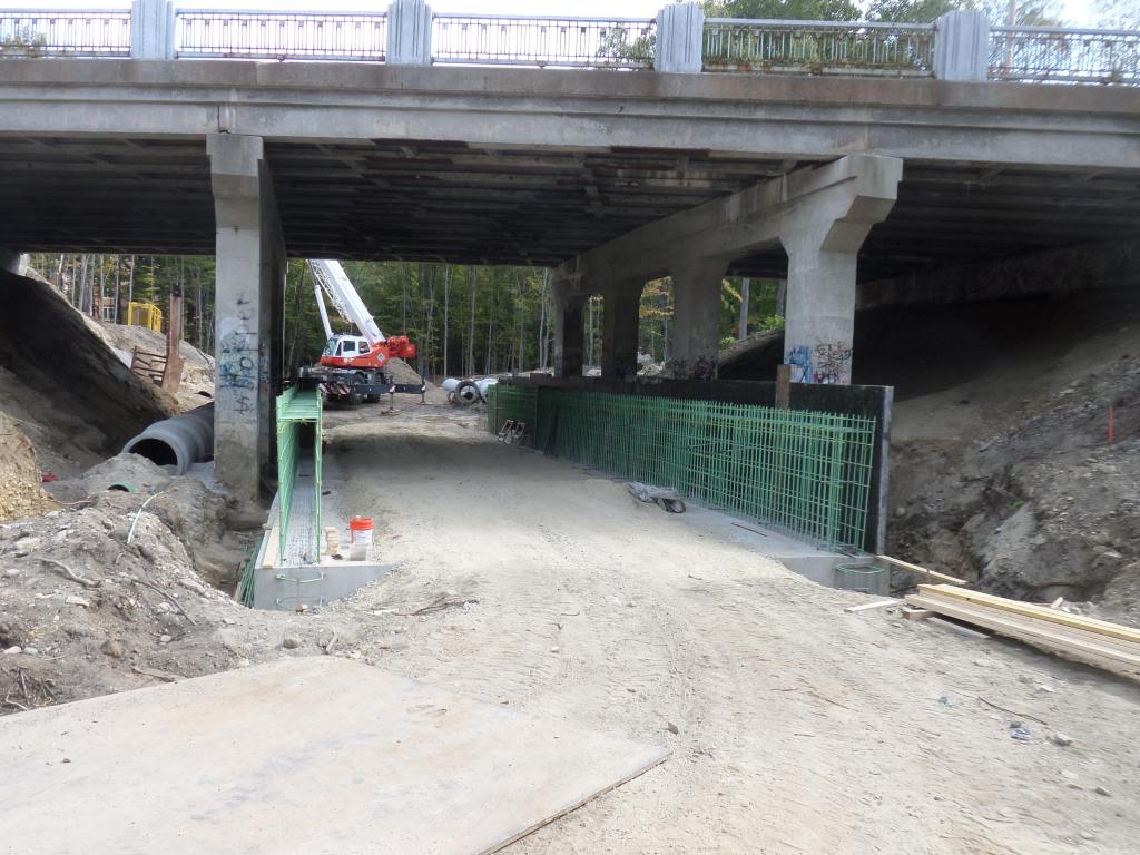
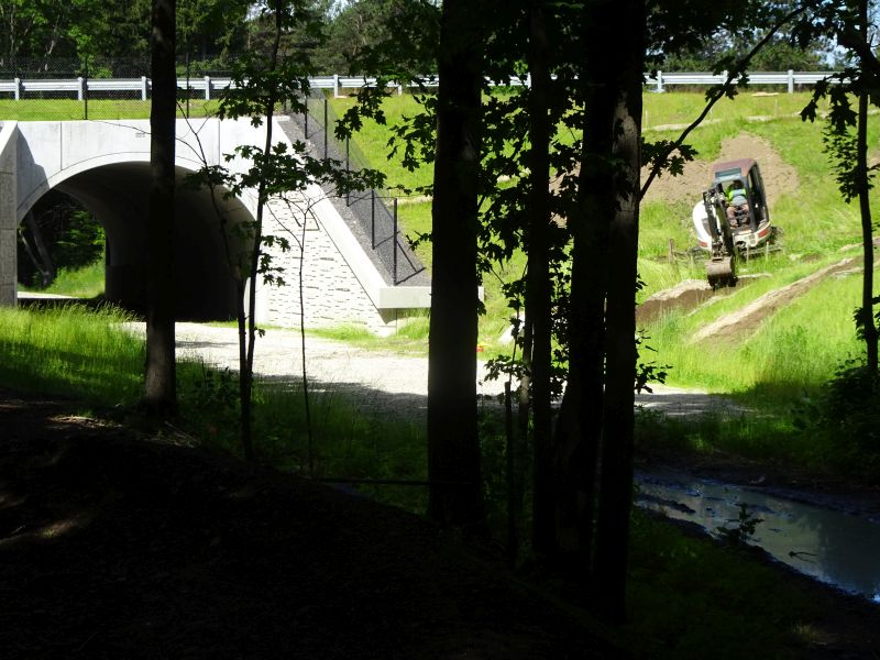
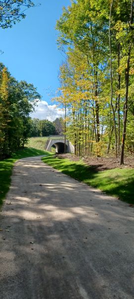
Other important improvements to the SNETT have included the construction of a tunnel/culvert in Franklin underneath Prospect Street so walkers no longer have to scale a steep, twenty-foot incline up and over the road above the trail.
A paved section of the trail from Blackstone (at Canal Street) through Millville and into Uxbridge (presently designated as the Blackstone Greenway) was completed (including at least eight bridges!) with MA DCR funds in 2017. This section is an important junction between the east-west SNETT and the north-south Blackstone River Bikeway (eventually planned to go from Pawtucket RI to Worcester, MA). The trails run concurrently for the three miles between Blackstone and Uxbridge. Eventually the greenway will head north toward Worcester, while the SNETT will continue west to Douglas. With each completed section, trail visitors have grown more exciting about finding ways to make the path more accessible.
A section of the SNETT in Bellingham from Lake Street to Center Street was developed in cooperation with Bellingham town officials. The town needed to put in new water (sewer?) pipes, and by placing the pipes underneath the SNETT right of way rather than digging up a nearby road, the town saved money and more of the SNETT was developed. At the same time, a very visible SNETT parking area was created at the corner of Fox Run Road and Center Street in Bellingham.
Much remains to be done on the SNETT, including the tying together of this east-west path with the north-south Blackstone River Bikeway. Real progress has been made and we are excited to have such a local resource available to those looking for accessible outdoor walking and biking opportunities. Happy trails!
Marjorie

Marjorie Turner Hollman is a writer who loves the outdoors, and is the author of Easy Walks in Massachusetts, 2nd edition, More Easy Walks in Massachusetts, 2nd edition, Easy Walks and Paddles in the Ten Mile River Watershed, Easy Walks South of Boston and Finding Easy Walks Wherever You Are. Her memoir, the backstory of Easy Walks, is My Liturgy of Easy Walks: Reclaiming hope in a world turned upside down.
