
Marjorie Turner Hollman is a writer who loves the outdoors. Link to all Marjorie’s books.
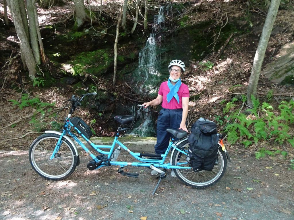
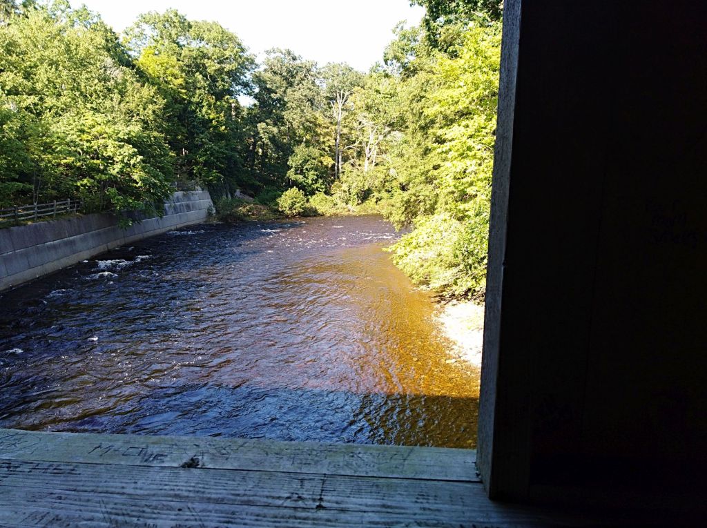
We took our adaptive tandem bicycle to the Salmon River State Forest in Colchester and East Hampton, Connecticut and found such a different place from our visit a few years back. Typically the Salmon River is wadeable in late summer, a small almost stream that cuts its way through steep banks of rock.

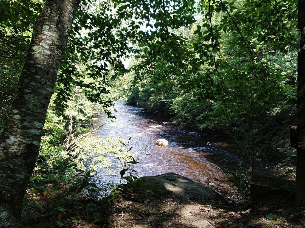
We visited shortly after a hurricane had blown through, bringing heavy rain with it and filling all the area rivers to the brim. Rather than a calm stream, we found the Salmon River to be a raging torrent, very dramatic. Thankfully the steep embankments we walked and rode along are high above the high water mark, and we were able to stay dry as we explored the area.
We parked on River Road in Colchester, an unmarked parking area that has access to both the Airline Trail and the
Salmon River. To reach this parking, start at the Comstock Covered Bridge and drive north on the comstock covered bridge road to the fork on the right for River Road. River Road is a packed dirt road, great for walking (or bicycling) right along the river, with lots of pull off points to enjoy views of the river.
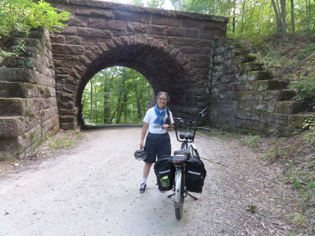
River Road goes underneath an old brick railroad bridge, and the parking is about 100 yards from there on your left. There is a trail kiosk for the Airline trail at this parking, but no other indications that it is a great place to park and walk or ride your bike.
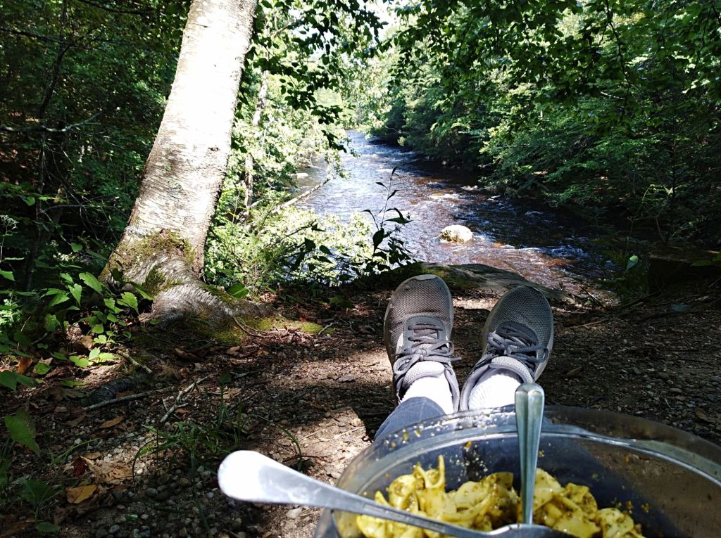
We try to pack a lunch for these outings, and found a perfect spot overlooking the river to sit and enjoy the thundering river as it flowed past us. What a wonderfully quiet, peaceful spot to be outside and witness the power of a river in full flood.

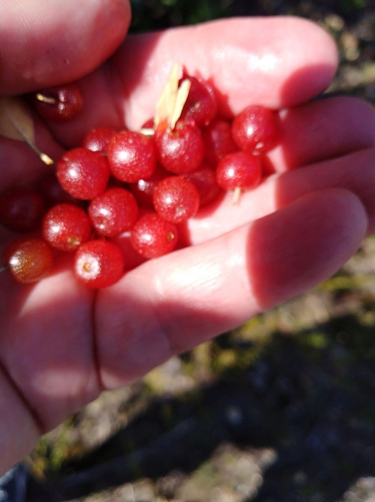
After lunch, we pulled out our bike and headed on the Airline Trail toward East Hampton. Along the way we found autumn olive trees laden with very edible berries (very tasty, and extremely high in vitiamin C). Sadly, we did not have containers in which to keep the berries, so I grabbed several handfuls and enjoyed a fest right on the trail.
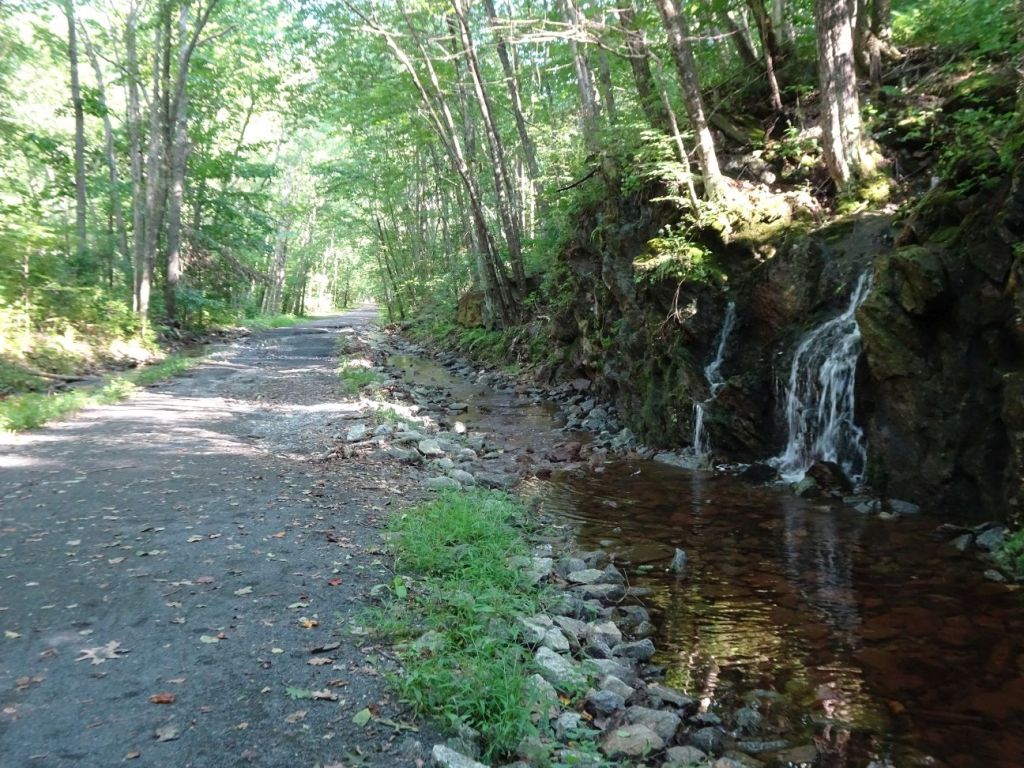
Besides the Salmon River filled to the brim, the recent rains created stunning waterfall cascades, both along River Road facing the Salmon River, and on the Airline Trail itself.
We also saw evidence of the heavy rains that nearly washed out portions of the trails in several sections. We rode very carefully through these sections. One fallen tree nearly blocked the trail, but there was enough room so we were able to squeeze by without having to perform trail maintence along the way.
We made it as far as East Hampton Center, where the trail becomes confusing. Eventually we found the rest of the trail continuing behind the town hall and explored a little farther, but decided we had had enough for the day and headed back to where we started.
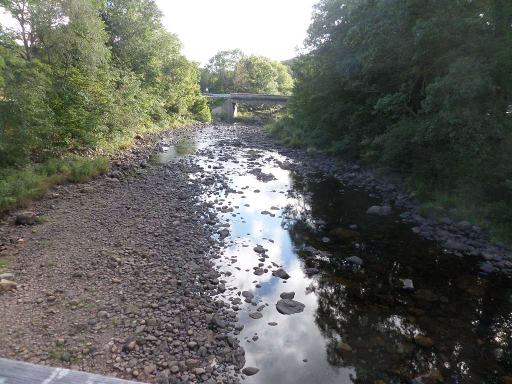
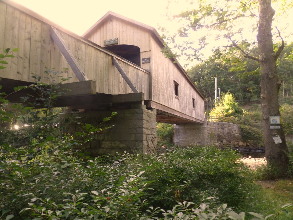
Unwilling to wrap everything up when we got back to the parking near the old railroad bridge, we stayed on the bike on River Road alongside the river, then did some road biking on Comstock Covered Bridge Road down to the Comstock covered bridge in East Hampton. We saw a few dog walkers, and otherwise the bridge was pretty quiet. The river, however, continued to roar past us on its way to the Connecticut River.
Prior to the pandemic we did little road biking, but in our efforts to #avoidcrowds we have learned ways to feel safer on country roads. Our bike now has reflective markings, and we will usually wear reflective vests, and bring along a warning flag. These simple steps have made us more comfortable when we choose to share the road with cars and trucks traveling the same direction that we are.
Reaching the Salmon River is a little under two hour drive for us, but the spectacular beauty of the area makes it worth the drive. Happy trails!
Marjorie
Marjorie Turner Hollman is a writer who loves the outdoors, and is the author of Easy Walks in Massachusetts, 2nd edition, More Easy Walks in Massachusetts, 2nd edition, Easy Walks and Paddles in the Ten Mile River Watershed, Easy Walks South of Boston and Finding Easy Walks Wherever You Are. Her memoir, the backstory of Easy Walks, is My Liturgy of Easy Walks: Reclaiming hope in a world turned upside down.
