

Marjorie Turner Hollman is a writer who loves the outdoors. Link to all Marjorie’s books.
We visited the Franklin Falls Dam recreation area and found a great six mile long trail (basically a fire road) alongside the Pemigewasset River. The trail is in good condition, offering views of the river along almost the entire length of the path. Besides a great spot to enjoy the natural history of the area, we realized we had stumbled into some fascinating cultural history as well.
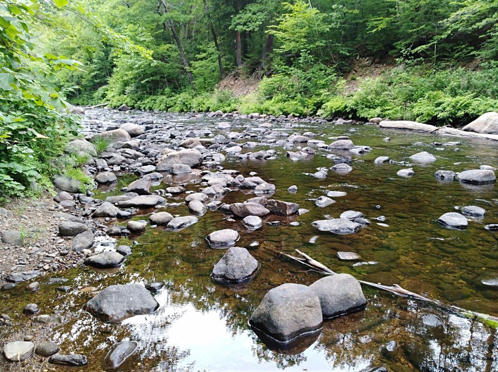
We started near Profile Falls, Bristol, NH, accessed from Profile Falls Road, just off Rt. 3A. Most visitors head straight for the falls, a relatively Easy Walk up an incline, then down to the base of the falls. We skipped the falls, found a quiet spot just below the falls with several picnic tables, had lunch, then went over to a parking area near the start of the path alongside the Pemigewasset River. This appears to be a little used trail. On a Saturday we saw only two horseback riders, a couple of dog walkers, and one other person on their bike. We pedaled the entire six miles of the trail to Franklin, to Rt. 3A, where we turned around rather than ride farther south on the busy road.
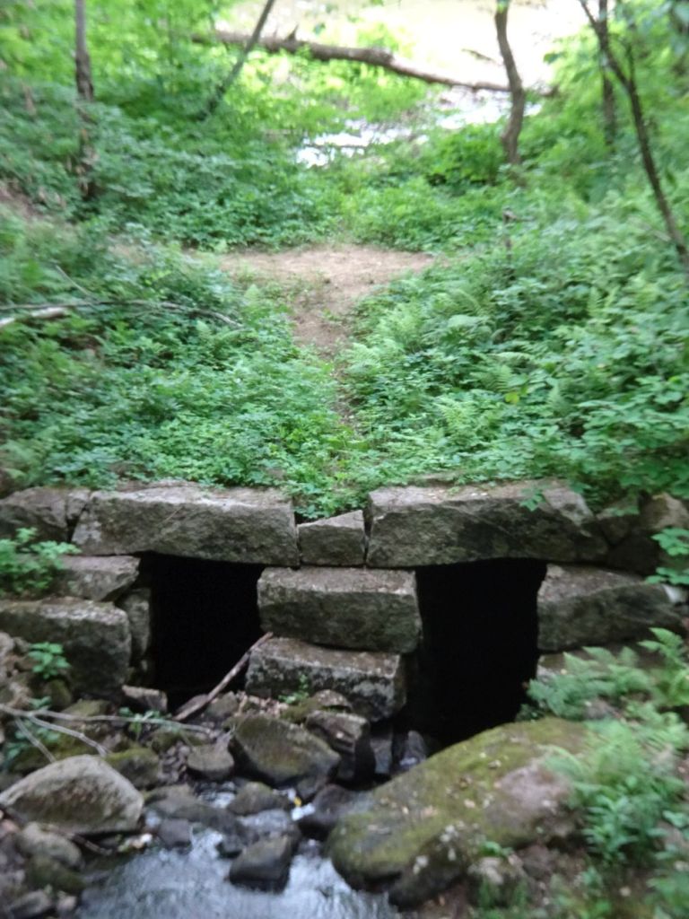
Along the way we encountered a few rock cuts, a picturesque seasonal cascade next to the path that flowed underneath the stream, and found hints of a canal structure with tow path and canal next to the path (check the link for Sewell’s Fall, north of Concord) , very similar in feel to the portions of the Blackstone Canal we have encountered on our travels throughout the Blackstone Valley.
I discovered information about efforts to extend navigation north of Concord, New Hampshire along the Pemigewasset, but it appears the canal was never completed. Along portions of the trail near the Profile Falls end we saw signs of the work that was done, but it is also clear that floods have taken their toll over the years, filling in the canal, and creating breaks in the tow path.
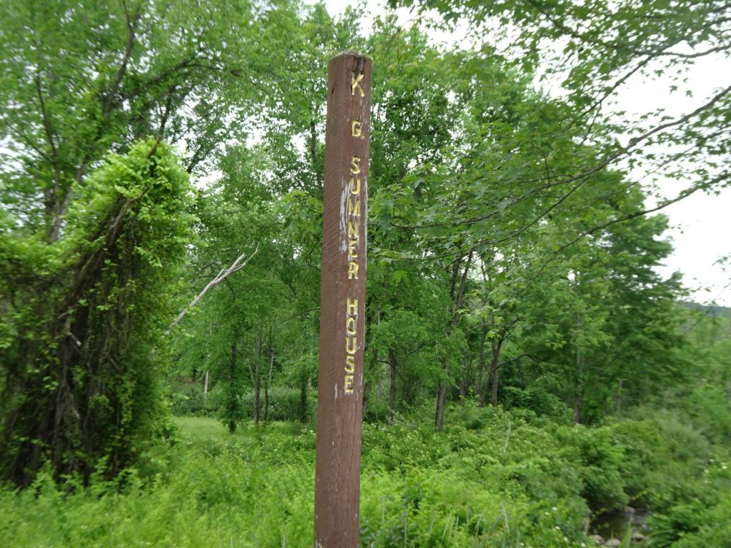
Historical markers along the trail provide clues to what used to be in this area before the Franklin Falls Dam was built. Construction of the dam turned this area into a flood plain, providing flood control but requiring the Hill Village to relocate to higher ground outside the flood plain. Here’s a fourteen minute video that offers a quick tour of the history of the village and what happened when the village was abandoned. The video offers great views of the trail we traveled on.
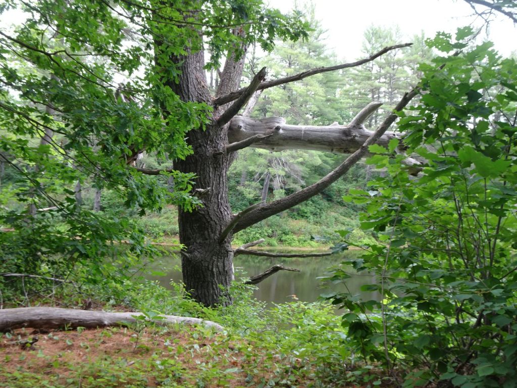

This “driftwood” was lodged fifteen feet up in the branches of a tree alongside the river, a stark reminder of the power of flood waters of the river and of how high the waters have been in the area where we were riding our bike.

We stopped at the remnants of an old bridge that used to cross the river. Notice I am decked out with all my cooling gear–cooling scarf and cooling vest. It was humid, pretty warm day. For less warm days I can use the much cheaper cooling vest, but it is not effective in really hot weather.
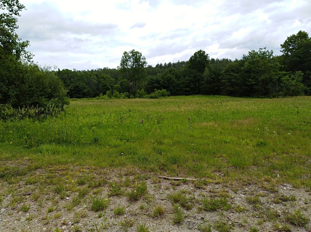
Open fields offer great habitats for birds along this path. We spotted a quail as it ran across the road in front of us, then quickly slipped into the brush.
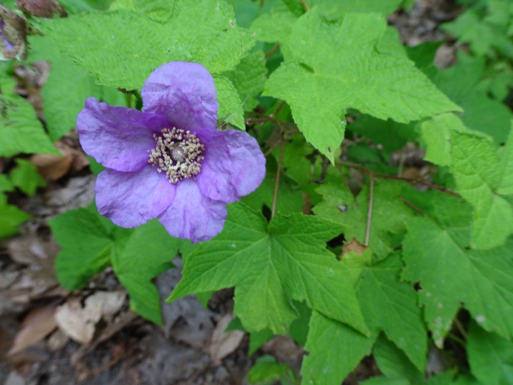
Blackberries and purple flowering raspberries grow alongside the road, none quite ripe yet when we visited. Beware poison ivy, growing alongside the trail in many places.
One word of caution–we discovered that ticks had been catching a ride as we pedaled along the sometimes grassy path. The ticks seemed curiously uninterested in latching on to us, simply staggering up our legs as we sat in our car, heading out to explore a little farther. Perhaps they were a little dizzy from having ridden in our shoes as we pedaled our bike for several hours, a sort of carnival ride for ticks. You just never know… (and always do tick checks after these outings–plus throw clothes into the dryer for ten minutes on high heat).
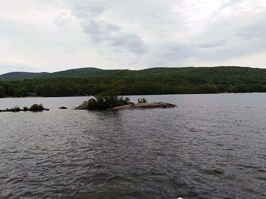
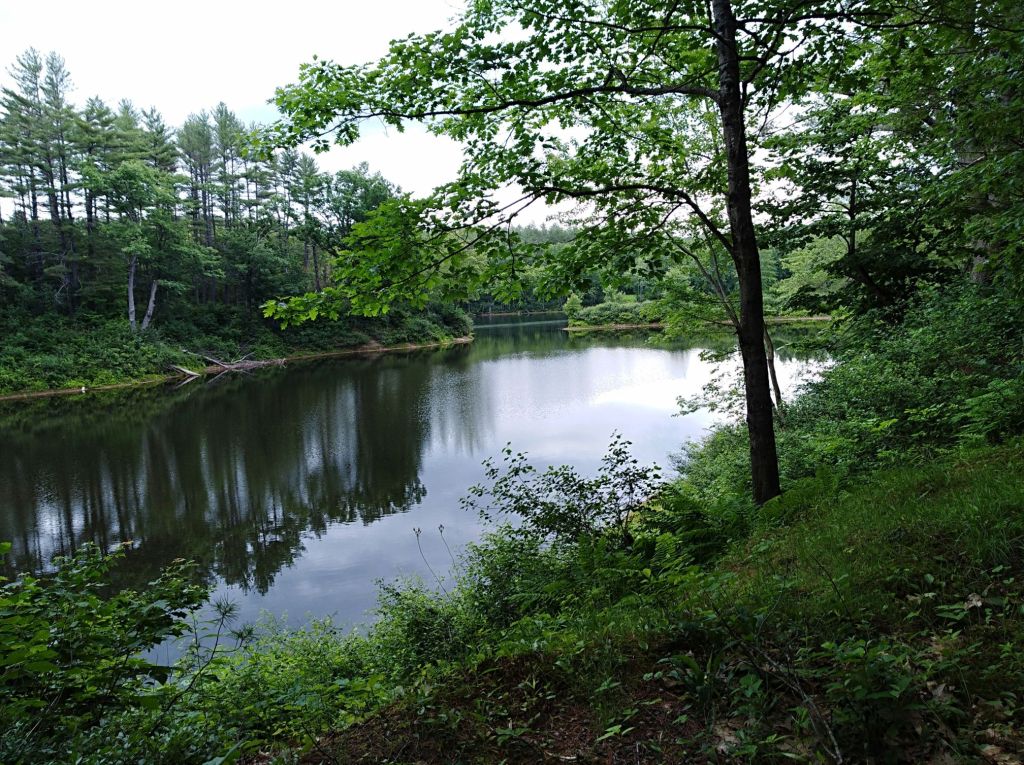
After our bike ride we explored a little farther north to Newfound Lake and encountered Paradise Point, a New Hampshire Audubon property with access to the lake. The wildlife sanctuary was empty at the end of the day, so we wandered down the trail and had the dock to ourselves. This area offers some great views of the northern end of the lake. Because of the lateness of the day we did not explore all this lovely spot has to offer, and it is a place I would visit again, for sure! Happy trails!
Marjorie

Marjorie Turner Hollman is a writer who loves the outdoors, and is the author of Easy Walks in Massachusetts, 2nd edition, More Easy Walks in Massachusetts, 2nd edition, Easy Walks and Paddles in the Ten Mile River Watershed, Easy Walks South of Boston and Finding Easy Walks Wherever You Are. Her memoir, the backstory of Easy Walks, is My Liturgy of Easy Walks: Reclaiming hope in a world turned upside down.

I always love seeing the happiness on your face! And I love getting to travel with you vicariously – (with no worry of ticks…!)
Happy Trails,
Best,
Terri
How kind of you to say! Yes, It really does make me impossibly happy to get out on these adventures. The ticks were easily disposed of, although they really did seem a little puzzled how they’d gotten where they were.
Great photos, nice commentary and good links! I especially was interested in the canals link, as that is something I’ve been interested in.
Rich Westhoff
You are so welcome. Thanks for reading and commenting!