

Lucky for our family, we have practiced #avoidingcrowds for years, and yet even we are struggling this year to figure out where to go where lots of others are not. We avoid visiting Cape Cod in warmer months specifically because of how busy the area is. But late fall, early December on the Cape seemed like a good bet for meeting up with fewer people as we continue to strive to stay healthy in the midst of the pandemic.
We never seem to get an early start, but after a rainy day the day before, we were eager to get out on a mild sunny day and stretch our legs. This trip reminded me of a time we were able to visit Yellowstone National Park. We encountered so many stunning sights that we traveled almost by inches, seeing new and astonishing things at every turn. While the Cape does not offer the weird and wonderful features of Yellowstone, we have many favorite spots to stop at along the way. This means that reaching any destination takes time.

As soon as we crossed the Bourne Bridge over the Cape Cod Canal, we headed west at the rotary and made our way down to the railroad bridge near the western end of the canal. We find the rail trail on the Cape side of the canal to be less crowded than the rail trail next to Rt. 6. Perhaps this is because the south side rail trail has parking that is a little more challenging to locate. We stopped for a little while next to the railroad bridge, taking in the speed of the current coursing its way through the canal.

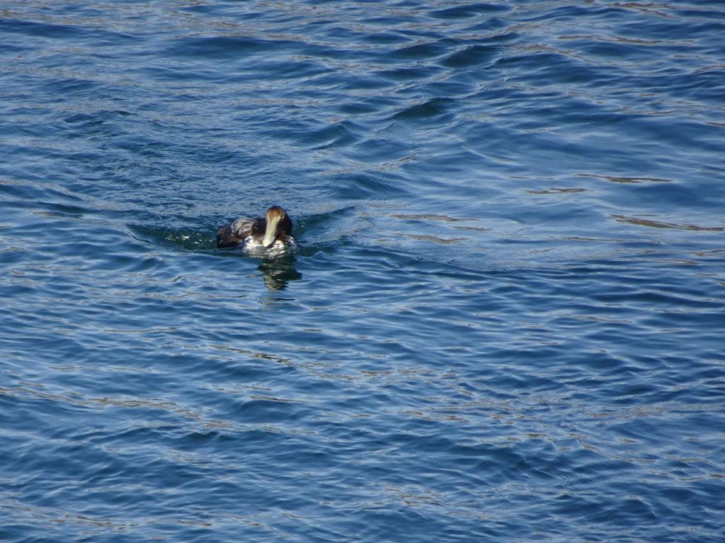
Next we stopped near the eastern end of the canal, and found a large flock of eider ducks paddling against the current. While the rail trail was not filled with people, we saw enough to convince us this was not where we would find our Easy Walks for the day.
Sandy Neck Beach in Barnstable was our next stop, but a quick drove through the parking lots offered few empty parking spaces. Although the beach is wide, we chose to move on. The area that is Sandy Neck is actually quite large, and we watched the map as we drove, wondering if there might be another way in to the salt marsh areas the make up such a large part of this conservation land.

One dead end unpaved road we tried led out to the marsh, where we got some amazing views of the area.
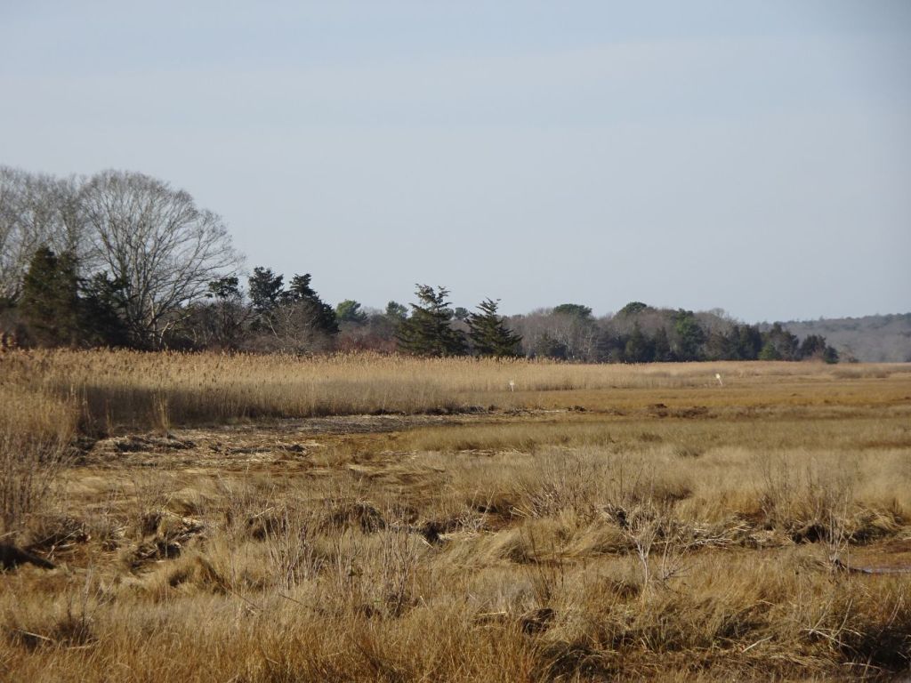
We spotted a red tailed hawk lurking along the edge of the marsh, and he moved off as soon as he heard us. We should have stopped at the Barnstable Land Trust offices, which has a trail abutting the Sandy Neck marshes–next time!

Farther down the road we spotted a sign for Long Pasture, in Barnstable, a Massachusetts Audubon wildlife sanctuary.

There we found mowed trails through old pasture land, where we met only one other couple. Looking at the map, we learned the sanctuary offers access to the beach, so we headed down the access road to the headquarters, continued past the parking area and found only a very few others strolling the shoreline.

Across the water from this beach was the very end of Sandy point. It was low tide, and we walked out onto the ground that had recently been underwater.
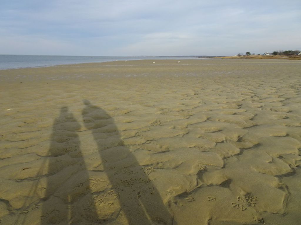
We looked at the gps, and my husband noted with a smile, “It says we’re standing in the ocean.” Well, yes, that would soon be the case again. But for the moment, it was (mostly) dry land. Seagulls shared the mudflats with us, leaving their prints wherever they wandered.

We made our way back to the shoreline, following the path of the small stream flowing into the ocean.

The sun dropped lower and we noted as we left that the crowded parking area was now almost empty.

With the remaining light we headed into West Yarmouth port, and stumbled upon a bridge over a narrow stream flowing into mud flats. In other areas we have found similar spots, where rivers flow into brackish waters. These tidal influences create dramatic disturbances in the flow of water back and forth, sometimes called “reversing falls” and we happened to arrive just at the right time to see the water rushing out of the river into the marsh. In the fading light, we got out of the car and stood on the bridge, taking in the sights and sounds, grateful for the chance to enjoy the wonders of the tides.
We managed to #avoidcrowds, and spent hours taking in the smell of salt air. While we did not travel terribly far from home, it was nice to have a change, great to walk on a sandy shoreline, and sweet to see water rushing into the sea. Be safe wherever you go, and happy trails.
Marjorie

Marjorie Turner Hollman is a writer who loves the outdoors, and is the author of Easy Walks in Massachusetts, 2nd edition, More Easy Walks in Massachusetts, 2nd edition, Easy Walks and Paddles in the Ten Mile River Watershed, Easy Walks South of Boston and Finding Easy Walks Wherever You Are. Her memoir, the backstory of Easy Walks, is My Liturgy of Easy Walks: Reclaiming hope in a world turned upside down.
