
Along the Grand Trunk Trail in Brimfield
When the weather forecast for Columbus Day weekend promises lots of rain, it makes a lot more sense to stay closer to home and enjoy what we can, when we can.
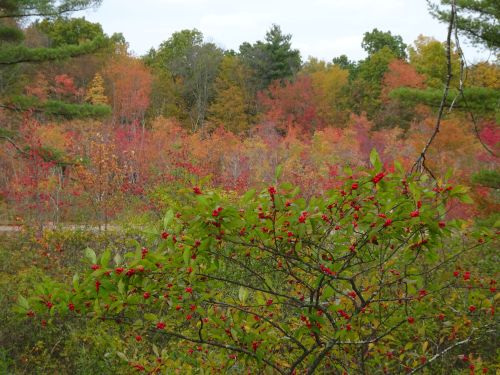
Stunning color in the wetlands in early fall
For us, that meant heading to Brimfield, MA to explore a section of the Grand Trunk Trail that some day will travel from Franklin, on the SNETT, (part of the larger Grand Trunk Trail, or Titanic Rail Trail) quite near where I live, through Bellingham, practically by my house, and out to Palmer, MA.

On the banks of the Quinebaug river, along the trail
The Brimfield section of the Grand Trunk Trail offers views of the Quinebaug River, overlaps with the Trolley Trail,
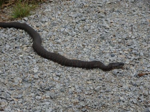
A very dead snake along the Siog pass Trail.This section of trail was gravel, parts were crumbling pavement, others were stonedust.
the Lake Siog Pass trail,

At the edge of Holland Pond (other signs called it Brimfield Lake)
and Holland Pond, in Holland, MA.

At one of several bridges that cross the Quinebaug River
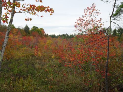
Much of this area is wetlands, and offers early views of foliage.

At the start of the Quinebaug River trail
Swamp maples and other plants in these wetlands change early in the season, and will drop their leaves soon. Heavy rain will speed up the season, blowing the colorful leaves right off the trees.
On the river
But at least for a day, we enjoyed overcast, somewhat humid, but manageable weather to bike about ten miles in total along the connected trails in this area. Despite the warm temperatures, the foliage assured us that fall is in the air.

Bunny enjoying well-trimmed grass at the trail’s end in Brimfield just off Rt.20
We started out on the far western parking area, accessed directly off Rt. 20, west of Sturbridge, at 120 Sturbridge Road, Brimfield. Ample parking for at least 15 cars is available at this trailhead. There are additional parking areas available, with room for horse trailers.

There is more trail on the other side of the river, but it’s a long jump to get there.
A long-gone bridge that I suspect carried trolleys across the Quinebaug River at one time is missing; bridge abutments remain, but it would require quite a running leap to get across the river as it stands today. We turned back at this point, after enjoying the foliage and river views.

Poison ivy turns early in the season
With all the stunning foliage on view, we expected this trail to have more visitors, but we had the area almost completely all to ourselves. Once we got away from Rt. 20 the remaining portion of our ride was blissfully quiet.

These two trails are somewhat parallel, but mostly follow the same track
The Army Corp of Engineers oversees parts of this area, and one section of where we traveled was a dirt road that took us to the Siog Pass,
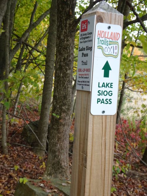
Clear signs point the way
a trail that leads to Lake Siog, or Holland Pond.
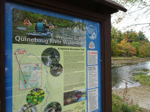
Extremely convenient boat ramp for canoes and kayaks at the parking are, 20 Pond Bridge Road,Holland,MA
It is also the trailhead for the Quinebaug River Trail, a 5.5 mile river trail from the pond back to East Brimfield Lake.
The trail we biked over was quite flat, which made for easy pedaling.

Rock cut along the trail
We can across one rock cut, and had multiple chances to view the Quinebaug as it wended its way through the area.

The Quinebaug
We got back before the rain, and were glad to be headed home. But we’ll be back out, visiting other places soon. But for this weekend, it’s a time to stay closer to home.
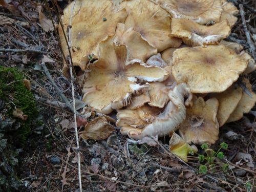
My friend Sue is always looking for mushrooms on her hikes. Thinking of her when we spotted these
Marjorie
Marjorie Turner Hollman is a writer who loves the outdoors, and is the author of Easy Walks in Massachusetts, 2nd edition, More Easy Walks in Massachusetts, 2nd edition, Easy Walks and Paddles in the Ten Mile River Watershed, and Finding Easy Walks Wherever You Are. Her memoir, the backstory of Easy Walks, is My Liturgy of Easy Walks: Reclaiming hope in a world turned upside down.
