Marjorie Turner Hollman helps authors self-publish their nonfiction books. She is also a disability advocate, sharing information about Easy Walks (not too many roots or rocks, relatively level with firm footing, and something of interest along the way) in open space.Learn more.
LISTEN:
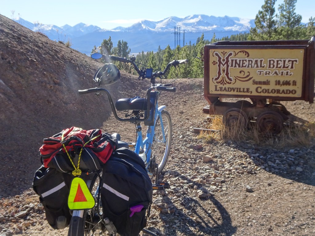
We visited Leadville, Colorado in the fall, when the weather can get very iffy. The town, elevation 10,000+ feet, has a twelve-mile loop trail, which is paved the entire length. The Mineral Belt trail travels around and through the town.
We were wearing t-shifts when we started pedaling our tandem bicycle, but the weather forecast for that night predicted 15 degree F. We did not want to get stuck out on the trail!
Marjorie Turner Hollman helps authors self-publish their nonfiction books. She is also a disability advocate, sharing information about Easy Walks (not too many roots or rocks, relatively level with firm footing, and something of interest along the way) in open space.Learn more.
LISTEN:
Sights along the trailCampground next to trail
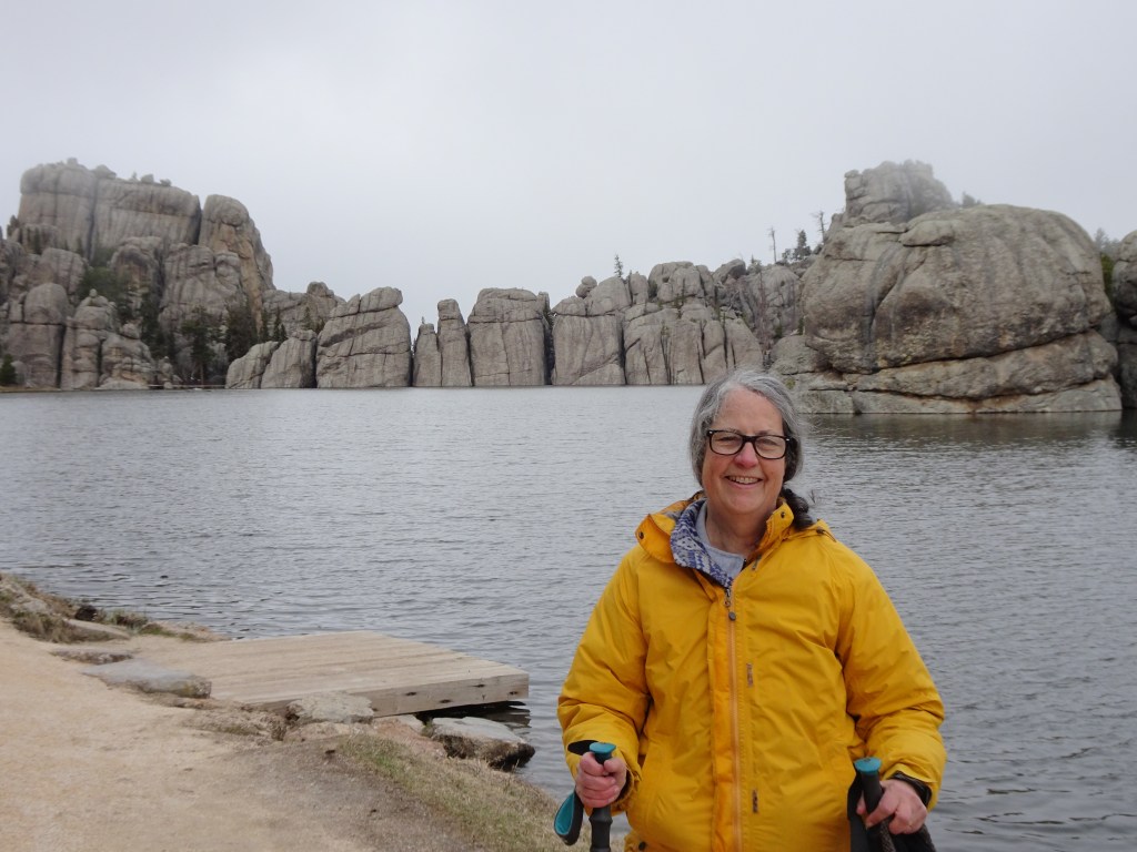
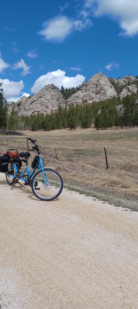
We had hoped to visit Yellowstone National Park and the Grand Tetons on our trip west from New England. Unpredictable spring weather, however, caused us to pause in the Black Hills, hoping the weather farther west would warm up. It didn’t (at least not on our time schedule!).
Marjorie Turner Hollman helps authors self-publish their nonfiction books. She is also a disability advocate, sharing information about Easy Walks (not too many roots or rocks, relatively level with firm footing, and something of interest along the way) in open space.Learn more.
LISTEN:
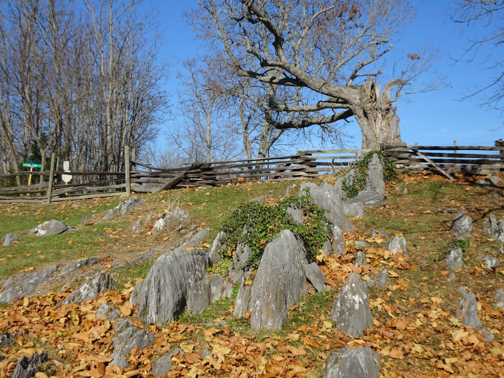
It began as a simple lunch stop on our way from New England to Tennessee to see grandboys. Just off I-81 in Raphine, Virginia, the sign on the highway said McCormick Farm. We were curious. So we turned off at the exit.
Marjorie Turner Hollman helps authors self-publish their nonfiction books. She is also a disability advocate, sharing information about Easy Walks (not too many roots or rocks, relatively level with firm footing, and something of interest along the way) in open space.Learn more.
Marjorie Turner Hollman helps authors self-publish their nonfiction books. She is also a disability advocate, sharing information about Easy Walks (not too many roots or rocks, relatively level with firm footing, and something of interest along the way) in open space.Learn more.
LISTEN:
Our calendar to-do list is pretty big this fall. Before we tend to those tasks, and it gets too cold (for us) to bicycle in New England, we decided to take a break. Vermont is a New England state we have spent little time in. This was our chance to explore the Lamoille Valley Rail trail, near Stowe, Vermont.
Marjorie Turner Hollman helps authors self-publish their nonfiction books. She is also a disability advocate, sharing information about Easy Walks (not too many roots or rocks, relatively level with firm footing, and something of interest along the way) in open space.Learn more.
LISTEN:
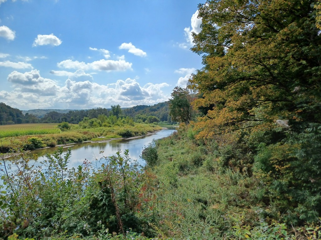
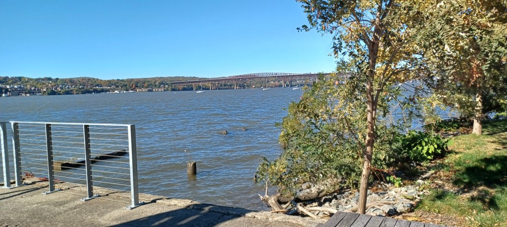
When traveling, we often find lunch spots along the way by looking at the map for what might be nearby. If we see a river, we then search for open space to get a water view to take a break from driving. On our way south from New England to see grandboys in Tennessee, we must cross the Hudson river.
Marjorie Turner Hollman helps authors self-publish their nonfiction books. She is also a disability advocate, sharing information about Easy Walks (not too many roots or rocks, relatively level with firm footing, and something of interest along the way) in open space.Learn more.
LISTEN:
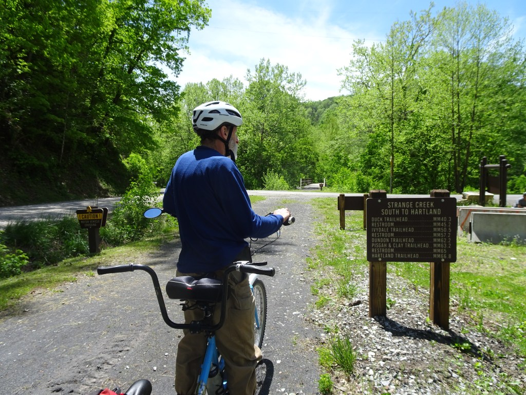
The Elk River rail trail was not on our radar until we stopped for the night at a Harvest Hosts camping spot near Beckley, West Virginia. We were on our way home to Massachusetts after visiting grandboys in Tennessee. As we sat around the campfire next to our host’s riverside spot, they mentioned a rail trail alongside the Elk River that they had heard about.
Marjorie Turner Hollman helps authors self-publish their nonfiction books. She is also a disability advocate, sharing information about Easy Walks (not too many roots or rocks, relatively level with firm footing, and something of interest along the way) in open space.Learn more.
LISTEN:
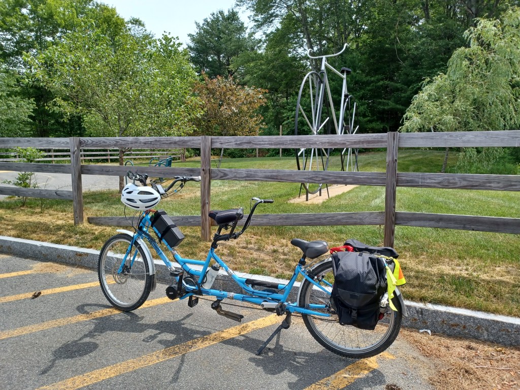
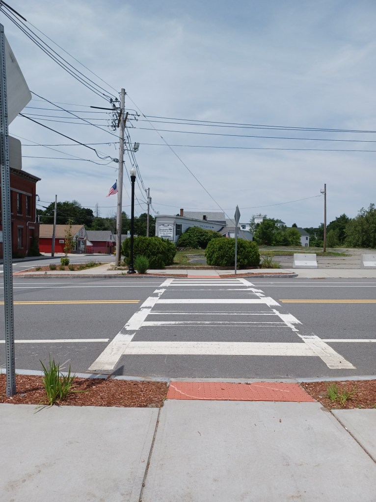
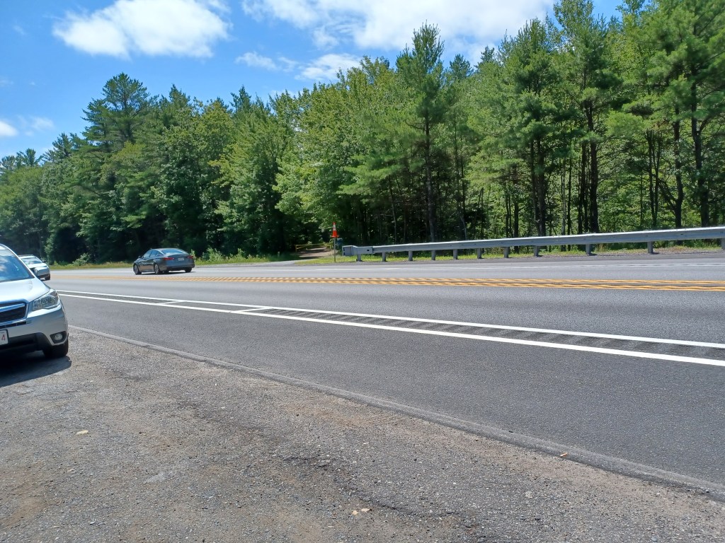
You know it’s summer when you have an errand and immediately think, “Where can we ride our bike near where we’ll be anyway?” The border of Massachusetts and New Hampshire is a pretty good distance from our home, (Rhode Island is a stone’s throw from my house), but we were on a mission, and Pepperell was on our calendar. The day was not too hot (for me) and our adaptive tandem bicycle was ready to roll. And so we did!
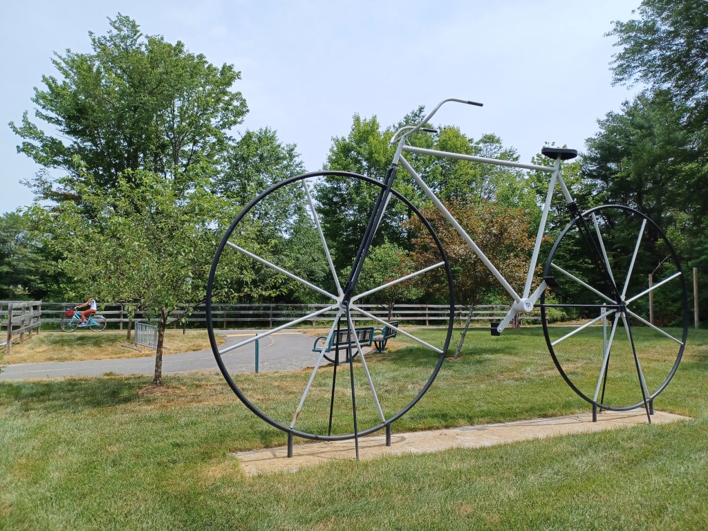
A giant bicycle sculpture next to the trail
The first sight that greeted us as we arrived at the small town park in Winchendon was the giant bicycle next to the parking area. What a friendly invitation for bicyclists to join others enjoying the trail.
Access to downtown WinchendonWater views along the trail
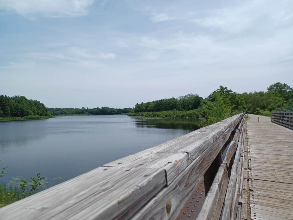
It had been ten years since we last visited this trail. The water views are the same, but the paved path has been vastly improved. For a holiday weekend, the North Central Parkway was not crowded. Several families with children passed us along the six miles or so we pedaled on the paved path. A few others on wheels passed us, including a child riding her small tricycle. Slowing down and being willing to stop when little ones stray over the line is part of the territory. Offering a smile to parents who are getting their kids out makes life better for all of us.
It takes practice to understand how to navigate rail trails that are shared by walkers, bicyclists, and dog walkers. Staying to one side or the other can be confusing. Chatting with friends can distract us from looking out for others on the trail. And some who (likely) walk ever day appear to use headphones to keep them entertained.
Safety tip—doing anything that compromises your ability to hear while on a rail trail is dangerous. You will not be able to hear when people pass by you from behind. Perhaps more concerning, if someone might wish you harm, you could be caught unawares. Be selfish—take care of yourself and others by using all your senses!
OK, end of public service announcement.
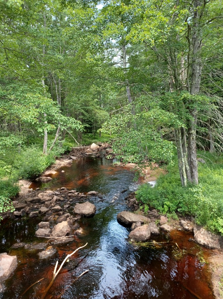
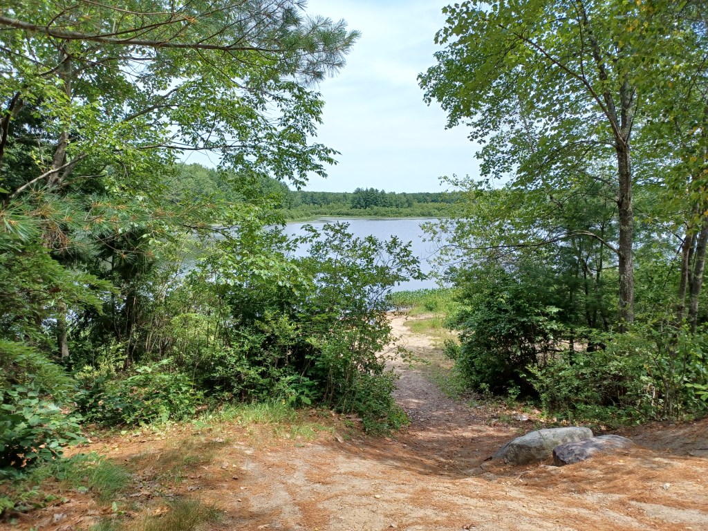
I so enjoyed the multiple spots along this trail with water views. Small streams cross underneath the path. Wetlands with little pools of water are right off the trail. Reminders remain of important infrastructure trains used along this right of way in days gone by. Look for old bridge abutments next to or underneath where new bridges now allow us to cross streams along the way.
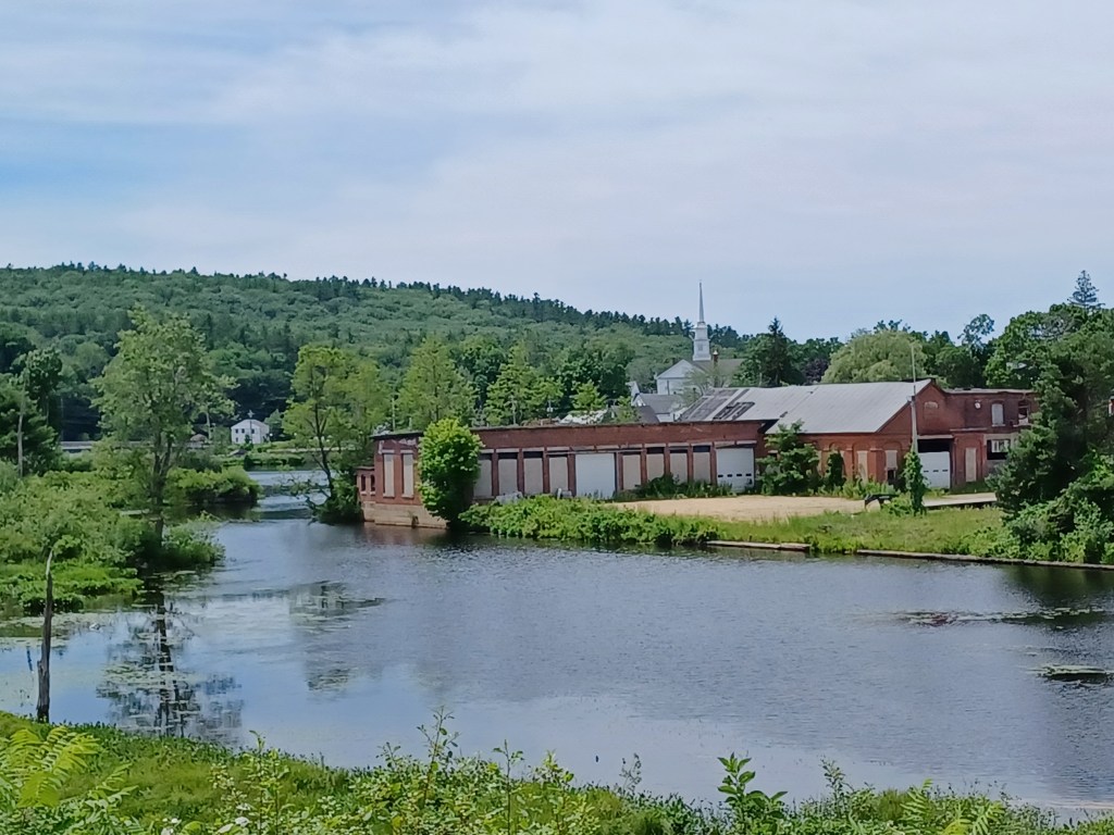
Old mill buidlingsAccess to the pond
Some mill buildings remain next to Whitney Pond, from a time when Winchendon was one of many New England towns with local industry that used water power to run their machinery. A bridge spanning a portion of the pond allows for access from the downtown to the rest of the trail.
We found multiple benches along the way, many with nice water views. We stopped at one spot for a snack. The chocolate in our trail mix had not melted, thanks to the ice I carry to help keep me cool. Once I got the nuts and chocolate in my hand, however, I was reminded why the company that makes M&Ms claims, “melts in your mouth, not in your hands.” My hands would have been less messy if our trail mix had had M&Ms as one of the ingredients. Live and learn? Maybe.
Small tunnel along the wayTrail access
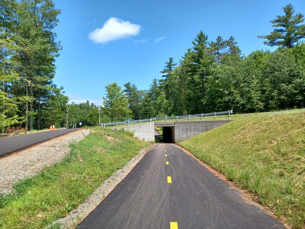
We returned the next weekend to check out the Gardner section of the North-central pathway. We parked on Commercial Drive, in Gardner, just off Rt. 140. The paved rail trail goes right underneath the road and continues both directions. Additional parking is available just off Old Gardner Road, right off Rt. 140.
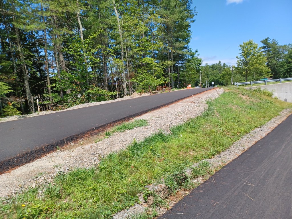
The old Gardner Road parking marks the northern end of the developed section of the Gardner trail. By continuing past the parking on Old Gardner Road, you will soon intersect with Spring St., Rt. 12. Just a short distance southeast on Rt. 12 is North Ashburnham Rd. Turn left and travel a quarter mile to the Winchendon portion of the trail. Riding on Old Gardner, Rt. 12 and North Ashburnham Road allows you to avoid the undeveloped portion of the trail between Gardner and Winchendon. That unimproved section is damp, with lots of roots, some rather large rocks, and has evidence of ATV usage. We pedaled along it for a short distance till we encountered a tree trunk too large for us to remove.
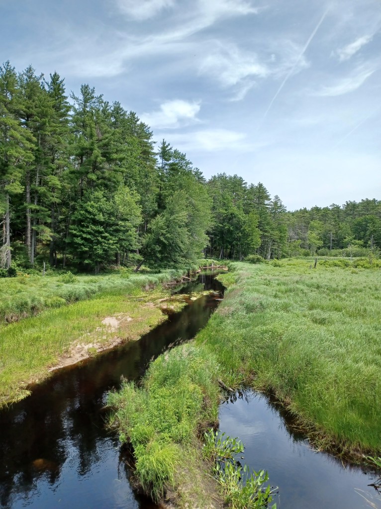
We headed back south on the Gardner section, crossing several pretty streams along the way. When the trail intersected with Rt. 140, we could see that it continued beyond the highway. There is no cross walk nor signals to warn traffic of potential travelers crossing the road. The speed of oncoming traffic from both directions persuaded us to turn around.
Rt. 140 is a formidable barrier between two sections of the Gardner part of trail
While some of the trail hugs busy Rt. 140 (and thus is pretty noisy), much of what we rode on during our second visit offered quiet, and water views. Other than at mid-day, much of this trail, both in Winchendon and Gardner, has welcome shade in the summer. Summer bike rides provide plenty to love, but I for one am looking forward to foliage season and cooler weather. Till next time, happy trails!
Marjorie Turner Hollman helps authors self-publish their books. She is also a disability advocate, sharing information about Easy Walks (not too many roots or rocks, relatively level with firm footing, and something of interest along the way) in open space.Click to learn more.
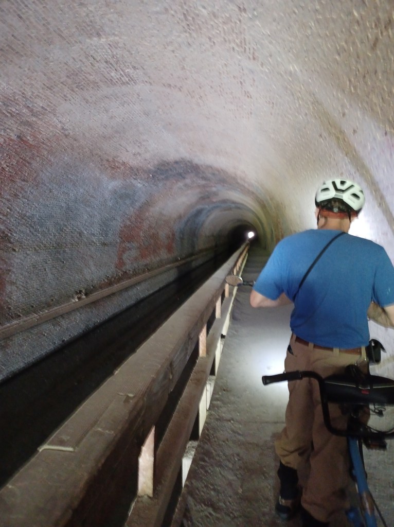
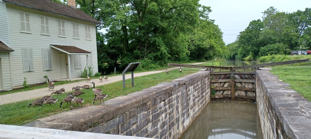
We rode our handicapped accessible tandem bicycle along the 184 mile C&O Canal rail trail, with the goal of going through the Paw Paw Tunnel in Paw Paw, West Virginia. Rather than creating an opening through the mountain (now called Tunnel Hill) for trains to traverse this rough terrain, this tunnel was built to allow canal boats to carry coal, lumber, and produce to market.
Water still flows through the canal inside the tunnel, although much of the remaining canal infrastructure suffered floods and is now infilled with soil. The tow path, a number of locks, and lock keeper cottages remain from when the canal network was an important form of transportation in the 1800s. The linear C&O (Chesapeake and Ohio) National Historical Park documents the history of the canal, which operated alongside the shoreline of the Potomac River from Maryland, into West Virginia then back into Maryland, finally terminating in Georgetown, Washington D.C.
The brick-lined Paw Paw tunnel is too narrow to safely ride a bike through the half mile distance as it burrows underneath the mountain. A sturdy railing between the tow path and the canal protects visitors from tumbling into the water.
Inside the tunnel
Headlamps are helpful when passing through the tunnel. The footing is somewhat irregular. Apparently floods over the years have washed through the area, creating potholes and various other irregularities on the former towpath that makes walking challenging (at least for me). The tunnel has leaks, and water collects in various spots along the walkway.
The other side of the tunnel
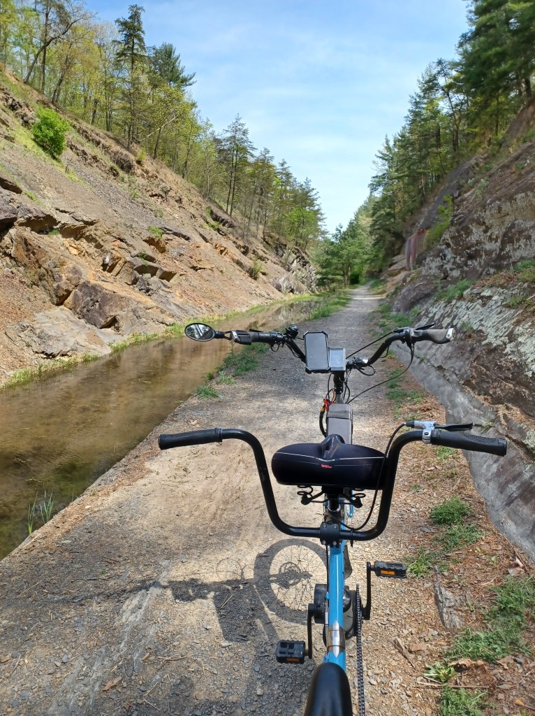
On the other side of the tunnel, a wide vista opens up. Massive rock faces on either side of the water-filled canal and tow path provide visual evidence of the monumental effort that went into the construction of the canal. Run off from the mountain flows across the path in several places. We needed to dismount from our bike several times in order to safely cross the narrow platforms that spanned those areas.
Intact canal with infrastructure in place
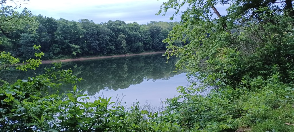
As the tunnel receded into the distance, views of the Potomac River opened up. We encountered a series of canal locks, the granite blocks of each lock still in place. Where water once flowed, many of the locks are now filled with soil and grass.
The signs for the locks near the tunnel have posted numbers. They also offered fractions. Lock No. 64 1/3 then Lock No. 64 2/3. The next lock we found bore the label, Lock No. 66. We never found Lock No. 65.
The near 90 degree (f) day shortened our outing, but the coolness of the tunnel provided a respite from the unseasonable heat of spring. It is especially important to make way for travelers you meet or who need to pass you in the tunnel itself.
We met some through-bikers on the trail, kitted out with all their supplies in panniers attached to their bikes. Multiple tent-only campsites along the trail invite ambitious bicyclists to ride for days on end with no need for motorized transport. Pedal power alone takes riders from one point on the trail to the next.
Campsite area (tents only) offer through bikers a place to rest overnight
We have ridden on several sections of the C&O rail trail in Maryland. We have now added to our visits a portion in West Virginia. We look forward to making trips to enjoy more views of the Potomac as it wends its way (mostly) southeast to the nation’s capital. The trail surface along every portion we’ve visited are impressively well-maintained, packed, crushed stone dust.
Camping alongside the Potomac River. West Virginia is just on the other side of the river
McCoy’s Ferry National Park campground has been our go-to stop when traveling from New England to visit grandchildren in Tennessee.
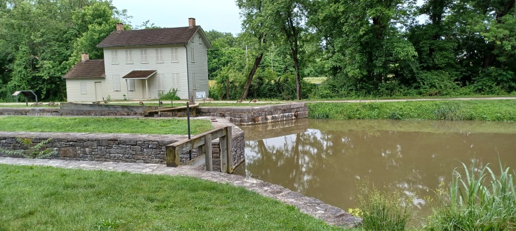
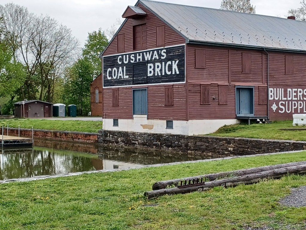
Cushwa Basin, Williamsport, Maryland
It is just north of the Cushwa Basin, site of the C&O National Historical Park headquarters in Williamsport, Maryland.
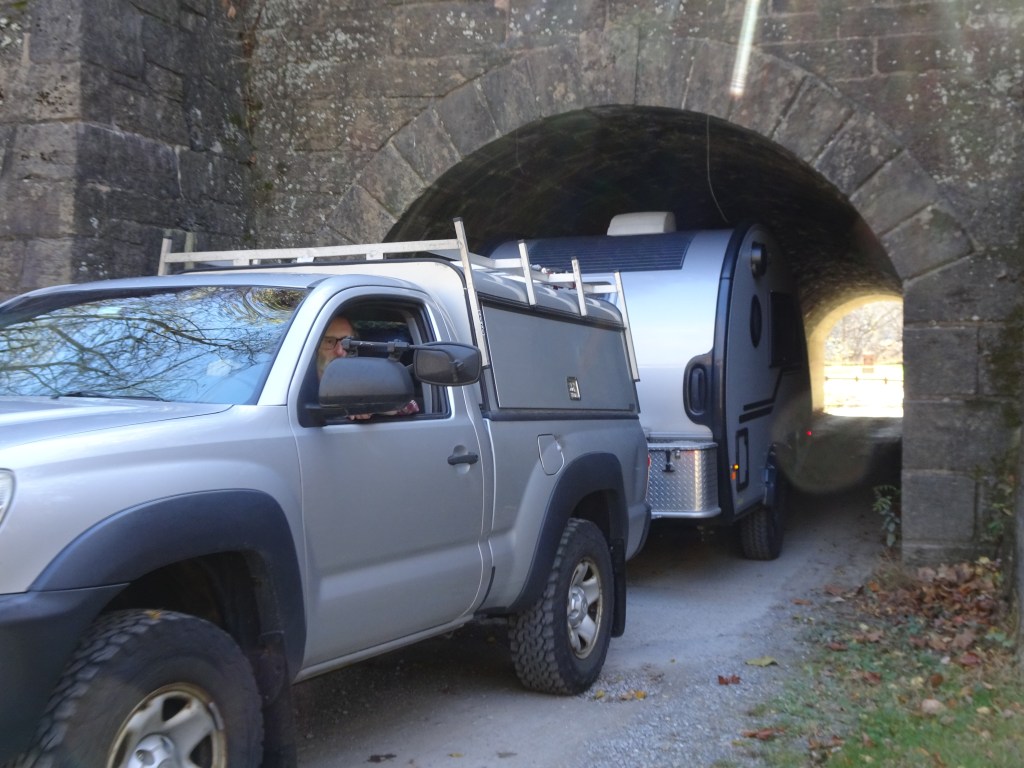
A snug fit passing through the tunnel at McCoy’s Ferry Campground
A diminutive tunnel at the entrance to the campground severely restricts the size of RV that can use the site alongside the Potomac. We have a very small camper, and it is still a very tight fit.
One of the multiple intact locks, with a lock keeper’s cottage on left. Rail trail next to canal
The rail trail is accessible from McCoys Ferry. A steep slope makes getting up to the trail somewhat of a challenge, but allows for leaving directly from the campground and spending the day on the trail. We look forward to more visits along this extensive rail trail network the next time we are in the neighborhood.
Marjorie Turner Hollman helps authors self-publish their nonfiction books. She is also a disability advocate, sharing information about Easy Walks (not too many roots or rocks, relatively level with firm footing, and something of interest along the way) in open space. Link to all Marjorie’s books.
LISTEN:
Pretties
Nearly 500 miles of cave passage have been mapped to date with explorations ongoing. Despite the name, however, Mammoth Cave National Park, has much more than caves to enjoy.
When you visit, be sure to make time to tour the quality exhibits in the Visitor Center that are free for all to enjoy.
Visitors from around the world come to enjoy the wonders of Mammoth cave
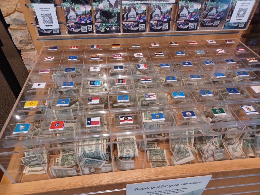
The donation box next to the entrance was especially intriguing, since it was set up for contributions by country. Dollar bills were stuffed almost to overflowing underneath the national flags of multiple countries, including, of course, the U.S.
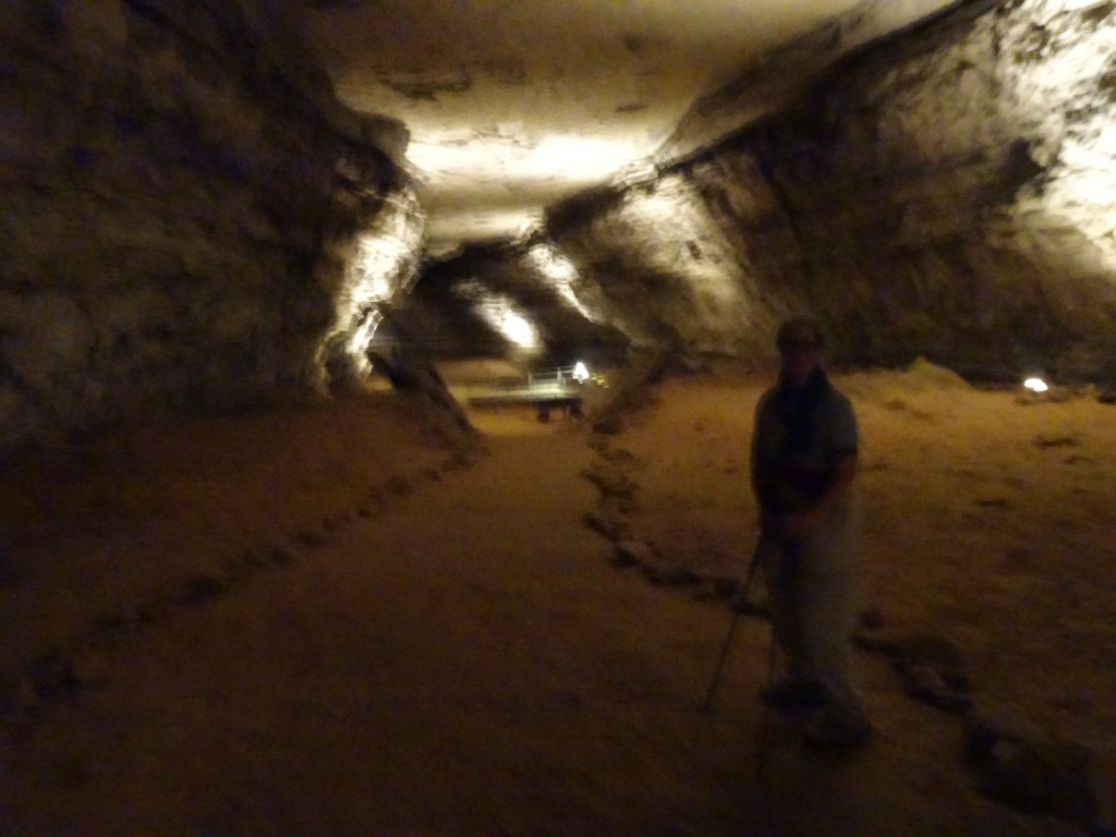
This is a heavily visited national park. For cave tours, especially the handicapped accessible cave tour, plan ahead. We did not. We were, however, able to sign up for two that were not labeled specifically accessible. We managed well regardless.
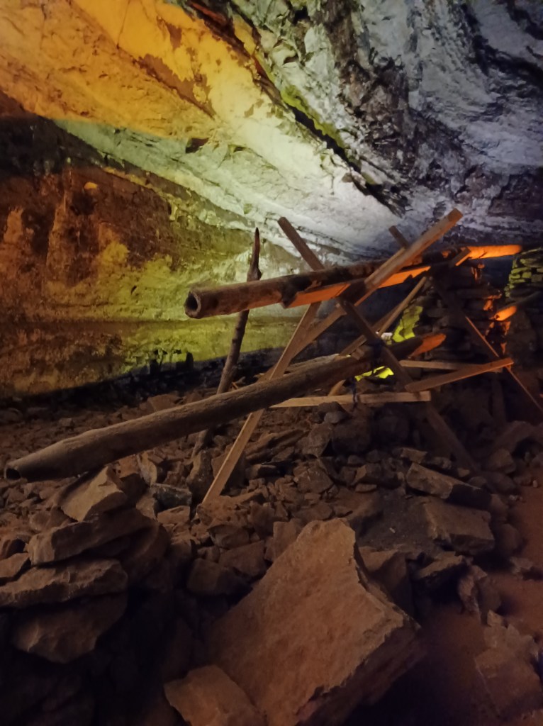
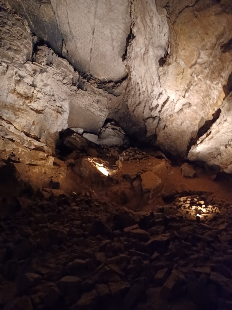
Infrastructure used in the mining of saltpeterInside the cave
Historical artifacts in the cave offer insight into how humans used the cave for industrial purposes, especially during the Revolutionary war, when bat guano was used as a source of material to produce gunpowder.
Clear walkways provide safe footing for visitors to the public portion of the cave
Mammoth Cave earned its UNESCO World Heritage site designation primarily because it is the world’s longest known cave system. This fact is not evident to casual visitors like us. (Public access is limited to a tiny fraction of the known branches of this extensive network of passages.) For researchers, serious cavers, and other scientists, it offers unmatched opportunities to learn more about cave environments.
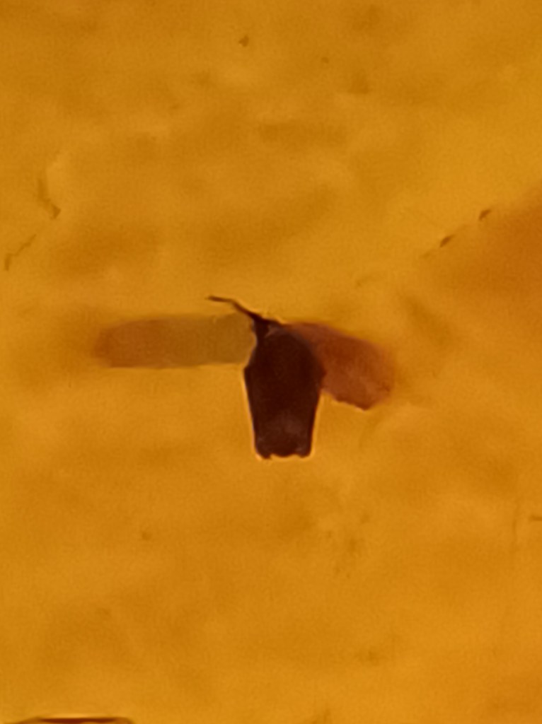
Little brown bat sleeping in plain sight
The cave tours we took were awe-inspiring. Little brown bats added extra interest as they hid in plain sight, clinging to cracks in the ceiling as we walked underneath them on our self-guided cave exploration.
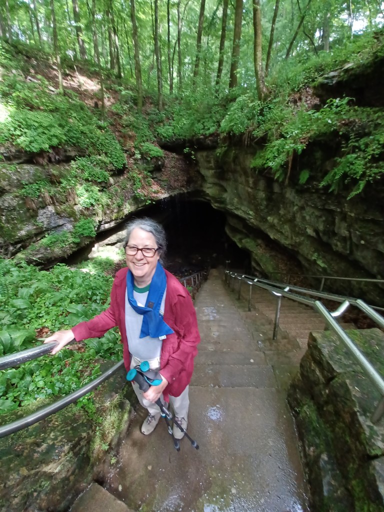
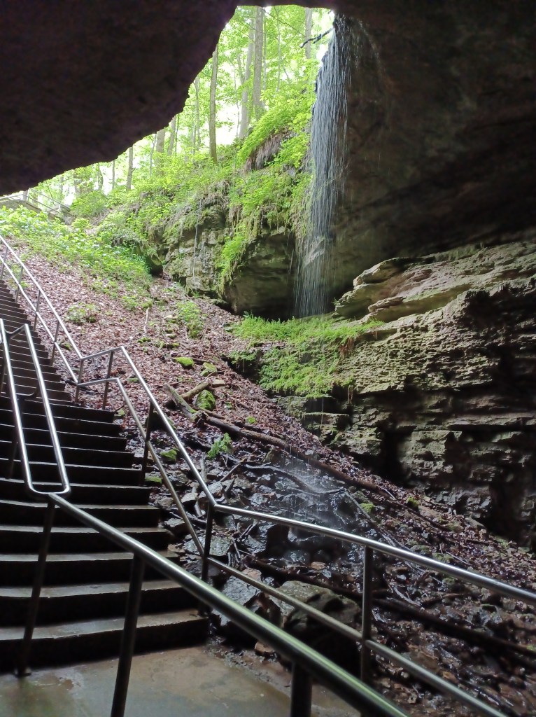
Standing at the historic entrance of Mammoth Cave
Same cave entrance after the downpour!
The park had a brief downpour while we were taking our self-guided tour of the cave system. We waited out the rain, only getting slightly wet as we headed up the stairs to the surface, ducking underneath the waterfall that was cascading into the historic entrance to the cave.
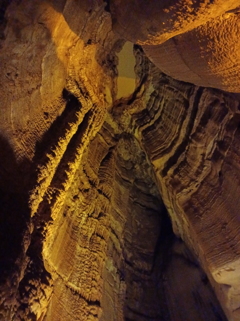
Looking up into a cave formation
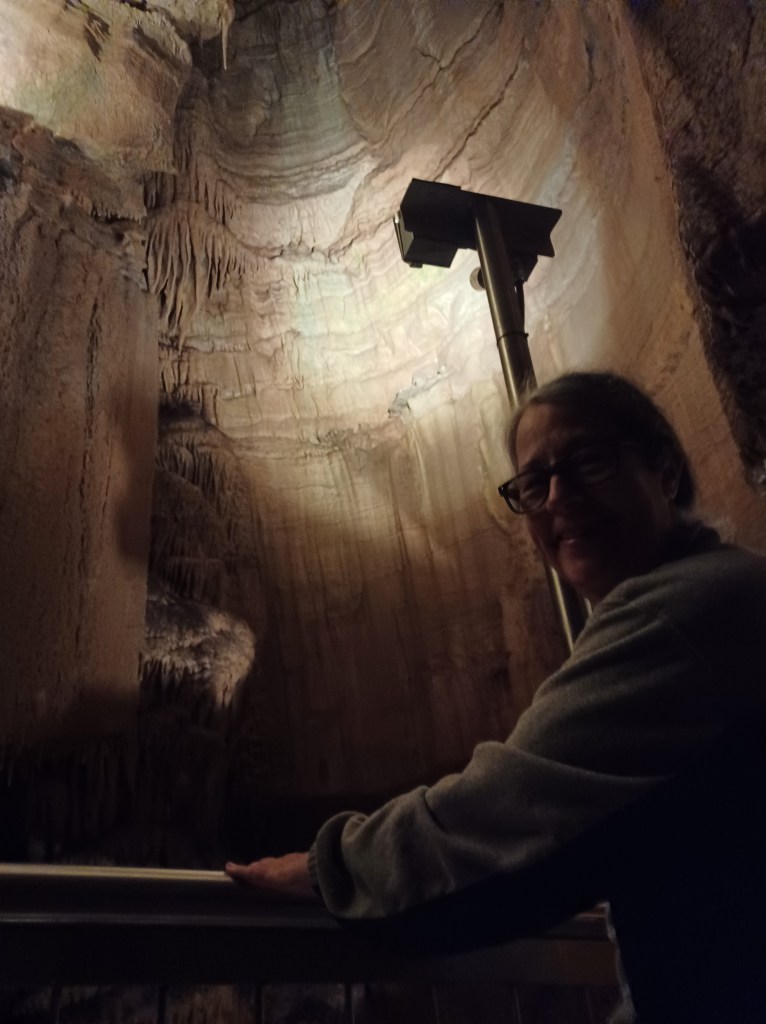
The Frozen Niagara tour, with stunning “pretties” cave formations, is equipped with handicapped-accessible stainless steel railings that provided the support I needed in the semi-darkness of the cave. The sections that are open to the public are dimly lit to prevent algae growth. The low light can offer challenges for those us not sure of foot.
A rail trail follows the path of the train that served commercial enterprises at the cave back in the day before this was a national park. We chose not to ride our adaptable tandem bicycle on the trail since it is rather narrow, only about six feet wide. It would have worked better (for us) as a walking trail than a place to tour by bicycle.
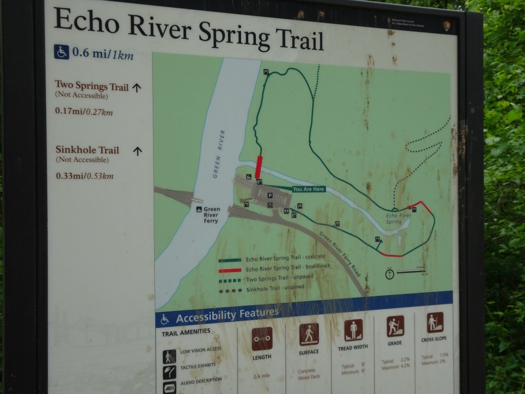
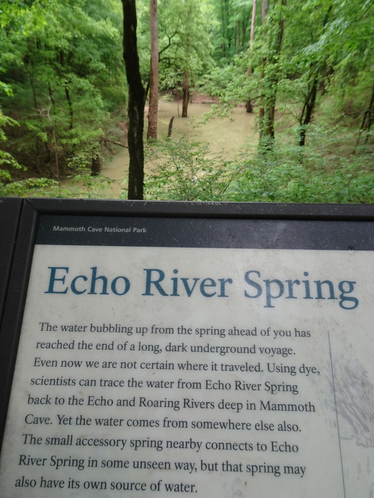
Miles of hiking/walking trails are maintained throughout the park. Before heading on to our next destination, we took time to explore a handicapped accessible path around the Echo River Springs loop trail. (The park also features two additional handicapped accessible trails.)
Echo river spring, easily seen from the walkway
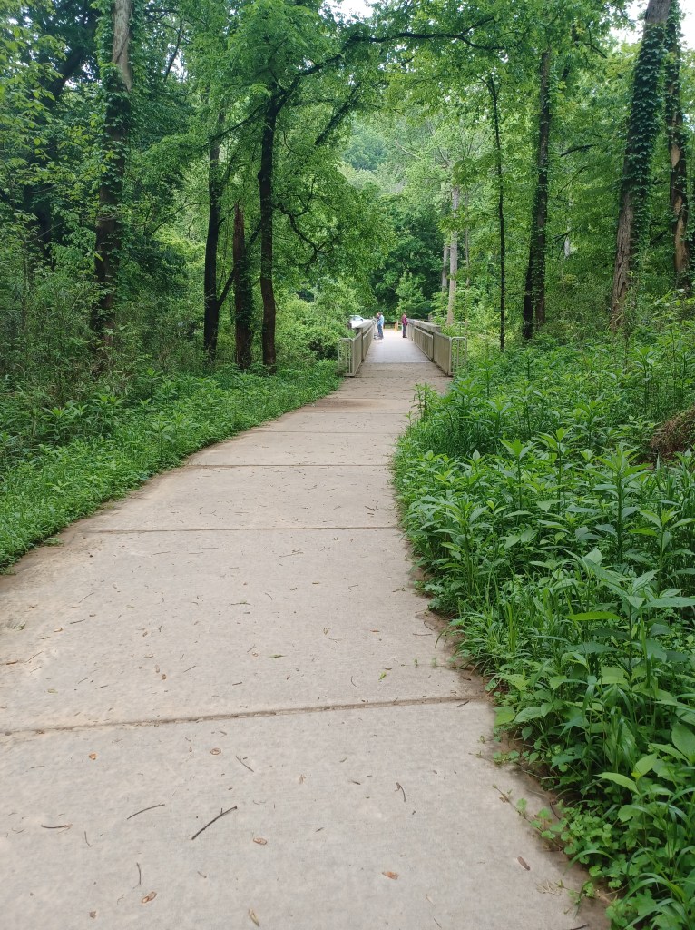
The bubbling spring is visible from the path, and its waters empty into the Green River. Echo River Springs trail provides a wide, paved, cement sidewalk adjacent to the Green River and into the surrounding woodland around the spring.
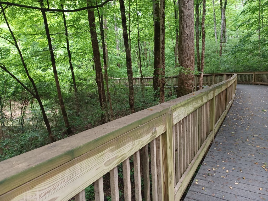
Cement walkway leads to boardwalk
After the rain from the day before, the dirt paths heading away from the handicapped accessible loop were messy, muddy, and treacherous.
As we explored we felt a few sprinkles, but the cement surface of the walkway and textured lumber on the boardwalk next to the spring provided solid footing.
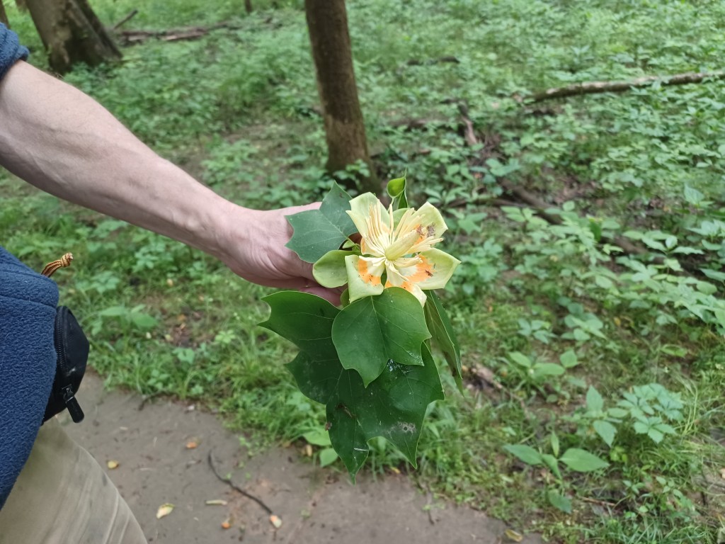
Blossoms from tulip trees in the surrounding woodland littered the walkway
The surrounding woodland was filled with bird song. We recorded on the Merlin app the songs of wood thrush, cardinals, scarlet tanagers, warblers recently migrated to the area, woodpeckers, and crows.
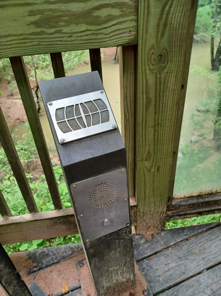
Audio kiosks offer listening optionsSign overlooking the spring
Interpretive signage is posted along the way, including some with Braille. In addition to the Braille, an audio speaker stood next to the signs, providing a listening option for those with visual impairments.
Our visit was in early May, and we enjoyed both mild temperatures, and limited crowds. The cave tours filled quickly, but our walk alongside the spring was solitary. The only other visitors we encountered on our walk were fishermen, trying their luck as they stood on the bridge that spans the outlet to the spring as it flows into the river.
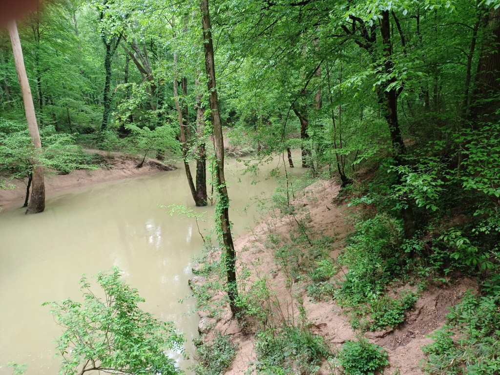
View of the Green River and ferry ramp. The ferry is presently out of service
A severe storm hit the park and surrounding countryside in late April, 2025. Visiting just a week or so later, we witnessed remnants of the flooding that ensued. The ferry that carries visitors over the Green River was out of service during our visit, put out of commission by the floods. The warning signs at the road entrance to the ferry may have discouraged visitors to the path we enjoyed. Yes, the ferry was out of service, but the road to the river was quite open, as was the parking area and the trail.
Campsites in the campground in the park are wooded, well marked, and are relatively level for the most part. No power or running water is available. At least one bath house is open for campers.
Be sure to thank the rangers for their work. They care deeply for this park, and face serious challenges. A simple “Thank you,” and taking care to treat this place respectfully, can go a long way in making a difference as we can. Happy trails!