

Besides flying, taking the ferry from Cape Breton is the shortest, least expensive way to get from the North American Mainland to Newfoundland. We brought our camper along and found some delightful Easy Walks along the way in New Brunswick and Nova Scotia. Our goal, however, was Newfoundland and we were delighted to find a number of Easy Walks very close to where we disembarked in Port aux Basques, NL in the far southwest of the island.

When in our first provincial campground, J.T. Cheeseman Provincial Park, just five miles from the ferry, we noticed something odd. Many other campers drove their RVs into the campground after disembarking, like we had, spent a quick overnight there then headed out first thing in the next morning, missing all this less populated area has to offer.

We chose to spend time in the Port aux Basques area to explore and see what we could find. There was so much to enjoy that we extended our original stay from three days to seven, and made time for an additional two days on our way home, before boarding the ferry back for Cape Breton.
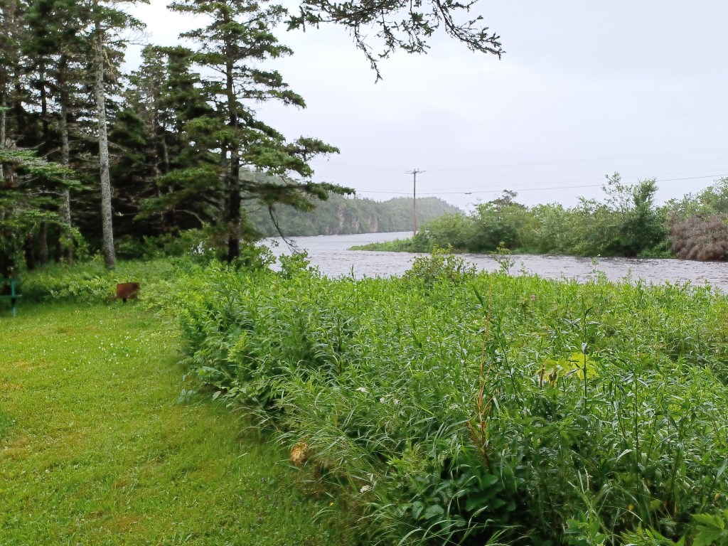
Upon landing we were handed information about various places in the area that were suggested destinations. The Harvey Trail on Isle au Morts (Island of the dead) seemed promising so we headed that direction down a two-lane road with very little other traffic. The single road into Isle au Mort offered sweeping views of gorse covered mountains and valleys. The “dead” in its name refers to how dangerous the coast there has been for ships in years past, and presumably still today. No dead bodies apparent at all. The Isle in its name does not require visitors to take a boat. A bridge over the Isle au Morts River provides easy access for visitors.


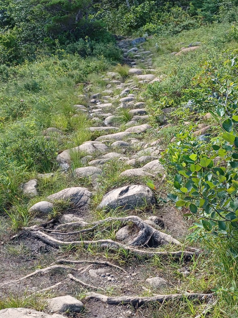
Before we reached the Harvey Trail we spotted a relatively small (room for probably six cars) parking area. There was, however, no sign at the parking lot. We puzzled over this, but decided to check it out. What we found, because of the steep terrain, was not a completely Easy Walk, but still, a graveled path to several viewing platforms, allowing passage through dense patches of alder, cloudberries, blueberries, sphagnum moss and other thick vegetation. Stepping off the path was inadvisable.
The sphagnum is very spongy. The alders are deceptively tall, concealing large holes along the way. Seeing this made the existence of this path all the more remarkable. Such a lot of work to create a simple pathway out to a pond that was an essential fresh water source for the community in years past.
My hiking poles and a helpful hand on the steepest parts allowed me to venture out to the viewing platforms and take in the wide expanse of rugged landscape. We turned around as rain threatened, and made our way back, promising ourselves that we would return.

Our next adventure on Isle au Morts was along the Harvey Trail, another gravel path that skirts the edge of the cliffs that make this such a scenic (and dangerous for ships) place along the southwestern Newfoundland coast. Unlike the linked article above, the signage is greatly improved to help visitors find the Harvey Trail, although way there is still rather circuitous. The trail has two entrances, one with a good sized (about ten cars) parking area, the other next to a local restaurant on the main road.
We soon learned to ask about “graveled paths” since the concept of Easy Walks (not too many roots or rocks, firm footing relatively level with something of interest along the way)gave little insight to residents of this rugged island.
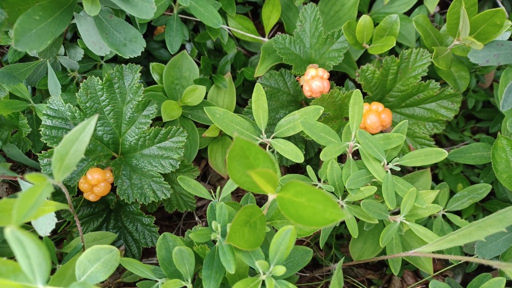

The Harvey trail is nearly a loop, following along the cliffs then circling back to the main road into Isle au Morts. This is where we found an abundance of cloudberries, some just ripe. Very tasty! We later saw people in fields abutting the coast carrying large buckets. We only saw cloudberries within a few hundred yards from the ocean. Other edible berries grow on the island but since we were unsure of which were edible and which were not we confined ourselves to eating the recognizable berries.

Artic raspberries, blackberries, and blueberries seemed to be the most common and were ripening during our visit. Finding (and picking them) made our walks doubly enjoyable.

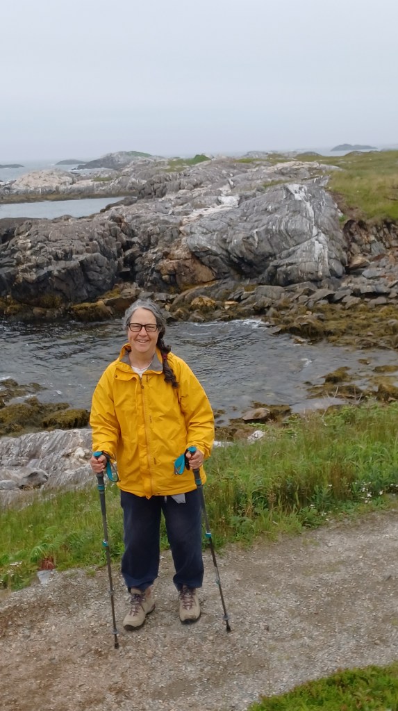
We found our way to the cliffside parking and headed up the incline to the trail. The gravel path is wide enough for two to walk side by side. Most of it is easy to manage (I use hiking poles to assist with balance). One portion was quite steep, but a gentler incline was there for me (and others, of course!) to use right next to this tougher part and I was able to manage my way along independently.

A resident walking his dog told us he’d grown up here and had now returned. He explained the existence of both the Harvey trail and the first trail on the way into town. He credited the provincial government for providing funds for both trails. Clearly volunteer labor was also contributed. These trails required (and continue to require) a tremendous amount of work to provide safe passage and repair damage to trails across an otherwise inhospitable landscape.
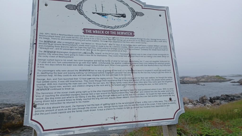
Along the Harvey trail are multiple historical signs telling the stories of George Harvey and his family, and the multiple ship that foundered along the coast. The Harvey family was instrumental in saving hundreds of lives that would otherwise have been lost at sea. Portions of the trail are so close to the water that winter storms have washed away sections of the trail. Those damaged places had been repaired and provided intimate views of the jagged coastline just below our feet.
We found multiple additional Easy Walks quite near to where the ferry landed. I will save those for upcoming posts. Happy trails!
Marjorie

Marjorie Turner Hollman is a writer who loves the outdoors, and is the author of Easy Walks in Massachusetts, 2nd edition, More Easy Walks in Massachusetts, 2nd edition, Easy Walks and Paddles in the Ten Mile River Watershed, Easy Walks South of Boston and Finding Easy Walks Wherever You Are. Her memoir, the backstory of Easy Walks, is My Liturgy of Easy Walks: Reclaiming hope in a world turned upside down.
