
We are continuing our quest to #avoidcrowds, and after looking at maps, focused on the area around the Burlingame Wildlife Management Area in Charlestown, RI as a place to explore, and perhaps return to visit trails when it is cooler. For now, we are getting me out on our adaptive tandem bike, with cooling gear making it possible for me to enjoy the outdoors, even on these days it has been 90+ degrees out. You who are able to sweat have no idea how much this body function helps in keeping your body temperature regulated. Those of us who cannot sweat either suffer, become terribly ill, or sometimes find ways to manage.
When road biking in an area away from home, the challenge is finding a place to park that does not attract undue attention to our truck when we leave it behind to set out for our ride. We decided to see if we could park at the entrance to the Burlingame Campground on Klondike Road, which worked pretty well, except when the parking area filled with trucks towing trailers.

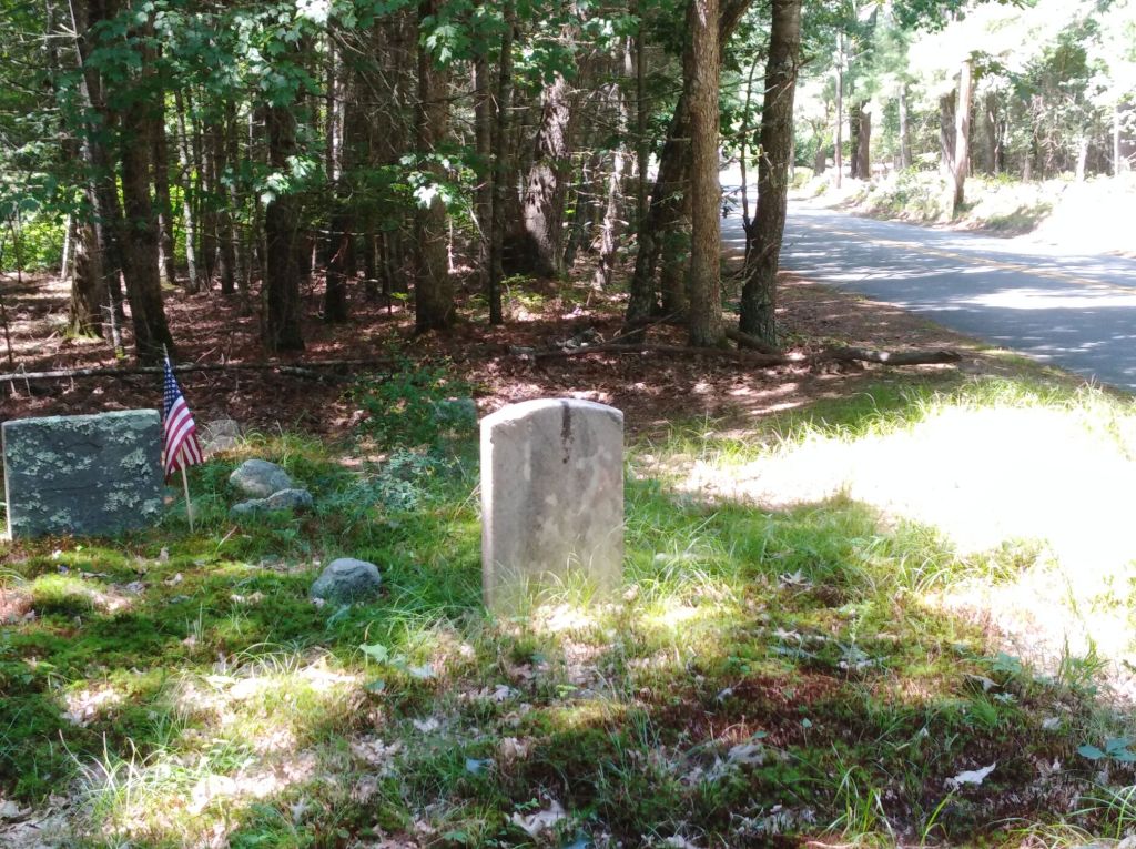
We followed Klondike Road north, away from the campground, basically circling the Burlingame Wildlife Refuge. Houses were on one side of the road, while the wooded refuge was on our right as we circled it. All along the road were signed posted prohibiting on-road parking. Evidence of quarries through the woods led us to conclude that this parking ban is intended to discourage visitors who hope to swim in the water-filled quarries.
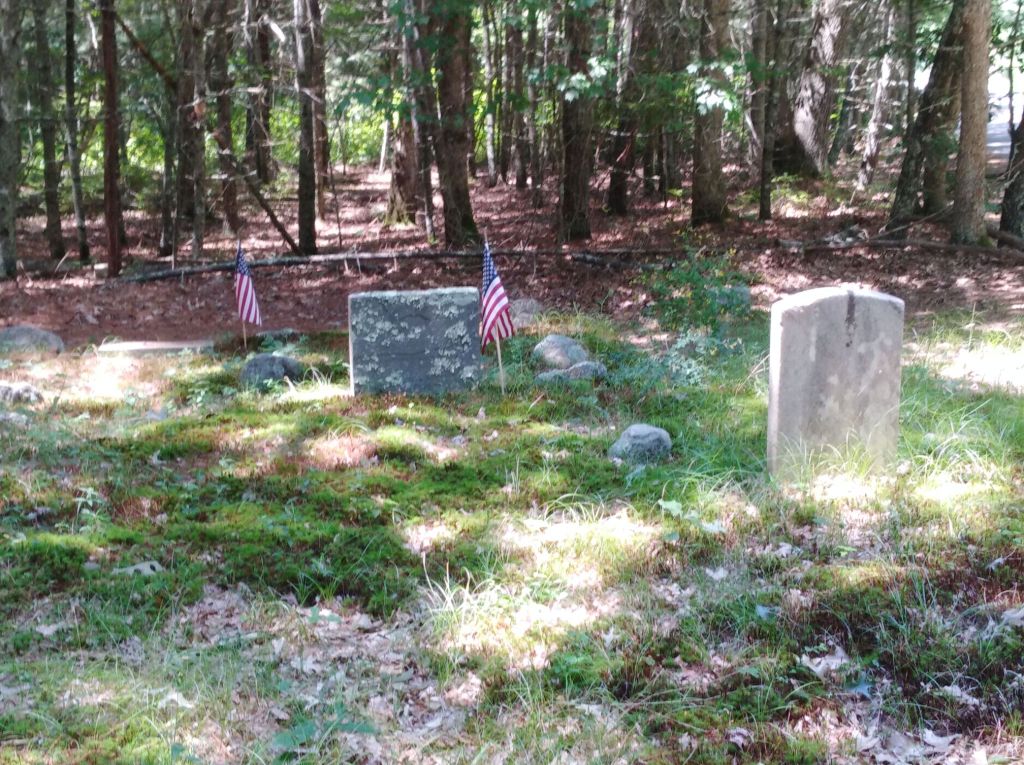
Like a number of our other road trips, we found that the roads we followed had stone wall remnants on both sides of the road, sure signs that many travelers had gone this way before. Before long we spotted one, then another small, marked historical cemetery right next to the road. We have seen these in many other communities as well, some surrounded by low stone walls, others a simple collection of headstones. As we pedal along, my imagination easily brings me back to a time when these were dirt paths that carried horses, carts, and foot traffic. The cemetery we stopped at had some intact headstones, but others were broken off just above ground. These places of remembrance have stood through many winters, and the elements have taken their toll. We spotted a few new-looking American flags next to tombstones, and a very few flowers.

Trail markings were painted on trees along the road, and we spotted signs for the North-South Trail, which journeys the length of Rhode Island, from Burrillville to Charlestown. My friend Ernie Germani has led groups along this trail, and shared details of the trail here. We have spotted trail markings on our visits to Burrillville, Coventry, and now, in Charleston.

We traveled only about five miles in the heat before turning around, riding ten miles total. We saw probably three cars during the two hours we pedaled along exploring the area. While we were quite close to the coast, the crowds had gone to the beach. We had these roads almost totally to ourselves.
We stopped briefly at yet another conservation area in Charlestown, the Charlestown Moraine Preserve, that was filled with mountain laurel. The plants had already blossomed, so we missed the stunning displays of these woodland flowers. This glacial moraine marks the southern edge of the continental ice sheet that shaped so much of New England. It’s part of the fun of visiting new (to us) areas, when we find ourselves saying, “We need to come back here another time.”

“Be willing to explore” is one more tip we write about in the soon-to-be-released book, Finding Easy Walks Wherever You Are. Stay safe out there, and happy trails!
Marjorie
Marjorie Turner Hollman is a writer who loves the outdoors, and is the author of Easy Walks in Massachusetts, 2nd edition, More Easy Walks in Massachusetts, 2nd edition, Easy Walks and Paddles in the Ten Mile River Watershed, and Finding Easy Walks Wherever You Are. Her memoir, the backstory of Easy Walks, is My Liturgy of Easy Walks: Reclaiming hope in a world turned upside down.
