
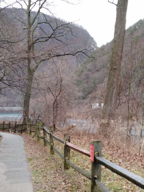
Delaware river with mountains on either side of the river
When we got to the Delaware Water Gap, I was surprised to learn that it is so much more than a spot where the Delaware River cuts between a mountain range. In fact, for about thirty miles, on both sides of the river, the Water Gap is actually a National Recreation Area.
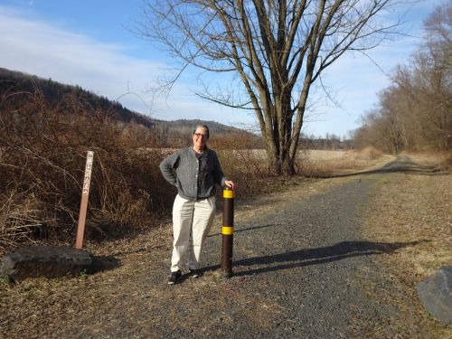
McDade bike trail is crushed stonedust and follows the river for 31 miles through the Delaware Water Gap
The McDade bike trail travels along the length of the area, close to the Delaware River, about 31 miles in length (on the Pennsylvania side). Because of the steepness of the mountains on either side of the river, waterfalls appear alongside roadways as the run-off heads toward the river. We found ponds, smaller streams, and even a toll bridge where, historically, a ferry used to carry traffic across the river. And yes, the bridge at Dingman’s Ferry bridge is quite narrow, and feels precarious driving across it!
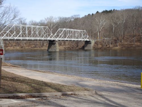
Dingman’s Ferry bridge–be sure to have your $1 ready to hand to the toll taker on the PA side of the bridge
We encountered a substantial waterfall on the PA side, Raymondskill Falls, that offered stunning views of multiple large and smaller cascades through the rocks.
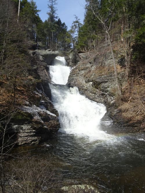
Raymondskill Falls
The ground near the falls is quite steep, and the National Park service invested substantial money to improve the access to this beautiful spot.
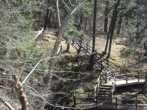
Lots of steps at Raymondskill Falls. The steps provide access, and surely prevent erosion in this steep area, but they are quite a challenge for anyone with mobility impairments
My guess is that this area is not open in the winter–the spray from the falls makes the steps quite wet.

These railings offered a real challenge ascending and descending around the falls.
The handrails were post logs, which I found very difficult to grab. Some steps along the way were stones, most of reasonable distance apart, all together very beautiful, but not a great area for those with mobility challenges.
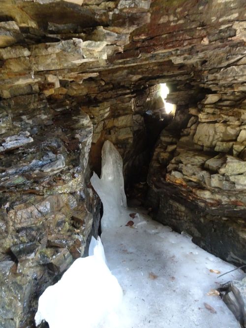
Ice cave in the Raymondskill Falls area
Along our way back up from the bottom of the falls, we found a small ice cave, a treat for those in our party who are passionate about caves.
We explored both sides of the area, in New Jersey as well as Pennsylvania, and found the PA road to be in better shape, while the NJ roads tended to wind and wander. The NJ side had a waterfall, Buttermilk Falls, that promised an easy view directly from the parking lot. But after following the signs, crossing a precarious bridge and putting our truck into 4-wheel drive to get through a nearly washed out road, we came to a locked gate. Presumably the waterfall is beyond the gate. Perhaps maintenance will restore the access road before their busier summer season. But for our visit, Buttermilk Falls was a wash.
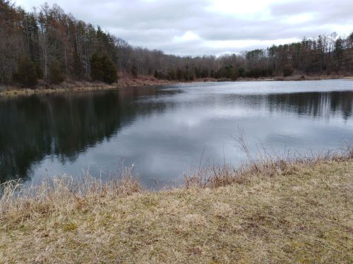
Spring peepers were calling in the marshes at the edge of the pond at the Watergate picnic area
On the New Jersey side we also encountered a good sized picnic area, Watergate, which charges for parking in the warmer months, and has a small series of waterfalls beyond the pond and picnic table area.
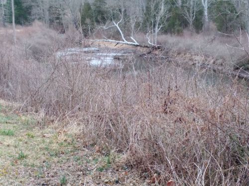
A series of small waterfalls cascade toward the Delaware, just beyond the picnic area
During our visit the spring peepers had just begun calling, and the picnic grounds were covered with robins hunting for worms, and masses of yellow-shafted flickers hunting the same grounds as the robins.
All up and down the river we found canoe put ins, which offered great spots for us to get out to enjoy views of the river. As we traveled south on the PA side of the park, we caught glimpses of the McDade Bike Trail, often close to the road and the rail trail traveled through open corn fields. At times the river was close to the road, with the bike trail next to the river, promising great views of the water for bike travelers and walkers.
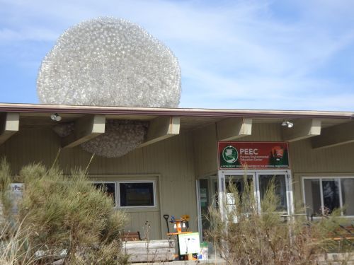
Pocono Environmental Education Center–with eye-catching sculpture created from recycled water bottles
We stopped at the Pocono Environmental Education Center, on the PA side of the park, and found multiple trails from the center heading off into the woods.
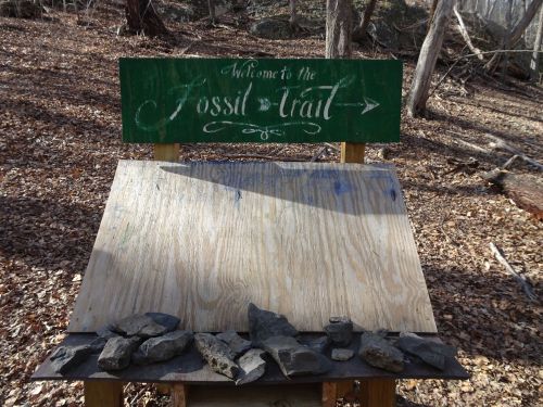
Fossil Trail leads away from the Pocono Environmental Education Center
From the size of the meeting room, and the various exhibits, it was clear this is a well-used educational resource, and well worth the stop.
As we left the area, we felt as though we’d only gotten a taste of what this area has to offer. Till next time!
Marjorie

Marjorie Turner Hollman is a writer who loves the outdoors, and is the author of Easy Walks in Massachusetts, 2nd edition, More Easy Walks in Massachusetts, 2nd edition, Easy Walks and Paddles in the Ten Mile River Watershed, and Finding Easy Walks Wherever You Are. Her memoir, the backstory of Easy Walks, is My Liturgy of Easy Walks: Reclaiming hope in a world turned upside down.
