
Looking for spring along the banks of the Upper Charles River in Sherborn
There is a time when the calendar says spring is here, and yet, and yet, in New England, the landscape still has a bleak look. Buds are swelling, grass has started poking out, in the marshes green shoots reach skyward, and migrating birds have begun heading north. But the trees remain bare. Ferns remain hidden under the soil. Bushes hint of color to come. and broken branches from the multiple March snowstorms this year litter both yards and trails.
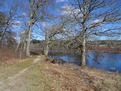
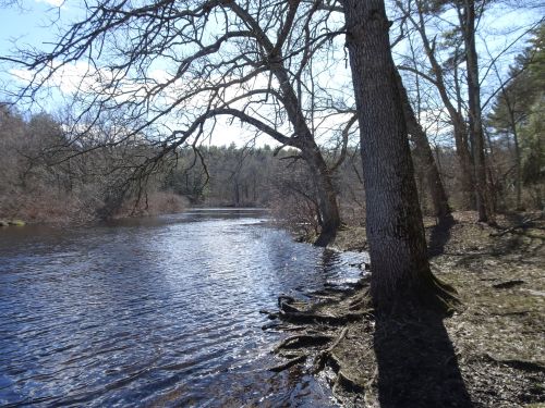
Great views of the Upper Charles from the carriage road at north end of the Reservation
We headed out on a bright afternoon and encountered brisk wind blowing off the Upper Charles River at Rocky Narrows, a Trustees of Reservations property in Sherborn. The Charles River is a liquid border alongside this lovely spot, with more open space across the river at the Medfield State Hospital property. A nearly mile long carriage path follows the shoreline of the river, from the main portion of the reservation north out to Farm/Bridge Street, where we found a place to park alongside a guard rail that borders the reservation.
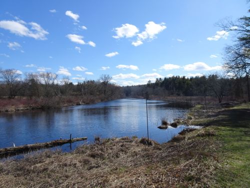
Hints of spring emerging in the marsh grasses in the river’s floodplain
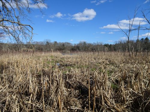
In past springs we’ve walked this path alongside the river and seen hundreds of ferns unfurling their fronds in the rich soil of the Charles River floodplain.

Ferns of past springs, still waiting to emerge
In some spots the carriage road is soggy, but we managed to mostly keep our boots dry as we headed back toward the main portion of the reservation.
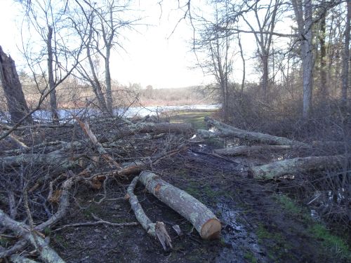
More trailwork awaits trailcrews
One section of carriage road was almost completely blocked by large branches that had torn loose from the trees overhanging the trail. Someone had come through with a chainsaw and cut some of the largest branches, but we found these logs still too heavy to shift out of the way, and so we climbed through the branching mess on the trail, boots threatening to get sucked into the mud that pooled in this lower-lying section.
View of the river from the canoe put-in
We noticed on the map a sign for a canoe put-in, something we had overlooked in previous visits. By following the open path, we found and an easy walk that led right to the shoreline, where we came upon an open clearing, designated as camping space (with reservations made ahead of time) for water-borne travelers. The trail along the river continued in a small loop till we reached the main path, at which point we turned back for home (well, for our parked car).
We walked in total just about two miles, and my legs reminded me of how house-bound I have been this winter. We missed the views offered at King Philip’s Overlook, but will plan to get there next time. And surely next time, green will fill the landscape, spring will for sure have arrived, the river will continue to head towards the sea, and the seasons will keep changing.
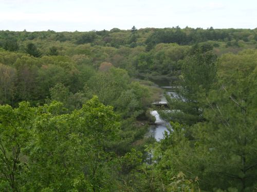
A view that will be waiting for our next visit, from King Philip overlook
Marjorie
 Marjorie Turner Hollman is a writer who loves the outdoors, and is the author of Easy Walks in Massachusetts, 2nd edition, More Easy Walks in Massachusetts, 2nd edition, Easy Walks and Paddles in the Ten Mile River Watershed, and Finding Easy Walks Wherever You Are. Her memoir, the backstory of Easy Walks, is My Liturgy of Easy Walks: Reclaiming hope in a world turned upside down.

This trail looks really nice! I can’t wait for Alida to be ready to start walking again!
It’s really quite nice, Mary. A bit of a drive, but such views of the river.