
Marjorie Turner Hollman is a writer who loves the outdoors. Link to all Marjorie’s books.
LISTEN HERE:
I was asked to review a new book that will be published April 2, 2024, Hiking Ruins in Southern New England. It was gratifying to see that the authors, both archeologists, not only provided information about archeological remains along trails, but also included helpful maps and information about how to reach the various locations they pinpointed in Connecticut, Massachusetts, and Rhode Island. Color photos convey a lot about what they categorize as ruins. In addition, they offered information about trail surfaces, a real gift to those of us with mobility challenges. This book made me want to get out and start checking these destinations off my list. Reading through the guide brought to mind multiple locations I have visited that feature similar ruins.
I had always thought of them simply as cool reminders of the past. Stone walls are at the top of my list.

Road side cemeteries are another feature in the landscape, found in many communities. Old mill sites along rivers and streams are plentiful. Abandoned railroad infrastructure is often visible on developed rail trails.
After reviewing the book, I searched through my own photos taken on local and less local walks, I found lots of pictures that fit the authors’ descriptions of ruins. If you are local to the Bellingham, Massachusetts area and are interested in exploring ruins nearby, you have lots of choices.
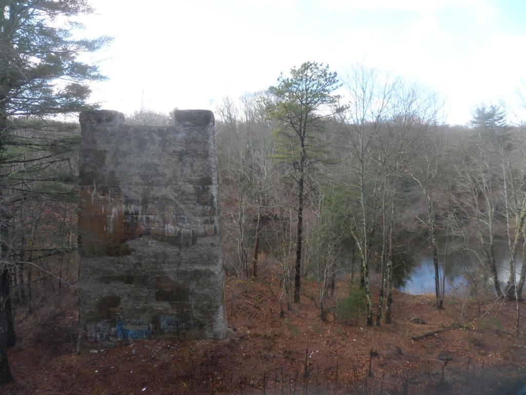
Venture over to the High Street athletic fields in Bellingham and head to the back edge of the field near the woods. Look for the trail kiosk and follow the red arrows to the Charles River (about one half mile). There you will find stone foundations partially buried by brushy plants. The foundation next to the river could be what remains of an early Bellingham home. The Charles River at this same spot hosts remnants of a dam that was most likely a seasonal power source for inhabitants.

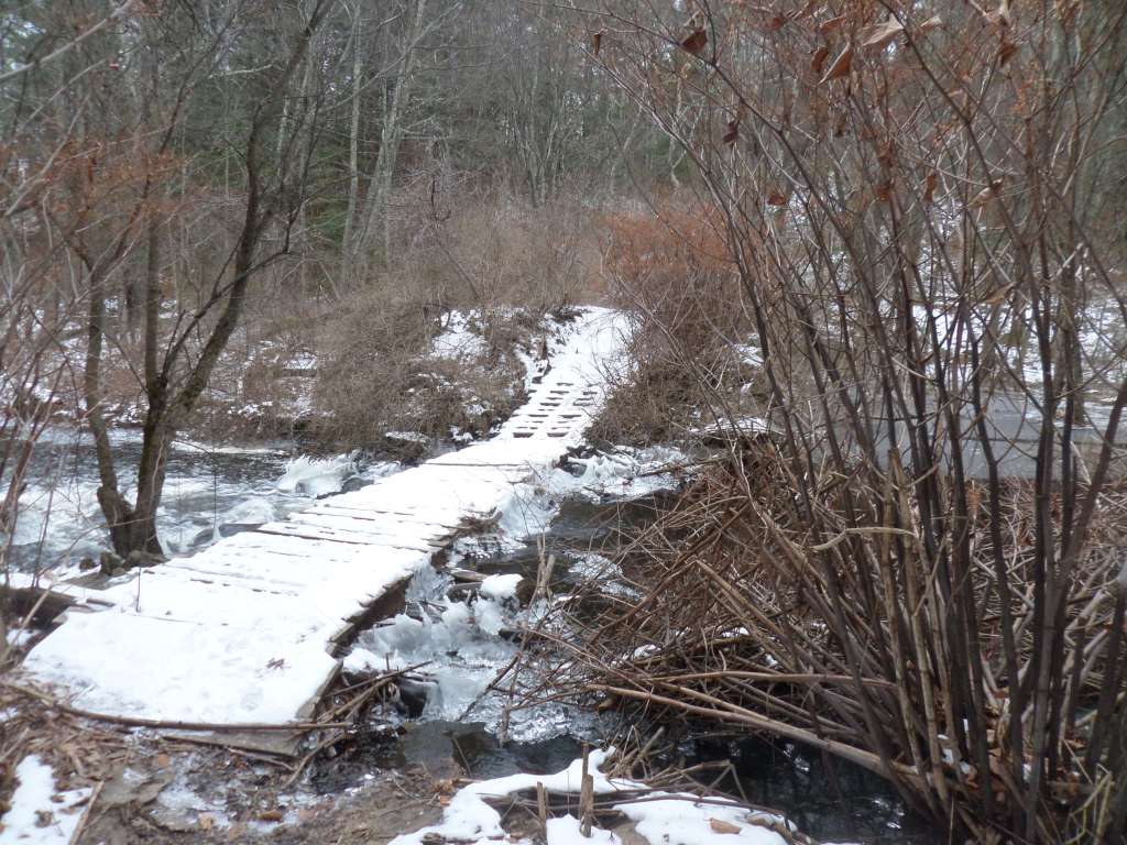
Also in Bellingham, stone structures remain of a mill that utilized the Stall Brook to power the mill located there. You must cross the stream behind Stall Brook Elementary School to see what is now a steep cascade of water headed toward the Charles River. Another impressive stone structure can be found at the Mowry Conservation area in Smithfield, Rhode Island.

A treasured town landmark in Bridgewater, Massachusetts features an intricate network of canals and sluiceways channeling water for powering a number of different industries at the site over several hundred years. Information about this and other nearby Easy Walks South of Boston can be found here.

Stone walls are quintessentially New England. In most New England (and New York) towns rock remnants along roadways confirm they were historic paths. The often stretched out piles of stone were important boundary markers, stone fences, animal enclosures, and markers indicating the edges of roads. They consistently delineate the borders of wetlands, perhaps an effort to prevent animals from being mired in mud.
Many stone walls are found in wooded areas. Were they built just for fun? Of course not. For land owners to build or pay skilled laborers to erect walls was a huge expenditure of time, effort, and often money. The land where you see them was open for farming and grazing. What we see today is property no longer used for agricultural purposes. Left untended, in New England (and New York) it will soon return to forest if not regularly cleared.
West Hill Dam, in Uxbridge, Massachusetts, has foundation walls next to a trail in the Army Corps of Engineers’ flood control area. Mass Audubon’s Stony Brook Wildlife Sanctuary in Norfolk has remnants of multiple mills that were built over the centuries using the brook for power. The picturesque dam and cascade are part of what remains of the mill infrastructure that was an essential part of the local economy in days gone by.

The Blackstone Bikeway that stretches presently from Blackstone to Uxbridge, Massachusetts has, among other features, the Triad Bridge. The site where three rail lines crossed gives the bridge its name. Abutments built over one-hundred years ago stand next to the river and the active railroad that passes underneath the Blackstone Greenway rail trail. Bridge supports still stand in the Blackstone River itself at this site, intended as the underpinnings of a railroad bridge. One of the principals of the company building the rail line had contracted with investors in England and was returning home on the Titanic. The cement structures were never used, having been abandoned after the loss of life and funding.
New England has a storied history, much of it in plain sight. We take for granted these features of the landscape. Awareness of how these man-made structures came to be and the stories they tell can increase our understanding of the treasures we have. It can also motivate us work to preserve what we are able to. If you have read this far, consider yourself motivated. Happy trails!
Marjorie
Marjorie Turner Hollman is a writer who loves the outdoors, and is the author of Easy Walks in Massachusetts, 2nd edition, More Easy Walks in Massachusetts, 2nd edition, Easy Walks and Paddles in the Ten Mile River Watershed, Easy Walks South of Boston and Finding Easy Walks Wherever You Are. Her memoir, the backstory of Easy Walks, is My Liturgy of Easy Walks: Reclaiming hope in a world turned upside down.
