

Marjorie Turner Hollman is a writer who loves the outdoors. Link to all Marjorie’s books.
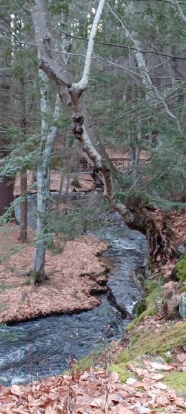
The Mowry Conservation Area on Old Forge road in Smithfield, RI is relatively small (forty-four acres), with two clearly marked loop trails. A burbling trout stream (actually part of the Woonasquatucket watershed) flows past the entrance of the property, with a small footbridge that provides easy access to the land on the other side of the stream.

On a mild (40 degrees F) almost winter day, we headed out to get outdoors and visit. Some have the mistaken impression that Rhode Island has either spectacular coastline or congested municipalities. What a mistake! Although Rhode Island has a small land area compared to other New England states, the northwestern part of the state offers miles of rural roads filled with stone walls, ponds, streams and lakes, historical villages, and wooded trails.


The trails, while well marked, are not handicapped friendly. I would suggest that it is not really even an Easy Walk. Because the bedrock is so close to the surface (and quite visible in many sections) the trails have many roots.

The paths were manageable for the most part, but the steepness of certain sections defeated my efforts to get to the top of a ledge that promised some limited views. My one effort to scale a steep footpath resulted in my sliding down rather than ascending. No harm done, just evidence that the path was too steep for me!
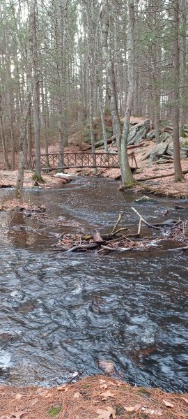
We have found many of the trails we visit in Rhode Island to have some quite steep sections, countering the popular perception of Rhode Island having dense population and little variety. But oh, the rocks…a stunning rocky overhang frames the Woonasquatucket River as it surges through the area. A bridge built over the river facilitates exploration on the river’s other side.

After crossing the river visitors can reach the old mill site where a forge and later a saw mill used the river to power their operations. The massive stones that created the dam are impressive, evidence of the plentiful source of stone that was right at hand to help create profitable enterprises.
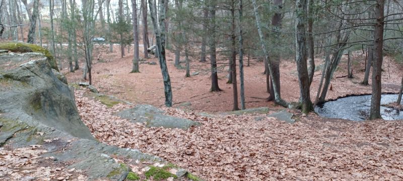
After checking on our Rockd app we confirmed what we suspected, that this area is in the midst of a fault zone. The protruding rocks throughout the conservation area provide access to views of rock layers, uplifted rock and water-worn stone sculpted by the river through the years.
While we encountered dog walkers and others seeking to use the picturesque stream/rock overhang as a photo shoot backdrop, we mostly had the trails to ourselves. There is only on-road parking along old Forge Road, with a few areas enlarged to assist visitors in getting most of the way off the road. Beware of traffic. It is a 25 MPH traffic zone, but there are curves that block the view.
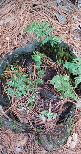
We look forward to visiting this area in different seasons. The remaining ferns indicated that plant life thrives and will bring green to the area when winter has passed. The rocks and river will create stunning ice formations in coldest weather. Bring hiking poles, good boots with tread, and layers for colder weather. Happy trails!
Marjorie

Marjorie Turner Hollman is a writer who loves the outdoors, and is the author of Easy Walks in Massachusetts, 2nd edition, More Easy Walks in Massachusetts, 2nd edition, Easy Walks and Paddles in the Ten Mile River Watershed, Easy Walks South of Boston and Finding Easy Walks Wherever You Are. Her memoir, the backstory of Easy Walks, is My Liturgy of Easy Walks: Reclaiming hope in a world turned upside down.
