
Mountains, river, trains, railtrail, and canal remnants at Lehigh Gorge State Park
Marjorie Turner Hollman is a writer who loves the outdoors. Link to all Marjorie’s books.
In the fall we took a long weekend to visit Lehigh Gorge State Park. The gorge itself was created by the Lehigh River. Like the Blackstone River Canal in New England, the Lehigh Canal was built in the early 1800s through the gorge next to the river to facilitate transportation of goods.

Standing amongst the ruins of one of the remaining canal locks along the Lehigh River. The walls of the locks were at least 20 feet thick, if not more
The Lehigh Canal operated from the 1830s until a massive flood in 1862 destroyed the canal infrastructure. Along the river gorge are now only portions of the stone structures, which are massive, and stunning to stand next to. At one point the locks dropped the water level in total about 600 feet. We marveled at the engineering feats that were required to create this mode of transportation. It was very cool to explore what remains, and spot remnants of the canal along the way.
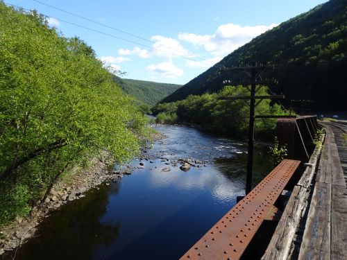
The walls on the right support raised railbeds with train tracks that are still in use. River is on the left
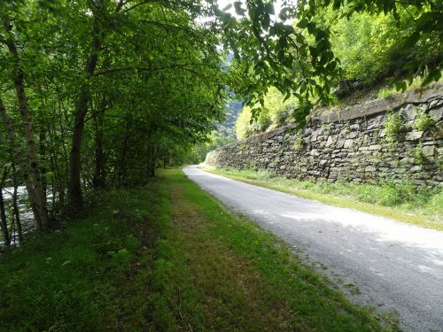
We started our trip on the bike railtrail at Glen Onoko, near Jim Thorpe, PA, and found absolutely stunning scenery, intriguing history, and 25 miles of nearly pristine, packed, crushed stone dust railtrail right along the river. We chose to take two days to explore the trail, the first day traveling thirteen miles to the mid-point,

Stream flowing into the Lehigh River at Rockport
Rockport, which has bathrooms, and road access. We then pedaled back to where we started. Bringing our lunch along was a great idea, since no services are available on this secluded trail through the state park. We did the same the next day, starting at Rockport, and traveling about 12 miles to White Haven, then back to Rockport.
Outfitters provide transport to the park to offer bike transport and guided rafting trips. Some whitewater rafting and kayaking trips begin at Rockport.
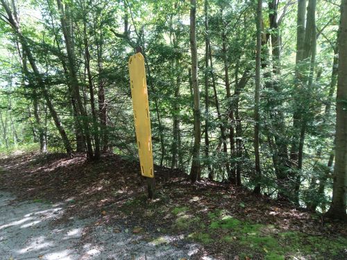
Backboard stands next to the edge of the river, ready to rescue injured kayakers, a solemn reminder of the dangers of the river
Visitors and their bikes can get dropped off at Rockport or White Haven to travel one direction (downhill!) on the trail.
Bikers stop at Buttermilk falls, but were quickly on their way
We had read about masses of bikes on the trail, but found, since our visit was after Labor Day, that the groups of bikes that came through were soon on their way past us and gone. We encountered some walkers, and spotted a few kayakers zooming through the rapids. Otherwise, this weekend after Labor Day, we had the trail almost all to ourselves.
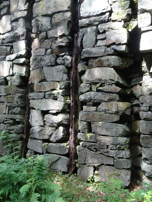
Detail of the canal wall. Timbers were inset into the walls, which were then lined with wood, to facilitate holding more water, and filling the lock quickly
Our second day of pedaling started at Rockport, and took us north to White Haven, crossing one road at the Lehigh Tannery. We found fairly intact, preserved examples of the canal locks in the northern section of the trail, while the southern portion offered barely a hint of the canal that had been there in the past. The southern half of the trail traveled along an existing railroad bed.

Telegraph poles, with wires still hanging from the poles, as well as intact glass insulators, followed the train lines and the rail trail
It was humbling to take in the immense amount of work involved that went into constructing these railroads through the river gorge. Each section of the trail has points of interest, and most of the trail is shady, offering shelter on sunny days.
Sweet treat along the trail!
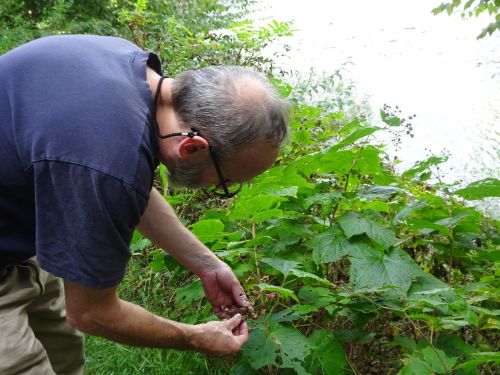
This will be a spectacular ride in foliage season, and in spring time when the waterfalls are full. As it was, in early fall, the scenery was beautiful, with mountain and river views around every bend in the trail. We found ripe purple flowering raspberries that had been ignored by other travelers. The berries offered a sweet treat along the trail.
The best parking is either at White Haven or Glen Onoko, within the state park. Parking with trail access is also available in downtown Jim Thorpe next to the river.
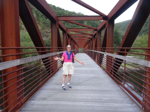
We found the new pedestrian bridge over the Lehigh River, next to downtown Jim Thorpe
The trail also continues south of Jim Thorpe and has the added connection of the Pedestrian bridge, newly opened shortly before our visit, that carries travelers right across the Lehigh River, next to the downtown area.
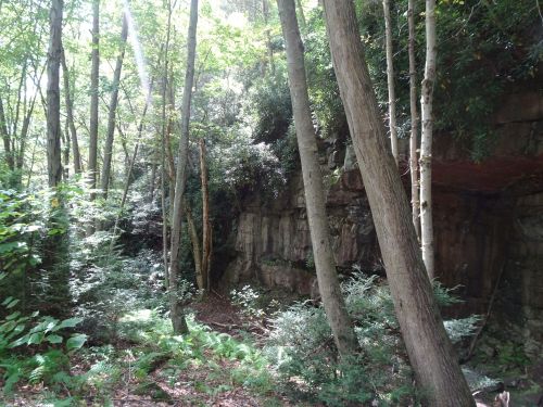
Cool rock overhangs, often covered by rhododendrons
Varied rock formations are visible along the trail, with lots of warnings about rattlesnakes. (One fellow traveler told us of a rattlesnake just next to the trail, but by the time we got there, the snake had fled.) As it was, the only snake (probably a water snake) we spotted was sunning itself on the steps down to the river at Rockport. It (and my husband) were both equally startled, and both moved quickly to head in opposite directions, with no harm done to either of them.
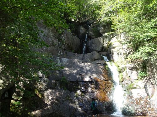
Buttermilk Falls
Streams along the way flowed into the river, sometimes offering spectacular waterfalls, other times appearing as quietly flowing streams,
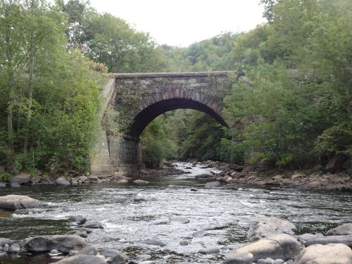
Railroad bridge carries trains over the stream flowing into the Lehigh river
while other streams flowed through arched stone bridges built by the railroad to carry trains across the streams.

View from across the river of the abandoned railroad tunnel
We also stumbled across two separate railroad tunnels, long abandoned, that were fun to explore.
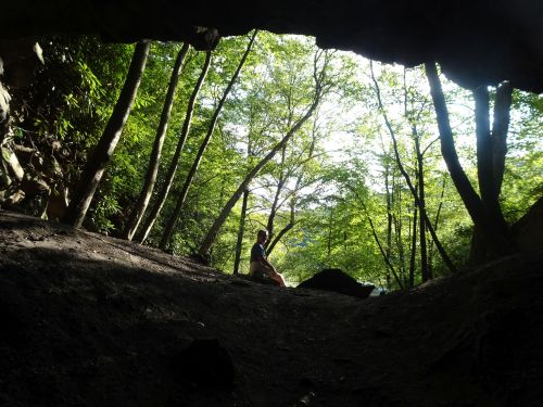
I waited outside while others explored the tunnel
These tunnels were not easy walks, so I explored vicariously through my husband’s pictures and descriptions. Neither the tunnel at Glen Onoko nor at Rockport had any interpretive signs at the time of our visit. We were left to wonder about who created these railroad tunnels, and why they were abandoned.

One of several statues commemorating the Olympian, and professional baseball and football player, Jim Thorpe
The Jim Thorpe memorial park is right on the edge of town, which offers a touching tribute to the Olympic athlete. Information about why the town was named Jim Thorpe was a little more challenging to find, but a quick Google search turned up the linked article that details the why and how of the town changing its name from Mauch (pronounced with an s-h sound) Chunk to Jim Thorpe.
We stayed the weekend in an inexpensive Airbnb in Albright, PA (sleeps 6) which was perfect for us for accessing the trail. Small restaurants are nearby, a food market is within a few miles, and gas was easy to find. Jim Thorpe has multiple restaurants, bike rentals, and evening entertainments. This is a destination that is well worth the trip when you can make the time.
Marjorie

Marjorie Turner Hollman is a writer who loves the outdoors, and is the author of Easy Walks in Massachusetts, 2nd edition, More Easy Walks in Massachusetts, 2nd edition, Easy Walks and Paddles in the Ten Mile River Watershed, Easy Walks South of Boston and Finding Easy Walks Wherever You Are. Her memoir, the backstory of Easy Walks, is My Liturgy of Easy Walks: Reclaiming hope in a world turned upside down.
