
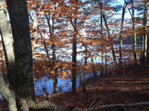
View of the pond through the beech leaves
Marjorie Turner Hollman is a writer who loves the outdoors. Link to all Marjorie’s books.
Sherborn does not make it easy to locate their public spaces. Information is not posted on line about their public spaces. A booklet, Sherborn Walks, is available for purchase at Sherborn’s town hall. Written in 1992, it has been frequently republished, but does not appear to have been updated since 1992.
My book, More Easy Walks in Massachusetts, includes the town of Sherborn, MA, but presently only includes Rocky Narrows in Sherborn. I am in the process of updating the entire book, probably adding at least another 15 Easy Walks, and Sherborn was on the list of places I wanted to revisit.

Sue shows me some mushrooms on the trail
My friend Sue agreed to join me as I headed to Sherborn. Last year she walked the entire length of the Bay Circuit Trail from Ipswich to Duxbury (in sections). As we came into Sherborn she spotted locations that looked familiar, and sure enough, throughout our explore,
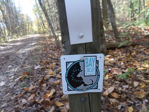
Bay Circuit Trail blaze
she found one after another Bay Circuit Trail emblem posted on trees, signposts, and where ever they could be posted. I would have missed most of them.
Prior to Sue’s arrival I looked through my booklet and picked out a couple of kettle ponds in Sherborn I hoped to locate and view. Little Farm Pond sounded like a promising walk, and Farm Pond is the town’s swimming area in the summer. I hoped to be able to walk in the swimming area “off-season” since I am not a Sherborn resident, and the pond is mostly open to residents only in the summer.

Well designated parking for lIttle Farm Pond
We found Little Farm Pond on Farm Road, between house numbers 101 and 105. Space for three cars is designated clearly, and the narrow access path to the pond is just to the right of the parking area.

Little Farm Pond
We found a large expanse of water with no houses along its shoreline. The fall leaves were gone along the waterline,
View of the pond through the beech leaves
but beech trees, leaves still clinging to branches,
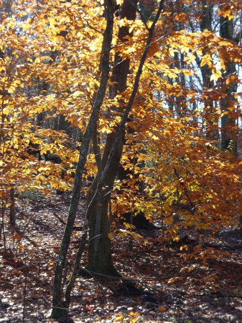
Beech leaves glowing in the November sunshine
glowed in the November sunlight as we explored the shoreline.
The property is part of Mass Audubon Society’s Broadmoor Wildlife Sanctuary, but travel between this section and the rest of the sanctuary is not possible because of extensive wetlands.
Trail headed along the shoreline at Little Farm Pond
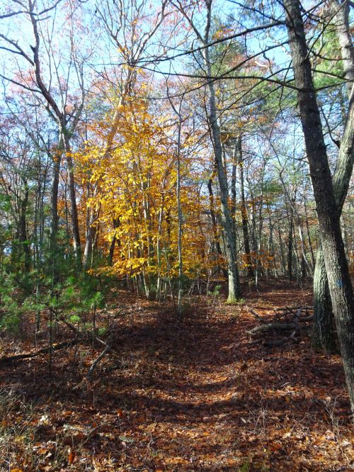
We spotted a trail along the western shoreline that offered an option for more walking, but since this was our first visit, and we had other locations to check out, more exploring will have to wait for another visit. According to the booklet’s information, a trail goes part of the way around the pond, but water will prevent travelers from getting all the way around. The eastern side of the pond has private property issues that will limit travel as well.
We headed on to find Farm Pond, another kettle pond quite near Little Farm Pond, on Lake Street. There we found locked gates, and No Parking signs posted on both sides of the road. After reading the restrictions and seeing the lack of public access, I dropped Farm Pond from my list of Easy Walks in Sherborn, since these books are designed to help people find spaces that are open to all. Farm Pond, while beautiful from a distance, is not accessible unless one has the financial means to live in Sherborn, or is able to obtain one of the limited permits awarded in a spring lottery, for a fee.
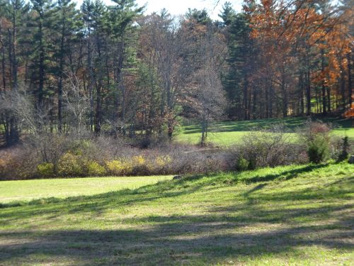
Open field next to the Charles River, along Farm Road
Onward! We stopped at Grandfather’s field, a place I had walked before, but until I obtained the Sherborn Walks booklet, had not known its name. Just south of Forest Street where it intersects with Farm Road is a pull off within view of the Charles River.

Well-worn path invites travelers to walk alongside the banks of the Charles River
The open field abuts the Charles, and by following the well-worn path across the field,

Carriage path alongside the Charles River
you will find a carriage road alongside the Charles River that eventually connects with Rocky Narrows.
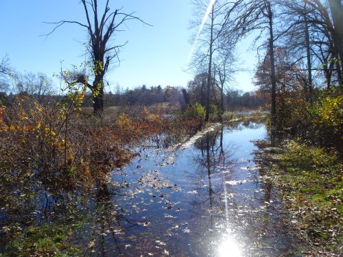
Path alongside the Charles is flooded as the river overruns its banks
The caveat for this walk is that at times of high water in the river, water floods this area, as we discovered after having walked about a half mile along the path.
Next time I will wear my farm boots! The river was quite high–we have had a very wet fall, and the night before our visit we had had yet more rain. For now, our trip was cut short, but in drier weather this is a wonderful, flat, easy walk for at least a mile along the Charles, with no houses on either side of the river in view. (Private homes are uphill on the Sherborn side of the river, but are at a distance. Access along the path is allowed, but visitors are urged to keep to the path.) The path eventually connects with the trails of Rocky Narrows.
While we did not find all we hoped on this visit, part of the work of compiling the Easy Walks book series is discovering places that are not workable for those looking for easy walks. It’s all part of the process, and keeps me going back for more, looking to see what is out there, and inviting others to get outside and take in the wonders of nature, right around the corner from where we live. Happy trails!
Marjorie

Marjorie Turner Hollman is a writer who loves the outdoors, and is the author of Easy Walks in Massachusetts, 2nd edition, More Easy Walks in Massachusetts, 2nd edition, Easy Walks and Paddles in the Ten Mile River Watershed, and Finding Easy Walks Wherever You Are. Her memoir, the backstory of Easy Walks, is My Liturgy of Easy Walks: Reclaiming hope in a world turned upside down.

like how you write about what doesn’t make it into the books! talk to you soon. love mg
Mary Chitty MSLS Library Director & Taxonomist cell 617 861 7410 work 781 972 5416 Cambridge Healthtech, Needham MA http://www.genomicglossaries.com http://www.healthtech.com
On Thu, Nov 8, 2018 at 11:12 AM Marjorie Turner Hollman wrote:
> marjorie561 posted: ” Sherborn does not make it easy to locate their > public spaces. Information is not posted on line about their public spaces. > A booklet, Sherborn Walks, is available for purchase at Sherborn’s town > hall. Written in 1992, it has been frequently republished,” >
Thank you–indeed, many trails do not get into my books, since after I walk them I feel strongly they are not places that families with young ones will feel safe traveling there, or the roots and rocks are simply more than those with physical challenges will do well on. Lots to include in the update, for sure, but some, for many reasons, do not make the cut 🙂