

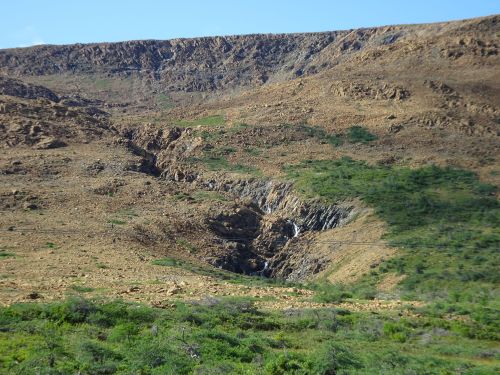
The stark tablelands, juxtaposed against the green of surrounding landscape
Marjorie Turner Hollman is a writer who loves the outdoors. Link to all Marjorie’s books.
We went to Gros Morne National Park on the western side of Newfoundland, to escape the heat, (success!) but came away humbled by the geology. Mountains right on the edge of the shoreline, rocks telling the stories of the ages, and ground that is toxic to life, directly next to green hillsides.
So much upheaval displayed in the rocks
My husband adores the geology and could write more knowledgeably than I about the various rocks we saw. I appreciated the upturned layers of rock, fossils, evidence of glaciation and plate tectonics,
Yup, heart is singing 🙂
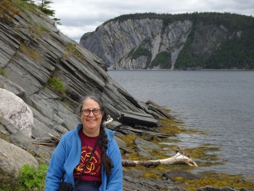
but my heart truly sang when sharing space with rushing streams, thundering waterfalls, and open ocean. Lucky for us, both the geology and the streams and waterfalls were all accessible to us on this trip.
Headed towards open ocean, with cliffs of the fjord on either side
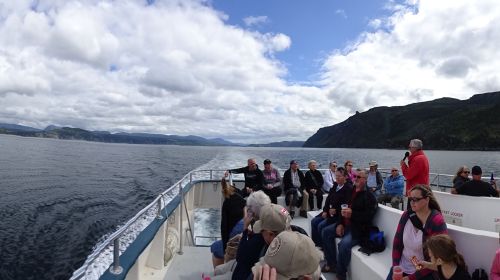
Since this rugged land was settled alongside the shoreline, it perhaps makes sense that the best way to see much of it is from a boat. We took a boat ride from Woody Point, on the southern area of Gros Morne National Park, across to Norris Point, where the tour boat headed out to tour the glaciated fjord of Bonne Bay. From there we were able to view cliffs that were otherwise inaccessible. Two hours of boat travel offered some insight into what we got glimpses of traveling along the shore roads that circle the bay.
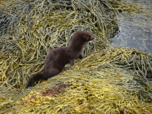
Young otter visited the shore next to where I sat at Norris Point Harbor
Just before we boarded the boat, I waited at the edge of the harbor, and was surprised by a young otter. It was difficult to say who was more surprised of the two of us.
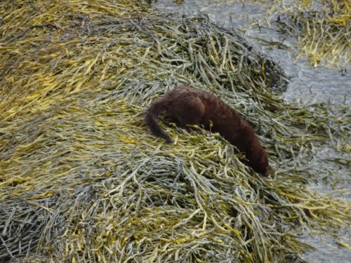
Off to continue the hunt for food
After checking me out, he headed back down the rocks and resumed his hunt for lunch.
Peridotite on one side of the road (on the left), granite on the other, stark contrast, and important to confirming the theory of plate tectonics
Another day we walked along the Tablelands trail, and saw snow still remaining on a hillside in September. I found this trail, labeled “easy” because it is relatively flat, to be quite challenging because of the many rocks along the trail.
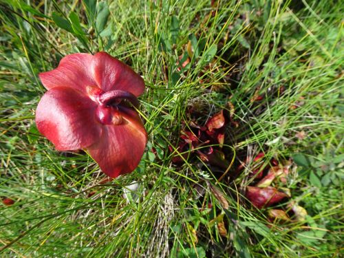
Healthy pitcher plants, with fruiting bodies. Clearly getting enough nutrition in this nutrient poor soil.
Amongst this barren landscape are a multitude of pitcher plants, carnivorous plants we have often seen in boggy areas. They grow alongside the streams flowing down the hillside from the tablelands, but the ground is so barren that few other plants survive. Somehow, these plants not only survive but thrive, and were setting out fruiting blossoms all over the lowland area where we walked. My guess is that the bug population keeps these plants well nourished. We were lucky to visit on days with a good amount of wind, and were little bothered by bugs on our travels.
Tablelands, with flowing streams rushing down the hillside
Peridotite, with magnesium and iron, derived from the earth’s mantle, is inhospitable to plant life. The Tablelands offers great views of miles of peridotite, leaving me feeling like I was walking amongst the landscape of Mars (minus the lack of oxygen and the extensive space travel to get there.)
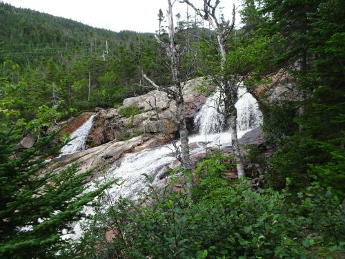
Southeast Brook Falls, on the north side of Gros Morne National Park, a short walk from the parking area
We encountered waterfalls on both marked trails,
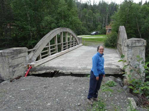
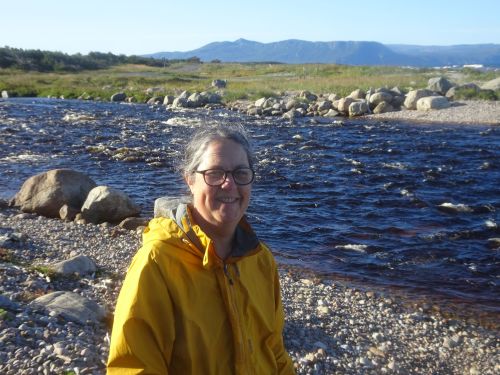
Curiosity about this damaged bridge led us to find a lovely stream frequented by fishermen
and just off the road in places that appear to be frequented only by trout fishermen.

Just upstream was even more spectacular falls
While rivers on the eastern US coast are tamed for the most part, the rivers flowing into the sea, at least where we traveled in this part of Western Newfoundland, have a wild and untamed feel. They flow where they wish, when they wish, and as high as they are able. Clearly it has been wise to stay out of the way, build away from the banks of these oft wild-flowing streams, and watch in awe.
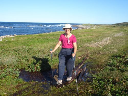
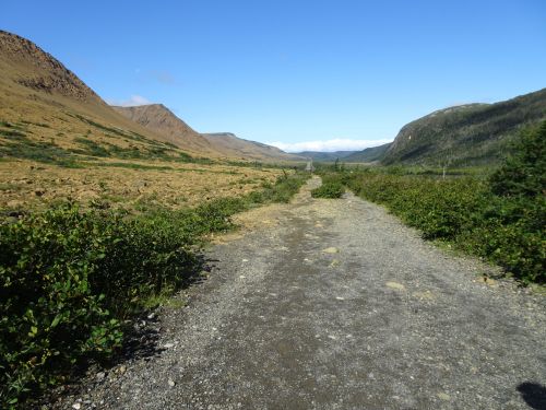
An easy walk today, this journey was only passable by dogsled up till the 1950’s
We walked the coastal trail just north of Rocky Harbor, on the north side of the park, and were stunned to learn that until 1954, residents of the coastal villages along this trail received mail only in winter when the mail was hauled by dogsled over the frozen muskeg. The roads we drove on had a modern feel to them. We realized that until these roads were built, there was little or no overland road access. The sea was the best and often only form of transport.
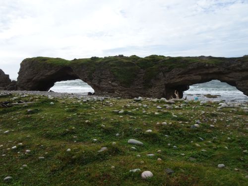
Huge, these arches were difficult to capture in one picture
Arches Provincial park, north of Gros Morne along the coastal highway, offered a taste of what we had up till now only seen on the west coast of the North American continent. What fun to climb under the arches and watch the waves crash into this resistant stone, still standing while the rock underneath the arches was washed away long ago.
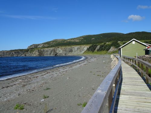
The boardwalk of the village of Trout River, just above the beach area, with cliffs in the distance
We found several trails, and boardwalks next ot the ocean’s edge, that had been built to facilitate travelers. Strong steps and sturdy railings allowed me to visit places that were otherwise inaccessible. Trout River, in the south section of the park, offers a boardwalk alongside their sandy beachfront,

Scaling the steps to the cliffs next to Trout River
and offers steps to aid in scaling the nearby cliffs next to the small fishing village as well.
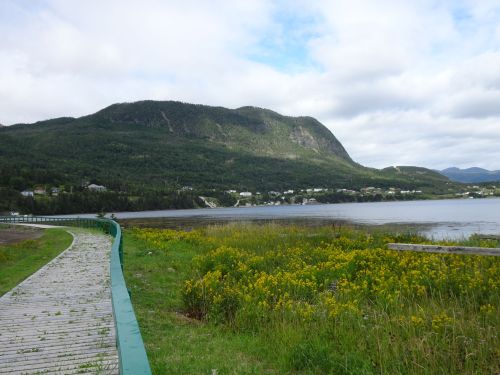
At the inlet feeding into the south arm of Bonne Bay, Birchy Head has a half mile board walk along the shoreline
Birchy Head also built a boardwalk near the head of the south arm of the fjord of Bonne Bay. We met neighbors walking their dogs alongside the shore, and watched sanderlings poke through the debris for tasty tidbits. The neighbors agreed that they had to repair the boardwalk each spring after the ravages of winter storms have subsided.
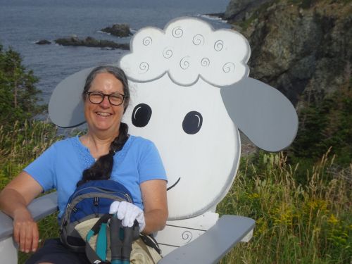
Taking a break after climbing the stairs to the cliffs at Trout River
Easy Walks in Massachusetts found much to enjoy in the rugged landscape of Gros Morne. We also found that much effort has been expended in making visitors welcome, and those with challenges to feel welcome and aided along our way.
Marjorie

Marjorie Turner Hollman is a writer who loves the outdoors, and is the author of Easy Walks in Massachusetts, 2nd edition, More Easy Walks in Massachusetts, 2nd edition, Easy Walks and Paddles in the Ten Mile River Watershed, and Finding Easy Walks Wherever You Are. Her memoir, the backstory of Easy Walks, is My Liturgy of Easy Walks: Reclaiming hope in a world turned upside down.

You have sent me to Google Maps to get a precise location…this is beautiful land and water!
It really is, Mary–a stark and beautiful place. Not as difficult to get to as we thought, at least by air. Driving is a longggg trip.