Marjorie Turner Hollman helps authors self-publish their nonfiction books. She is also a disability advocate, sharing information about Easy Walks (not too many roots or rocks, relatively level with firm footing, and something of interest along the way) in open space. Link to all Marjorie’s books.
LISTEN:
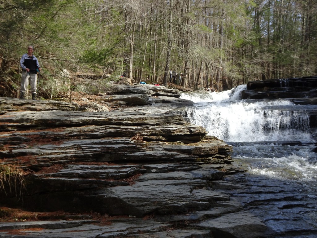
After an icy winter we were anxious to get outdoors and stretch our legs. Western Massachusetts was our destination. Finding some waterfalls was our goal. Umpachene Falls Park in New Marlborough, Massachusetts, was our first stop. This riverfront park includes a small grassy riverside space I’d describe as an Easy Walk, that is, not too many roots or rocks, relatively level with firm footing and something of interest along the way.
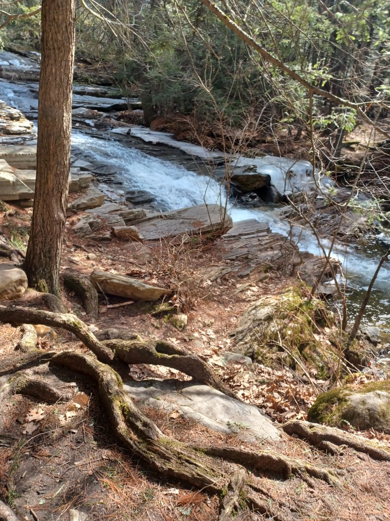
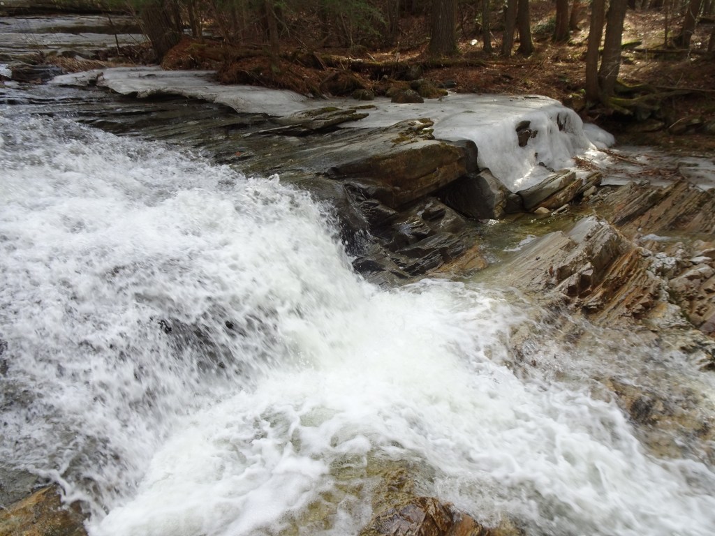
The best views, however, are attained only after climbing over countless tree roots. This also required me to take one very big step down onto the rocks at the edge of the large stream headed toward the Konkapot River.
No, not an Easy Walk, but manageable with support. It was not a path I would normally agree to take, but the possibility of seeing a waterfall is a great motivator for me.
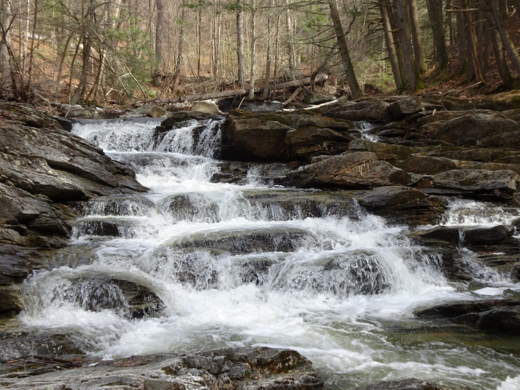
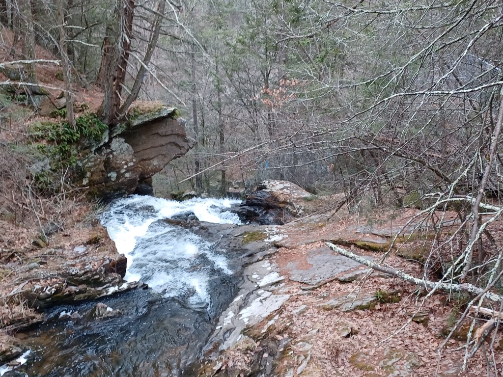
We visited in very early spring and the gate was closed. We found enough room to park without blocking the gate. We captured some lovely photos, and paused to take in the soundscape of the crashing currents tumbling down over multiple layers of sculpted rock. Other visitors had climbed higher along the falls, and from the high pitched squeals, we guessed they were attempting to dip their toes into the water. The increasing volume of their shrieks was our clue that some brave (or foolish) souls eventually ventured out into the icy stream. Spring melt in New England (and other northern climes) is not for the faint of heart.
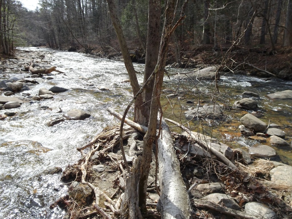
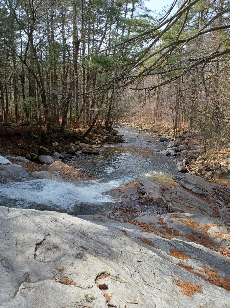
We found a path below the falls that offered a vantage point where we could stand on solid ground and enjoy the views as we looked upstream. The well-worn footpath is narrow, and vines of various sorts snatch at the feet of unwary visitors. The reward, of course, is some pretty views of the fast moving water rushing downhill to join up with the river. The multiple cascades were mesmerizing. Countless branches of the stream veered off course, found a way through the rocks, then joined up again, following the most advantageous path downstream.
I settled onto a bench alongside the river while my husband explored farther up the path alongside the falls. The area is obviously popular in warmer months. Both picnic tables and swing sets are available for fair weather visitors. During winter and mud season, the gate remains closed, reducing the number who can access the area. We saw no indication of when a groundskeeper is present. A note online suggested that if you encounter a gatekeeper, you may want to ask politely if you can visit. Otherwise, the area is restricted to town residents and their guests.
Another stop on our way was Campbell Falls. The Whiting River, which flows from Massachusetts into Connecticut carves its way through resistant rock, creating an impressive waterfall. The state park in which the falls are located is actually in both Massachusetts and Connecticut, managed cooperatively between the two states.
One entrance to the property is in Norfolk, Connecticut.
Limited signage and no map at that location left us unsure of the scope of the trip. A footbridge carried us over a small stream. After walking perhaps a half mile through often mucky, though pretty obvious footpaths, we began to question the wisdom of continuing on. Looking at an online map revealed that the distance to the falls was at least a mile off. We had started too late to allow us to reach the river before sundown. Sunset was not far off and without headlamps, we headed back for our car.
On our way out of the area we spotted yet another sign for Campbell Falls, on Campbell Falls Road in New Marlborough, Massachusetts. This felt like a second chance after having given up on seeing it this trip. This shorter access path, with limited parking, is actually a quite difficult trek. We went a few hundred feet uphill to the bridge over the river, and stood on the quiet, dirt-packed road. I was able to get a limited, but still lovely view of the rushing water as it flowed underneath my feet. The river crashed from rock to ledge down the crag hillside. A steep track following the path of the rushing water downstream was not tempting.
If we had stopped earlier in the day we might have explored this area more, but for this visit, a taste was all we were able to enjoy. Often, a taste is enough. Of course, sometimes it simply whets the appetite. As for us, we eagerly anticipate the next opportunity to explore some more. Happy Trails!
Marjorie